Sunrise at Kinnoull Hill

Early one morning in August I set off up Kinnoull Hill in Perth; a 40-minute stroll through the woods and I arrived at the top just in time for sunrise.

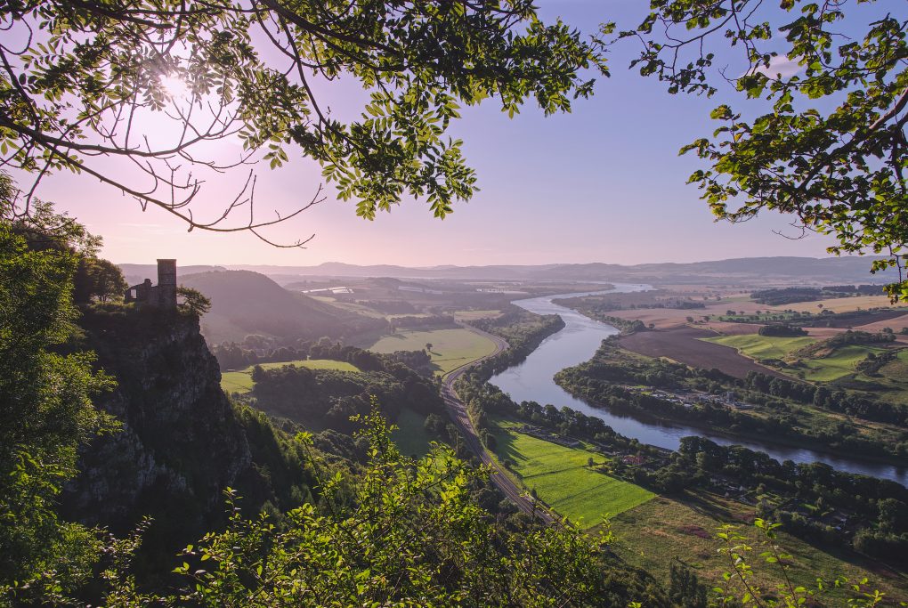
There are a couple of classic viewpoints, although juggling foreground foliage is not the easiest. This is the view closer to the tower with a hint of sunlight behind the hill, a line of light streaking round to illuminate some of the yellow trees below:

Sunrise behind Kinnoull Hill, with the River Tay running along the Carse of Gowrie into the distance

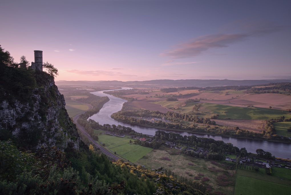
And this is a little further back, the sun having risen illuminating the whole Carse of Gowrie and River Tay, sky still shades of yellow and pink:

A classic view of the tower and River Tay from Kinnoull Hill, Perth

Walking back through the woods was rather pleasant too – lots of dappled sunlight on the trees.

This was one of the first photo-sets I processed using Affinity Photo Pro on the iPad. Loving the colour and tone already!

Birnham Hill

One of my favourite views is the Highland Boundary Fault running through the landscape, immediately in front of me standing at Stair Bridge Viewpoint part-way up Birnam Hill.

It looks particularly pleasant with light and cloud-shadows zipping over the trees too:

Along the Oak Walk

One of my favourite walks around the local area is the Oak Walk – running along the edge of a large field, it gets beautiful evening sunlight and has some characterful trees

One or two local folk have populated it with wooden sculptures, for amusement factor

And the surrounding paths are well populated with wild raspberries, brambles and even willowherb/fireherb looking pretty in the light.

Just One Photo

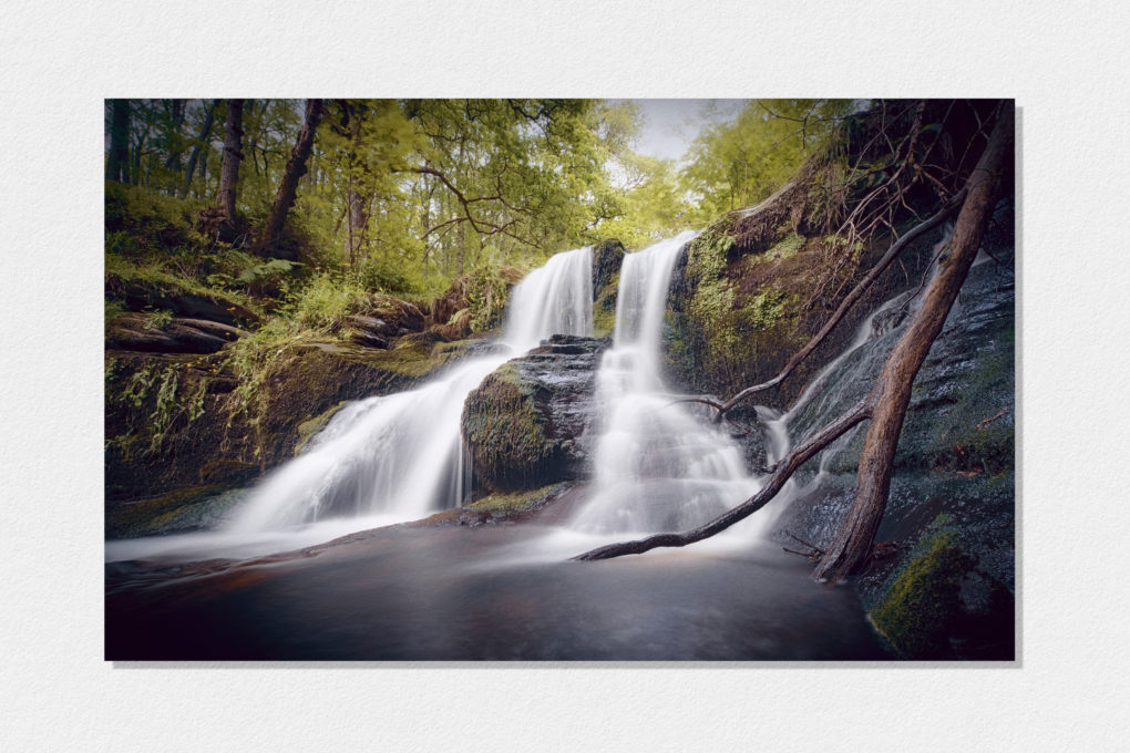
Black Spout Waterfall, Pitlochry

Some days you only need to come away with one landscape image to justify an excursion.

On Saturday I set sail with Doglet and a friend and strolled through Black Spout Woods around Pitlochry, up to the viewpoint across the gorge where you can see the full height of the waterfall, and then round to the more accessible bit near the top of the falls, which still takes a fair amount of scrambling around on the river bank to get down to.


A nice stroll through the woods, a view across the gorge to the full height of the waterfall, some scrambling around on the banks to get down to this level (a small fraction of the total height down from the top) with friend and dog… A good way to spend an afternoon

Technicalities:

There are three conscious aspects to this shot:

Composition

I wanted to make the most of the 15-30mm lens, so with a bit of wiggling around at the scene I found a spot right in front of the cascades that would showcase the 16mm ultra-wide field of view with a strong foreground. Nothing clipped; there’s negligible cropping except for lens-correction. There’s something in each pair of corners: the strong diagonal line of the dead tree-trunk in the foreground is echoed by the three distant trees in the far top-left; the negative space of the burnt-out sky has an echo in the expanse of run-off water in the bottom; treated as three stripes, there’s a balance between the height of the frame given to the run-off, to the bright white cascades, and to the woods+sky at the top.

Sensor controls

I made 10 source images on the Pentax K-1, varying the exposure as follows:

f/13.0 1/50s; f/14.0 1/8s;
f/16.0 0.4s; f/16.0 0.5s
f/16.0 0.5s; f/16.0 0.8s
f/16.0 1/4s; f/16.0 1/8s
f/16.0 1/8s; f/18.0 1/6s

This set of exposures spans a large contrast range from bright grey sky down to dark shadows in the rocks; it varies the shutter speed so at least a few will make the water look like brushed cotton; it varies the aperture partly to cater for the range of shutter speeds, and partly so as much of the shot as possible has a frame with maximum detail before diffraction. Enough data that enfuse could find a good midtone maximizing local entropy (detail) at every pixel.

Each of the above had pixel-shift enabled for greater resolution, totalling 40 frames of 36MPel resolution. The shutter was open for a combined total of 12s.

Post-processing

I used my open-source Pentax K-1 pixel-shift workflow on each of the 10 images above, and then reused it again to blend all 10 together into a combined HDR average. Opening this in darktable, I proceeded to correct lens-distortion, finalize the crop (16:10 aspect-ratio, one of my favourites for landscape), set detail modules (no need for noise-reduction! some balancing of detail, local detail, equalizer modules though) and exposure, toning (including tonemapping and low-pass filter) and colour (Velvia). There are not many localized modifications, but there are significant grad-ND filters both down through the trees and, opposing that diagonally, up from the bottom of the frame, along with two instances of the vignetting filter (one significant, one just clipping the corners); there is also extra local contrasted masked into an area around the dead tree trunk. Finally I opened the image in The Gimp and ran the G’Mic filter suite including colour-grading twice (once conventionally, once with extra highlight/shadow duotone effects, blended together – this has the side-effect of changing the tonality in the green leaves to make it look brighter/sunnier than it actually was). A tweak to the curves to lift the overall gamma and then I overlaid my favourite texture image, a photo of a sheet of Hahnemuehle Photo-Rag paper, in soft-light mode to soften the contrast and add a small amount of texture into otherwise barren areas.

Why this Workflow?

Working this way hits a sweet-spot in terms of convenience and image-quality.

I did not fall in the river. That’s a good start.

With such a wide field of view, every centimeter counts when choosing the location. With the 15-30mm lens I was able to experiment, iteratively varying location and focal length, until an optimum position was found, all the while seeing exactly what the final composition would be in live-view.

Pixel-shift – moving the sensor around in a 1px square pattern – works as a great way to increase the resolution.
The alternative would be to shoot a panorama, but that would still require HDR blending of frames as well as risking motion-artifacts in the trees; with just HDR on its own, the ghosting of the leaves from averaging multiple frames is a more pleasant indication of movement rather than errors in stitching. Additionally, shooting a panorama would require just as much care over camera position but would not allow a preview of the composition.
As a hybrid option, with cameras that lack pixel-shift or equivalent technology, one could compose approximately and then vary the tripod position subtly to emulate hand-held camera-shake; this is almost identical to pixel-shift in terms of super-resolution, but varying the camera position risks introducing artifacts from lens-distortion and parallax between foreground and distant parts of the scene, that pixel-shift avoids.

Additionally, shooting every frame 4x over, automatically, increases the overall exposure time into multiple seconds, even in daylight, which avoids the need for Big Stopper-type filters (especially handy on a lens that would require a special holder for such).

The Dumpling

Just to the south of Loch Lomond beside the village of Gatocharn lies Duncryne Hill – a positively cute protrusion consisting of sandstone and conglomerate from the Emsian era early in the Devonian Period, affectionately known as The Dumpling.

Having discovered it on Google Earth, thinking it might afford good views over Loch Lomond and the Highlands to the north, I visited it this past weekend.

I wasn’t disappointed.

Approaching The Dumpling

Some artwork – looking at Loch Lomond from the top of Duncryne Hill:

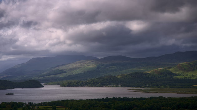
The Highland Boundary Fault runs from Arran to the south-west, cutting through Loch Lomond between Arden (west) to Balmaha (east), forming a clear escarpment along the side of Conic Hill.


The Highland Boundary Fault runs right through the middle of this photo – through Loch Lomond around Balmaha, causing the rising mountains to the right of the scene.

The clouds were fairly zipping along, obscuring and bathing the landscape in crepuscular rays, so I had to make a short timelapse video of the vista:

With such light and rain-clouds passing by, on returning to the top of the hill I was greeted by a dramatic full-on rainbow with complete primary and secondary bows and supernumaries glowing in super-saturated vibrant arcs over the trig-point.

And just to finish the day’s expedition, there was some beautiful early golden-hour evening sunlight back-lighting a group of trees outside Drymen.

A Day In Clouds

That was 2017-06-20, that was. A beautiful blue sky with white fluffy wispy cirrus cloud catching the setting sun…

…followed by a noctilucent cloud display around 1am:

NLCs are the highest-flying clouds, occurring at altitudes up to 80km where the next highest type (cumulonimbus) only reaches 12km and most are lower still. Most typically they resemble a fine silver filigree of ice-cold pale blue, although more complex forms have been seen. First maybe-seen in 1885, they only really came to prominence since the 1980s, as a canary for changes in the upper atmosphere linked to climate change.

As I stood and watched the display, a patch of silver mist formed over Strathearn and made its way west along the A85 toward Crieff, so I made a little timelapse video – 17 minutes’ data compressed into 1:

Portknockie

Continuing the mega road-trip drive from a day in April: having taken in Dunnottar castle I proceeded up to Portknockie on the north Moray coast. A well-known location with lots of scope to explore, sitting on a transition between red sandstone conglomerate and quartzite underlying rock.


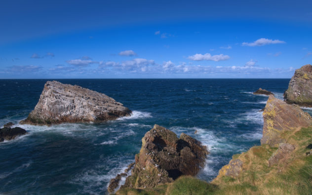
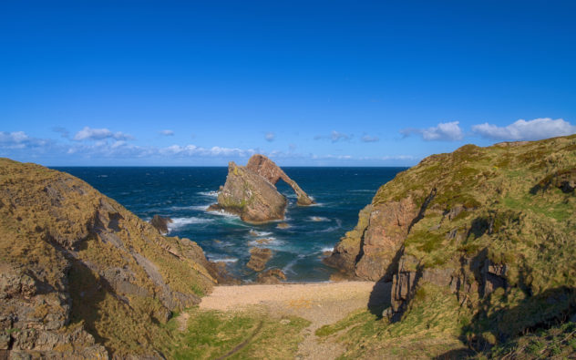
Bow-Fiddle rock itself is situated just beyond the mouth of a cove with interesting caves to the north side:

The approach to Bow-Fiddle rock at Portknockie.
We’re heading down to that strip of a pebble beach…

There’s a classic composition to be had by heading down to the boulders just beyond the pebble beach, plonking one’s tripod on the rock and adding enough ND filters to make a long exposure. With the right light and the wind kicking-up choppy waves, it can make for pleasantly dramatic arty photos. And despite being a sunny day, having to lie down on the hard rock to keep my shadow out of the shot, it definitely didn’t disappoint…

Technical details:

Pentax K-1; Samyang 24mm f/1.4 lens at f/11; Nisi ND1000 (equivalent to a Big Stopper) and circular polariser filters; ISO 100; 30s exposure using pixel-shift for a total of 2 minutes’ exposure at high resolution.

At Tarbat Ness

Continuing the third day of my holiday last November, having been to the Reelig Glen in the morning, with the weather still mostly inclement, I went for a nice long drive up to Tarbat Ness by Portmahomack. The lighthouse – the third-tallest in Scotland – was engineered by Robert Stevenson in 1830, a stripy shapely construction standing on cliffs above the Devonian old red sandstone shore, making a great classic scene to photograph.

And this is the more immersive view of what it’s like to be there:

[sphere 3047]

Landscape and Geology – an NC500 road-trip

Back last November I spent a very happy few days staying up North; the first day was spent in Glen Affric (sunrise, trees, water and light).
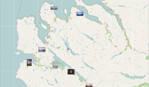
Photo Map

Photo Map – a long drive around Wester Ross

In the few years since I was last up there, there’s been a concerted push to market the road around the far north of Scotland as an “answer to Route 66” and thereby promote it as a tourist attraction.

The second day of my holiday saw lousy weather, completely overcast and foggy for much of the time. So I spent the day driving around Wester Ross wondering where the scenery had got to… trying not to think of it as the NC500 but actually enjoying several stops along the route that I’ve been to previously.

The first stop was the well-known view from a layby in Glen Dochart, above Kinlochewe to admire the sinuous road:
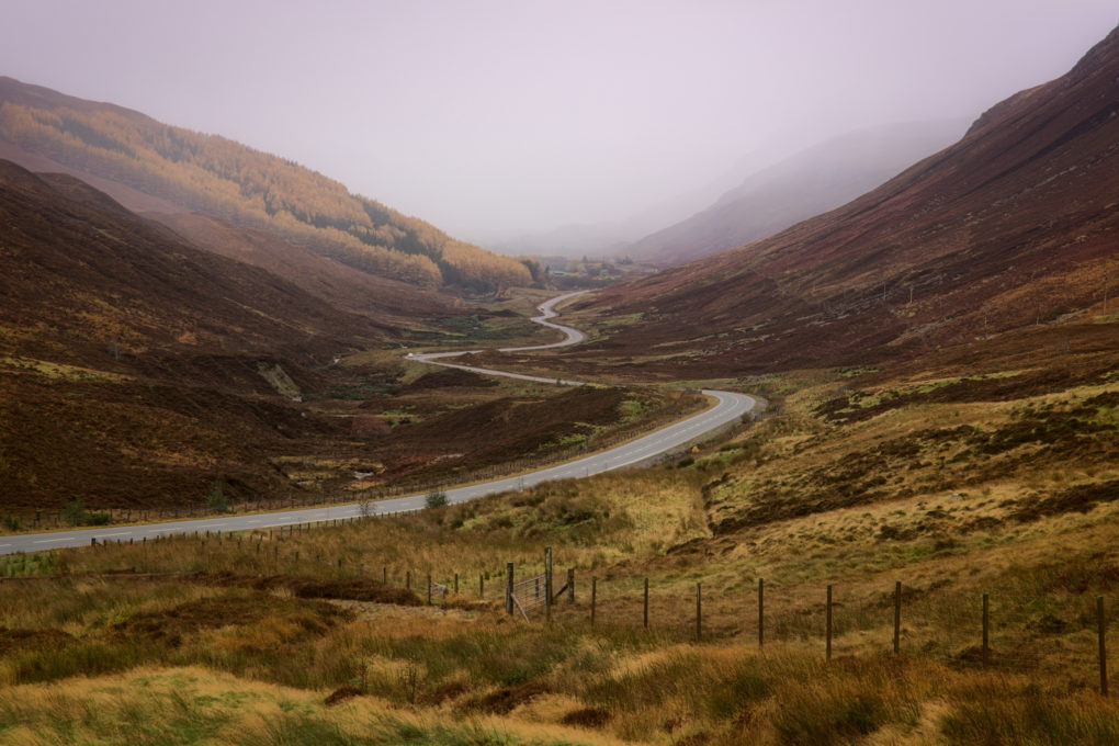
An obvious scene: the road wending through Glen Dochart toward Kinlochewe (not depicted: Kinlochewe, because of the mist).

Pity about the mist…

A little further along on the way through Kinlochewe are two mountains – Beinn Eighe to the left and Meallan Ghobhar and Coille na Dubh Chlaise to the right. We pulled off the A-road and Doglet had his breakfast more or less directly on the Loch Maree fault-line whilst admiring the quartzite rock strata.

There wasn’t much to be said for the views across Loch Maree, although the contrast of dull grey skies and warm autumnal orange and yellow colours was pleasant.

Some years ago, there was a TV documentary, a former politician’s search for the most natural woodland in the UK. After much searching around down south in the New Forest, he came north and explored Caledonian Forest remnants, finally finishing up on an island in Loch Maree – a rather bizarre arrangement of an island with a lochan with another island inside that – on which he stated the trees were least likely to have been touched by mankind. There is an obvious viewpoint, a small section of beach, at Slattadale toward the north-west end of Loch Maree, from which the group of islands can be seen.

Of all the photos I made during that day, this was perhaps the most classical landscape, in that I had the idea for these photos – the location, leading lines of foreground boulders, large expanse of silvery water and Slioch in the distance – planned in my mind for ages before revisiting the area.

What you don’t see is how, while I was making these photos (long exposures, totalling a minute’s exposure, focus-stacked) there was another photographer sitting 20yd away, cooking his morning breakfast – so the photos fail to include the clouds of fragrant bacon and fish smoke billowing past the camera…

Speaking of lunch, mine happened at Badachro, at the Inn. Highly recommended – everyone loved Doglet, which is a good start, and the burger was tasty as ever. Mostly the thing I like most is how the coastline is just like Plockton – west-coast rocky sea-lochs and seaweed – but without actually being Plockton that everyone else flocks to see.

And this is what it’s really like at Badachro:
[sphere 2974]

On a previous trip I had explored as far as Poolewe but not had a chance to go further; this time I stopped off at Loch Tollaidh to admire the rocky outcrops across the water (Lewisian Gneiss and other igneous rock).
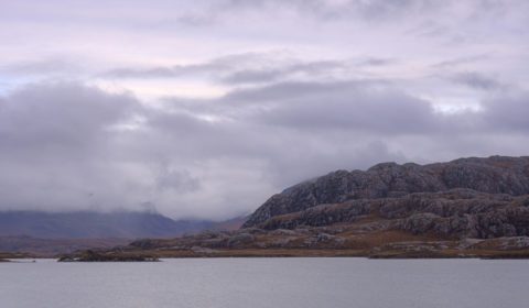
Classic Wester Ross landscape – huge lumps of Lewisian gneiss, beside Loch Tullie

Signs of industry: on the shore of Loch Tollaidh is a small jetty, presumably a put-in for boats to go inspect the small salmon farm. That and the remains of a very dead boat, wood bleached inland, caught my attention:

On travelling up the coast to Mellon Udrigle (what a wonderful name!) I was struck by the view across the Wester Ross Marine Protected Area to the mountains on the horizon on the mainland. On the left, a bit of misty cloud drapes over the top of Beinn Ghobhlach; to the right, there’s more mist flowing over Sail Mhor but the huge bulk of An Teallach was completely hidden behind the cloud.
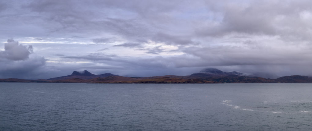
A wide-angle panorama: low-lying cloud (with a bit of precipitation) and mist flowing over Sail Mhor – the full bulk of An Teallach is completely hidden in the cloud beyond.
The mountain on the far left is Beinn Ghobhlach.

By the time I got back onto main roads, with a very long drive ahead, the light was fading fast toward dusk and the blue hour and clouds in front were thick and closing in fast, so I made one final photo for the day by the side of Little Loch Broom and scarpered fast.
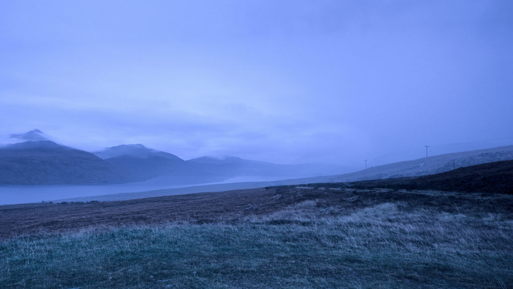
Lots of mist in the distance, travelling the A832 past Beinn Ghobhlach.
I was rather glad to get back in the car and head off before the weather got really bad!
Winter along the Provost’s Walk

This is fast becoming one of my favourite walks around town – not least because it’s less muddy than the other track out the back. Yesterday I awoke to find the world had turned white, complete with snow-drift piled-up on the front lawn by a passing snowplough. Naturally, over-inflated reports of traffic confusion abounded, although by the time I had to drive anywhere in the evening, the roads were as clear as a bell.

Anyway. I like this path. The Ruthven Water makes a great spot for the Doglet to paddle. All very relaxing and shiny in the white snow.

This is what it’s like around here…

Provost’s Walk:

Arty photos:

All shots taken on the Pentax K-1 using my new hand-held HDR workflow.

Around Glen Affric 3: Morning Sunrise

I first visited Glen Affric in September 2006, more or less 10 years ago. Not long after, I discovered the joy of standing at my favourite bench watching the sun rise behind the distant mountains, its light casting shadows of the trees on the mist. Since then I’ve been longing for a second chance at the same scene – and this year, with a bit of good timing, I think I managed it.

And another behind-the-scenes 360-pano selfie of what it’s like to be there…

[sphere 2868]

Around Glen Affric: water

I had a short holiday at the start of last November, a few days spent in Glen Affric. There are several aspects why it’s my favourite part of the planet, but for the purposes of this post, we consider the role of water in shaping a landscape, eroding its way through rocks to form river, gorges and waterfalls.

First, the impressive 150-foot drop of Plodda Falls from the top:

Second, some of the cascades in the River Affric, part of the way around the River Walk, rich autumn colours glowing in the morning sunlight:

And finally, a couple of 360-degree panoramas, partly to offer a behind-the-scenes view – they take a little while to download once clicked:

[sphere 2834]

[sphere 2836]

Around the Black Mount

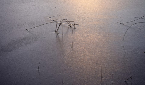
Detail of blades of grass poking throuhg a frozen Lochan na h’Achlaise, Rannoch Moor.

At the end of November I spent a happy Saturday afternoon driving out to the Black Mount area in Rannoch Moor, with photos in mind.

Didn’t help that I left the main camera battery at home in the charger, so was limited to the spare. Well, it makes one think when even turning the camera on to compose through the EVF uses finite battery life, especially in the cold. Lots of “pre-visualising” going on to keep the film-throwback photographer purists happy.

There were plenty of cars zooming along the A82 but a little stroll out into the bogs resulted in some nice landscape.

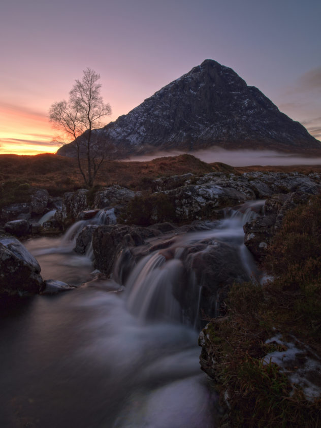
The crowning joy of the photographic excursion, however, was the total cliche scene of the Buachaille from the River Coupall. It’s sufficiently well-known that folks groan when it appears in photo-club competitions. The composition is more or less fixed, with varying extremity of weather conditions providing the value-additions to the photo.

This time, I spotted a little wisp of mist coming up Glencoe as I turned off down Glen Etive. There were only two other folks at the location; they said it was their second attempt that day as, on the way down the glen, there had been 20-30 folk milling around.

Funny how such an iconic landscape location still has people who will shoot it in suboptimal light.

We took a few photos, and dusk fell, with glorious shades of warm purple tints and an orange sky.

My temporary companions departed, leaving just me – well into post-sunset dusk blue-hour – at which point the wisp of mist rounded the base of the mountain underlining it in white to match the waterfalls in the river. And that is the shot of the day.

Buachaille Etive Mor from the River Coupall, Glen Etive

Stob Dearg – Buachaille Etive Mor from the River Coupall, Glen Etive