when a landscape location goes sour

I don’t know how to tag some of these photos: on the one hand, a place that’s been a good walk in the trees for over a decade, but on the other, one that’s now showing the tarnish of human influence. Landscape photographer’s idyll or sad anger?

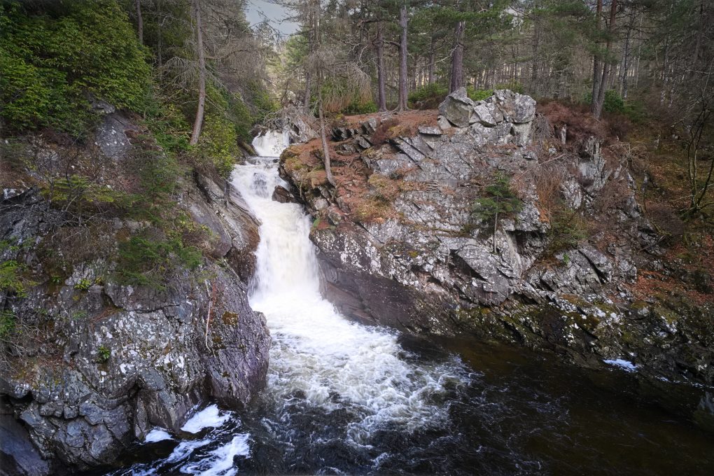
The Falls of Bruar present several well-known scenes. My own story is of having bought a tripod to do justice to a particular view and then using it to shoot a “hole in the ground in failed light” instead, thus getting one of my most-popular photos on flickr. I’ve been back probably 10 times over more years and enjoyed the stroll up the side of the gorge, admired the rocks, watched the three waterfalls doing their thing.

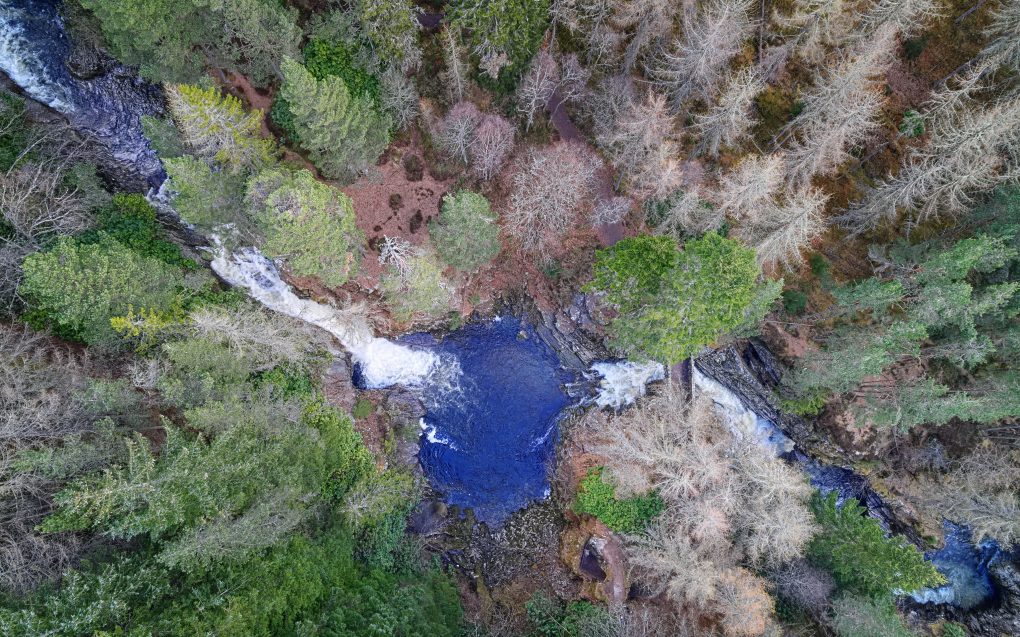
First there’s the regular cliché photo approaching the lower bridge – everyone gets the view from the top of the gorge opposite the lower bridge; I flew the drone down into the gorge and shot it from more on a level with the natural arch:

Nice rocks – psammite and semi-pelite as most of the Highlands, with the shear strata arising from the end of the Loch Tay fault-line.

Around the corner, there’s a viewpoint amongst the rocks of the second waterfall above the lower bridge:

Rising above the gorge one can see the pine trees lining the Bruar Water – it also shows how the middle cascades extend much further upstream than might be expected from the compressed perspective of ground level:

Abstract view of the lower Falls of Bruar

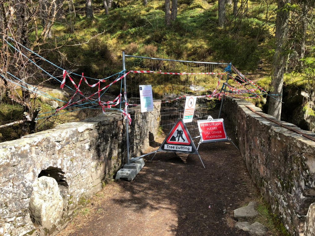
However, this visit was far from happy. Apart from some offensive uncouth ned muttering “hope you lose your drone” as he passed by, and the hordes of random unwelcome people thinking they were entitled to pester the dog, there are massive botanical problems: the two bridges have been closed so the path up the right side of the gorge is inaccessible due to tree works – possibly because of disease although I’m unconvinced this is the whole reason.

Bridge closed

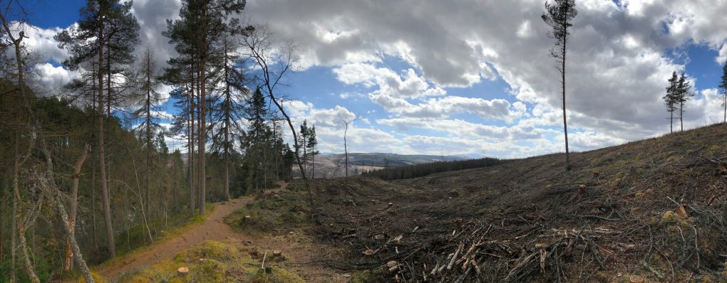
Walking up the left side of the gorge instead, the area is infested with non-native invasive rhododendron bushes; the Forestry on the adjacent hillsides has been harvested leaving a horrendous unsightly barren landscape; the burns and tributaries beside the path are in a dire state of disrepair also.

Who wants to walk along here?

This is the trouble with well-known landscape locations; as photographers we like the illusion of wilderness, or at least that places are natural. Bruar has become no more than an ill-kempt garden with a water-feature running through the rockery. The light and shade and calming deep greens are no more to be seen.

I’m giving it a decade to recover before revisiting.
Around Bangour

Situated outside Livingston, the psychiatric hospital at Bangour Village was founded in 1906 as Edinburgh District Asylum – one of the first in Scotland to be modelled on a village. In 1918 it housed up to 3000 patients. During the second World War, patients were transferred temporarily to Hartwoodhill Hospital. Around 1924-1930 it gained a multi-denominational church in the centre of the village.

These days the site consists of several listed buildings, most in increasing states of decay – ideal territory for urban exploration.

A few views from ground level:

And a handful of photos made with the drone:

Also see an aerial 360º drone panorama of Bangour I made using Hangar360.


The final ward closed in 2004 – worryingly one of those “in my lifetime” things…

Sma’ Glen: liminal landscape

Many years ago, as I was buying my first ever house in Perth, I remember the solicitor advocating the Sma’ Glen as a landscape to explore and photograph. He wasn’t wrong, but it’s taken over a decade to really start to explore it properly.

First there’s the natural appreciation of the place – light and landscape.

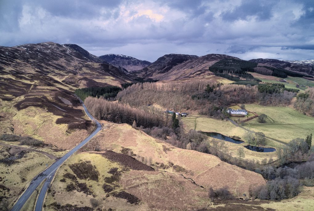
Taken right above the Highland Boundary Fault line looking north to the Sma’ Glen, Dallick House and plantation on the right and Roman Signal Station just visible as concentric rings in the bracken above a small burn.

Then comes the realization, due to geology, that the incredibly lumpy landscape is actually due to the Highland Boundary Fault running right through it – here, from left to right, along the line of the base of the hills and mountains. Lowlands beneath and behind, Highlands beyond to the north.

The second realization, due to heritage, is that the Romans had a series of “glen-blocker” forts along the Gask Ridge, of which one was situated here, at Fendoch. They even had a Signal Station across the road(!) – more accurately, across the fault line too – to alert the fort to incoming invasion from the north.

These days the fort itself is no great shakes – a few stone walls remaining and some faint outlines of rectangular structures beyond – and the Signal Station is a couple of concentric rings and a hint of more structure in the bracken.

Of course the final realization is thanks to the drone: rather that just the “intimate landscape” features within a few meters of one’s nose, one becomes aware of the landscape on a different scale of multiple miles and the way it’s divided up by roads and habitations (and how those have changed over the millenia).

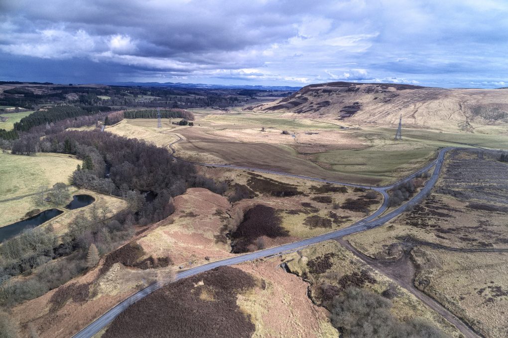
Roads slicing up the landscape: taken above the Roman Signal Station at the foot of the Sma’ Glen, looking south-east over the Highland Boundary Fault to Fendoch Roman Fort (between the pylons and Stroness hill in the distance) and thence along Glen Almond.

The Far North

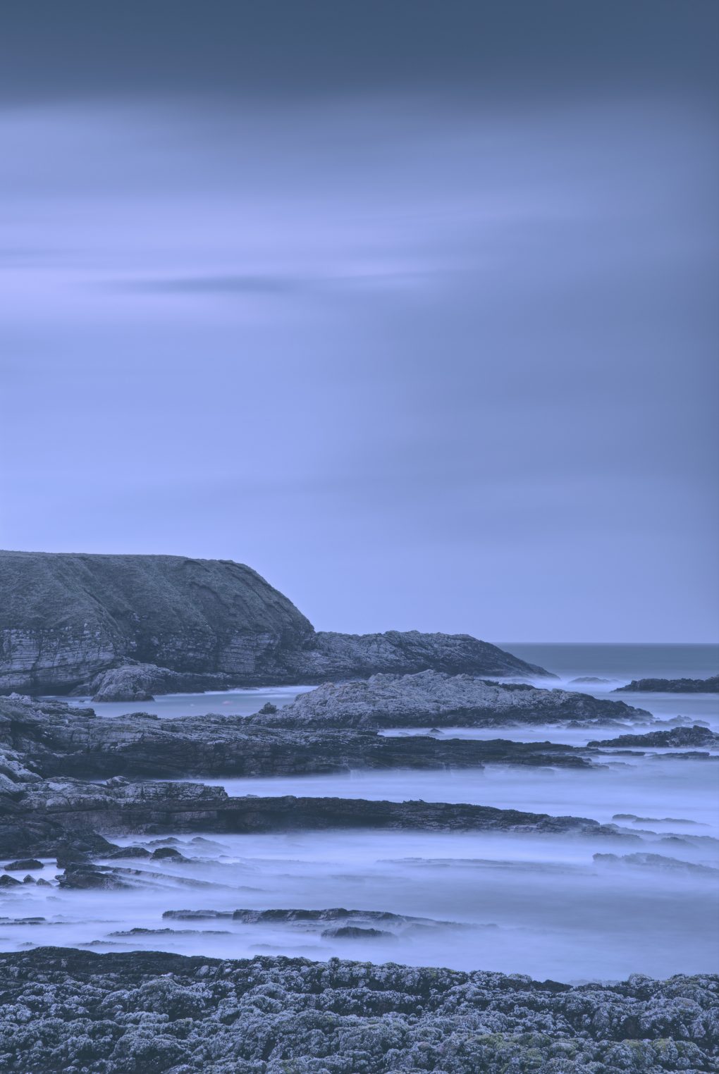
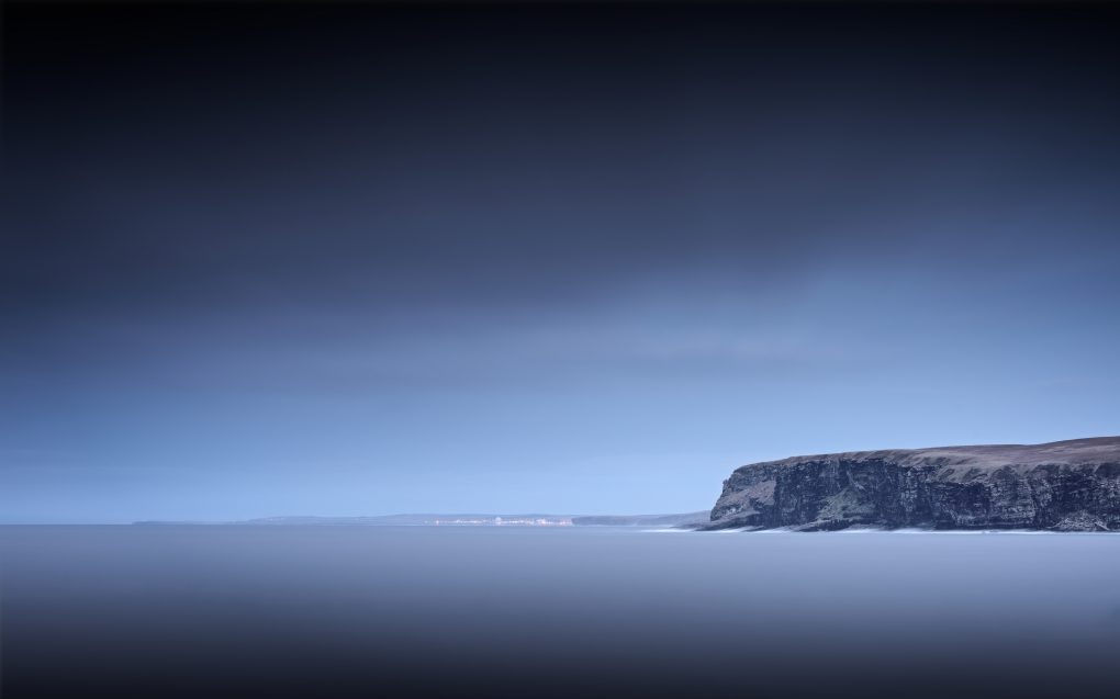
The intended road from Rosal due east was closed for road-works; I took an incredibly long detour all the way to the far north coast of Scotland – next stop the Faroes and Greenland – and stopped at Portskerra to make a couple of long exposure landscapes as the light faded to dusk.

The coastal geology was impressive – alternating areas of gneiss and sandstone with clear strata in the rock.

Portskerra at dusk – a long exposure of waves lapping around rocks on the beach looking north – next stop Greenland…

Dounreay in the distance beyond the next headland

Around Rosal

This was a strange place of varying thoughtfulness. Having previously visited Aoineadh Mor and found its handful of ruined crofts more thought-provoking, this was rather the opposite experience: having far more settlements dating back thousands of years including cairns, a souterrain and remains of crofts, with a history of particularly brutal evictions, there’s no real viewpoint from which one can see the extent of the clearing and experience all the time or place at once, so it lacks a certain atmosphere.

One thought, however. The Highland Clearances were mostly for the purposes of replacing crofting (seen as not cost-effective) with sheep farming (supposedly profitable). In practice, it’s a story about commercial failure: the sheep did not prove profitable, rendering the grassland barren; the monoculture spruce woodlands being farmed as the latest cash-crop are also barren, failing to nourish the land; the eviction of folks living a subsistence existence (which increasingly feels the innocent honest approach) was an offence against humanity – and yet the blasted sheep still remain.

The state of the Forestry Commission’s tourist information boards also being cast down on the ground, however, did provoke thought – is that sheer vandalism, an artistic statement about care and decay of property, or super-artistic irony that preservation itself should go the same way of all things?


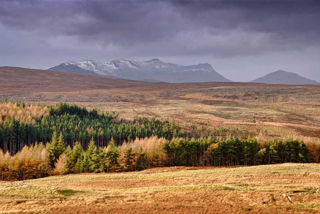
The landscape did provide a few moments of beautiful contrast, illuminating the foreground trees against the shadowy dark might of Ben Loyal, however:

Ben Loyal from Rosal Clearance village

Ben Loyal from Rosal Clearance village

Around Strathnaver

Strathnaver is a beautiful area – rural life, peaceful and quiet, where the only traffic jam is a herd of sheep trundling along the road beside the loch. Simple and elemental, a play of sky and land, light and limited human influence.

Outside Altnaharra:

Beside Loch Naver:

Around Altnaharra

Then came the churches, then came the schools
Then came the lawyers, then came the rules
Then came the trains and the trucks with their loads
And the dirty old track was the telegraph road
Then came the mines, then came the ore
Then there was the hard times, then there was a war
Telegraph sang a song about the world outside
Telegraph road got so deep and so wide
Like a rolling river
– Dire Straits, Telegraph Road

I’ve known of Altnaharra for many years, gradually accumulating little facts about the area. Situated in the middle of the far northern Highlands, it doesn’t get much more remote. Jointly with Braemar, it holds the record for the coldest recorded temperature in the UK – at -27.2ºC I’m glad I wasn’t there at the time.
However, last November on holiday – gravitated north as always – I found myself with a not-completely-planned day where the best weather indicated a visit was indeed possible.
As habitations go, it doesn’t occupy much space in the landscape.The high street (there is none other) is the A836, a single-lane road with passing places. Within about a 200m radius it boasts a handful of houses, an outsized hotel, couple of petrol pumps and a primary school. The village centre is barely a bend in the road with a pleasant Scots Pine tree and the Allt na h’Aire burn from which the place takes its name. I do love the little epiphanies when one makes the connection between the Gaelic names and their anglicised equivalents – in this case I was wondering if the burn in a photo had a name, looked it up, saw the gaelic and the pronunciation dawned on me: “that IS Altnaharra”.


Of course it is also very much Runrig territory; sitting at the end of Strathnaver, it suffered in the Clearances – I wonder what size of catchment area is required to keep that primary school active.

Lone Ash Tree, Glen Devon

Thanks to my friends Fox in the Snow Photography over on Facebook for their permission to steal one of “their” favourite trees in Glen Devon as a photo location this past weekend. Less gratitude for the attendant weather, however!

On approach, leaving the car across the road, there was quite a white-out blizzard – snow blowing up the glen, everything shades of grey, low clouds. There’s a whole hillside lurking behind the tree here, not that you’d notice:

First things first, I established it’s an Ash, Fraxinus excelsior. That probably explains some of the funky characterful shapes.

I had a bit of fun exploring the various compositions around the tree. The obvious thing is to get the whole tree in the frame, from sufficiently low on the ground to obscure the road behind, letting the visible grass merge, flowing, into the background.

One idea I’d had was to emphasize the curve of the split trunk by using it to fill the frame, leaving the branches and twigs flying around in the wind during a long exposure, Medusa-style:

Fortunately the spooky mood didn’t last long, as the weather was coming and going in alternating waves of white-out cloud and brilliant sunshine flowing over the tree.

Devoid

An exercise in uniformity: over the course of three days, I took the camera out for an hour’s walk, using the same settings (28mm f/3.5, auto-ISO, centre-zone auto-focussing) and took snaps – free-form composition, quickly grabbed, around the streets and countryside surrounding Auchterarder and in woodland outside Cambusbarron, Stirling. Every image was processed using the same settings in RawTherapee (with slight changes to exposure) and the same black+white sepia-toning.

From each day I chose the best 19 and averaged them with enfuse, slightly tweaked the contrast. Presented together they give an impression of abstract canvas texture with the merest hints of structure. 

Around Auchterarder 2

The results of the second day’s lunchtime hunt for photos without meaning or purpose. I switched to my 28-105mm lens, again using only 28mm and f/3.5, now in aperture-priority mode with -1/3EV compensation, still in daylight whitebalance and with the same processing and toning profiles in RawTherapee.

Around town:

And in the surrounding countryside:

Around Auchterarder

I’m not entirely sure why, but I got it into my head to make a series of photos without reason or purpose so I spent a couple of lunchtimes walking around Auchterarder just snapping scenes. Very different to my usual contemplative landscape style – this is reactionary, street photography, with a consistent presentation style (sepia-toned monochrome). All images were shot on a Pentax 15-30mm f/2.8 lens at 30mm nearly wide-open at f/3.5 as well using a daylight whitebalance.

Funnily enough, reducing the variables by insisting on one focal-length and aperture and allowing automatic exposure left me free to think about composition – in such relatively alien territory, wave the lens around and see what looks good.

Around town:

I took the new-found constraints into the surrounding countryside:

Country 2:

All images processed using RawTherapee; uncropped, but exposures normalized and the consistency of toning arising from an orange pre-filtered black and white conversion with sepia toning to finish.

In Glen Nant

One of my favoured locations for a quick hour’s stroll in Argyll is Glen Nant, south of the village of Taynuilt; in particular the Ant Trail which leads you through a small Caledonian forest – not very reserved as many of the trees were felled a couple of centuries ago to fire the furnaces at Bonawe, but it seems folks have repented a bit since then.

Herewith, some more back-to-earth simple landscapes: Ben Cruachan from Glen Nant and a couple of intimate landscape studies.

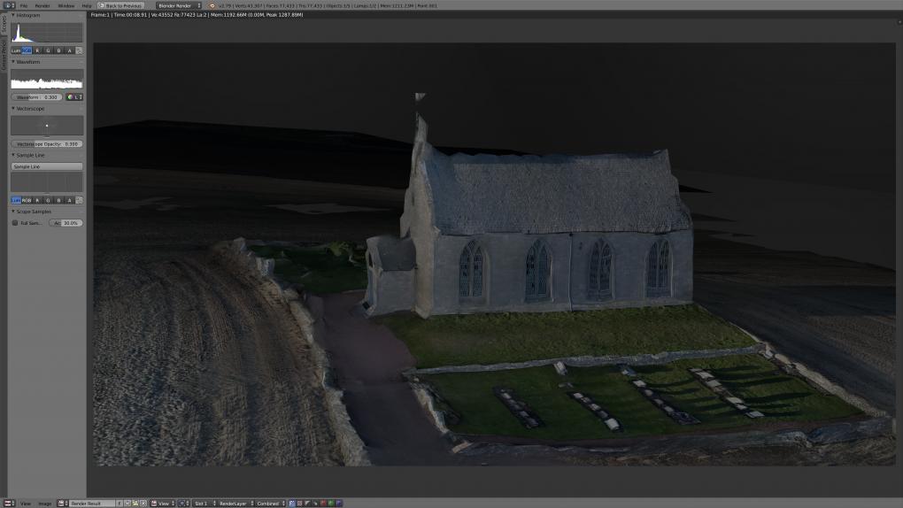
Going 3D: First Steps with Blender

Finally! It’s been only a dream for about 10 years but I have a new photo workflow – and one involving photogrammetry not just photography, too:

  • Fly a drone around an object – typically using point-of-interest mode whilst shooting video.
  • Run some structure-from-motion analysis using Open Drone Map
  • Import the resultant textured dense mesh into Blender
  • Play around with the scene, add lights and cameras…
  • Result!
Boarhills Church, East Neuk, Fife - 3D model rendered in Blender

Boarhills Church, East Neuk, Fife – 3D model rendered in Blender

OK, so it’s not quite as good as the native HDR off the drone but it will allow for even more flexibility in future artwork 🙂