The First Morning of Winter

I spent the morning of Dec 22 – the first day of winter – up Kinnoull Hill. There was beautiful mist rising from the River Tay as it meanders through the Carse of Gowrie.

I experimented with a few new compositions too: semi-abstract views of the hills of north Fife, the motorway/A90 junction and the river north of Perth as well.

My favourite two images were the fairly conventional view from above the cliffs, looking past the folly along the Carse of Gowrie. It’s not that comfortable a location to shoot – to get a clear view of the tower, one has to stand in a gorse bush…

Strathearn Sunset

My sense of the geography of Strathearn has not really fitted together until quite recently. There have been a few locations, isolated points and a few lines: the A822 from Gilmerton up past Monzie to the Sma’ Glen; The Hosh at the foot to access Glen Turret; a small B-road between the two; a hill known as Kate McNiven’s Crag; and one or two other areas. More recently I’ve been climbing hills, “bagging” Torlum Hill and Laggan Hill as part of the Lady Mary’s Walk circuit out of Crieff.

The Highland Boundary Fault emerges in a burst of very lumpy landscape at the southern end of the Sma’ Glen. But what it does in the rest of Strathearn to the west, I’ve never really seen.

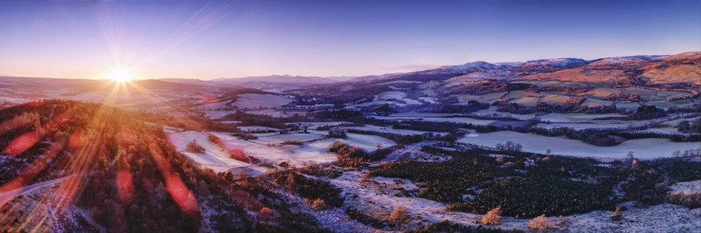
A couple of weekends ago I explored the Knock of Crieff independently; it struck me that the path up the north side afforded the perfect view along the length of the strath to the far mountains in the west, an elevated view along the glacial U-shape.

So late on Sunday afternoon I took the drone for a spin slightly out over the strath and made a panorama of 7 shots, each a 5-shot HDR exposure bracket sequence – blended on Linux, stitched and edited in Serif Affinity Photo for the iPad.

Lowlands to the left of me; Highlands to the right…

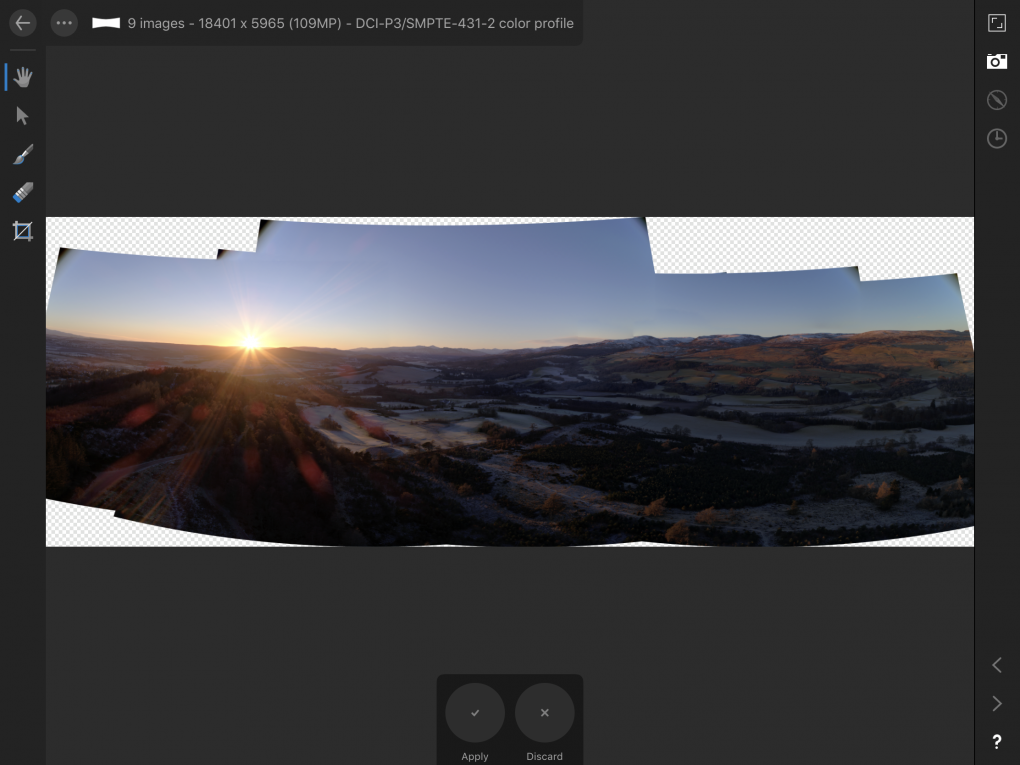
And just for the record, this is what it looked like in the middle of stitched the blended panorama, before I cropped and toned it:

Panorama stitching screenshot

Glen Clova

A couple of years ago, a photo-friend and I spent a happy afternoon exploring Corrie Fee in Angus; I remembered emerging from the trees in an impressive bowl of a glacial corrie. In August, I sought to repeat the experience, starting from the carpark nearby, but in my haste to get off the ghastly Forestry Commission track (more like a hard gravel road ploughed through the forestry, complete with yellow metal gantries), I wound up taking a different path. It also emerges from the trees into a bowl of a glacial corrie, but felt different and I couldn’t work out whether it was the wrong exit from the woods or what.

Came home and checked the geotagged images to find it was not Corre Fee but Glen Clova instead. That would explain a lot of things! And unsurprisingly, I now use ViewRanger to navigate whilst hiking.

Still, a couple of hours bumbling around in the grass finding interesting photos in a dramatic bit of landscape on a moody afternoon… Can’t complain.

As I was stumbling around in the foot of the glen, I stumbled across this lovely little burn tumbling its way through the hillside:

The surrounding rocks are quite dramatic – I was amazed at the green and purple hues of moss and primitive plants growing on the crags around

And much as I know the forestry is entirely artificial now, it still drapes over the landscape like a cloak.
A Sunday Afternoon Escape

A few photos from an afternoon escape in August – one of my favoured routes, starting with the trek from Amulree along Glen Quaich – a moderately long stretch becoming quite a tricky road, steep with S-bends:

As always, the view from the moor along the top was awesome – particularly with ominous dark clouds – I experimented a bit with a variable-ND (crossed-circular-polariser) filter to lengthen the exposures up to 30s:

From there, descending yet more wiggly bends on the way toward Kenmore, there’s a tiny track off the road to a small carpark nestling in amongst the heather. The hillside above there affords a glorious view over the Appin of Dull – there was even a bit of light on Loch Tay looking the other way as well:

The Nice Place(TM)

It’s been a bit of a dream, a life-mission of a bucket-list item, but the other week I flew over some of the Caledonian Forest at Glen Affric – the drone’s maiden flight, as it happens, and a new way to admire the trees from a different angle.

A scene I hope to revisit more often as flying skills evolve.

Above Kinnoull Hill

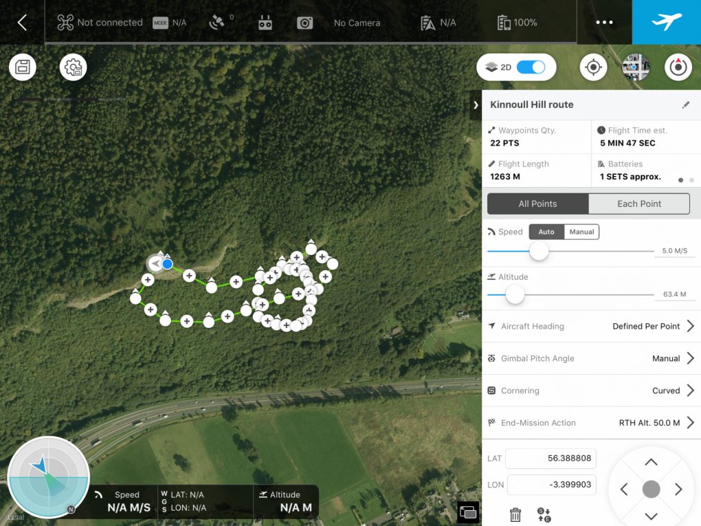
I’ve discovered DJI GS (“groundstation”) Pro, which allows me to plot-out routes in advance with waypoints and control what happens at them, long before arriving at a location.

Well, currently we’re at the stage of wondering why the camera’s pointing back the way we came when it should be looking exactly the opposite direction.

Still, there’s a lot of nice views to be had above Kinnoull Hill.


And the finished video: