Waterfalls and Mountains

We spent Saturday afternoon driving around the Tay Forest Park – up to the Mains of Taymouth at Kenmore for lunch then along the south Loch Tay road to the Falls of Acharn – a comparatively steep climb up the side of the gorge and negligible water in the falls, but there was pleasant subtle light making the most of the colours on the surrounding rocks:

Nice rocks (typical Highland semi-pelite) covered with colourful beech leaves and green moss. Shame they’d forgot to turn the water on…

Next stop: just outside Ardeonaig there is a tiny layby where the view of the southern end of Loch Tay opens up. There was pleasant light on the sides of Ben Lawers too:

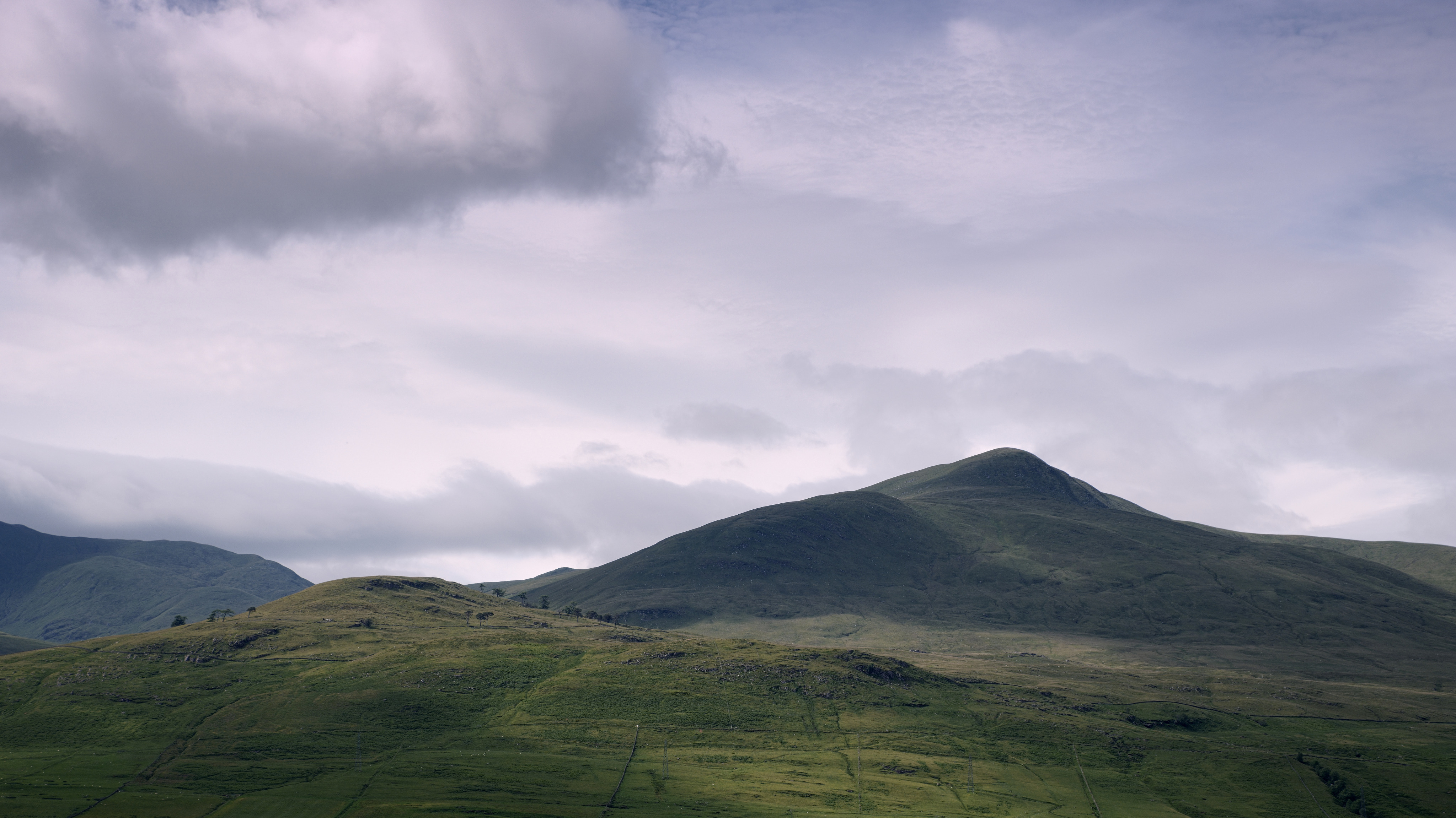
Still a favoured viewpoint right by the side of the South Loch Tay road – lovely soft mountainside illuminated by gentle light and shadow.

Driving further down the road to Killin, there was an awesome cloud inversion flowing around Ben More in the distance, outside Crianlarich – so I stopped at Lix Toll services and made a panorama of it:

Observant viewers will spot there’s even a tiny fragment of snow remaining toward the far left of the shot on Stob Binnein – not bad for the last week of June!

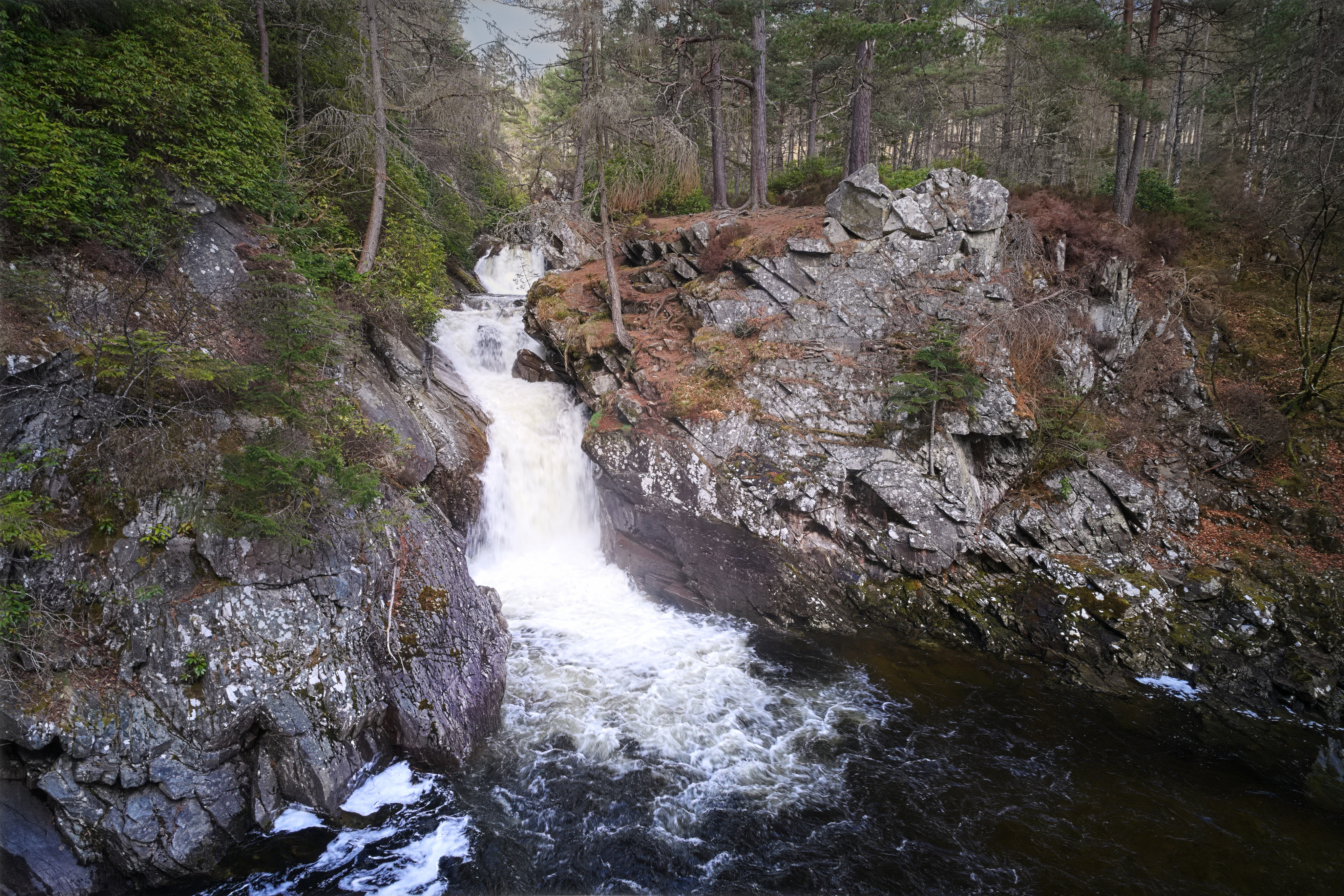
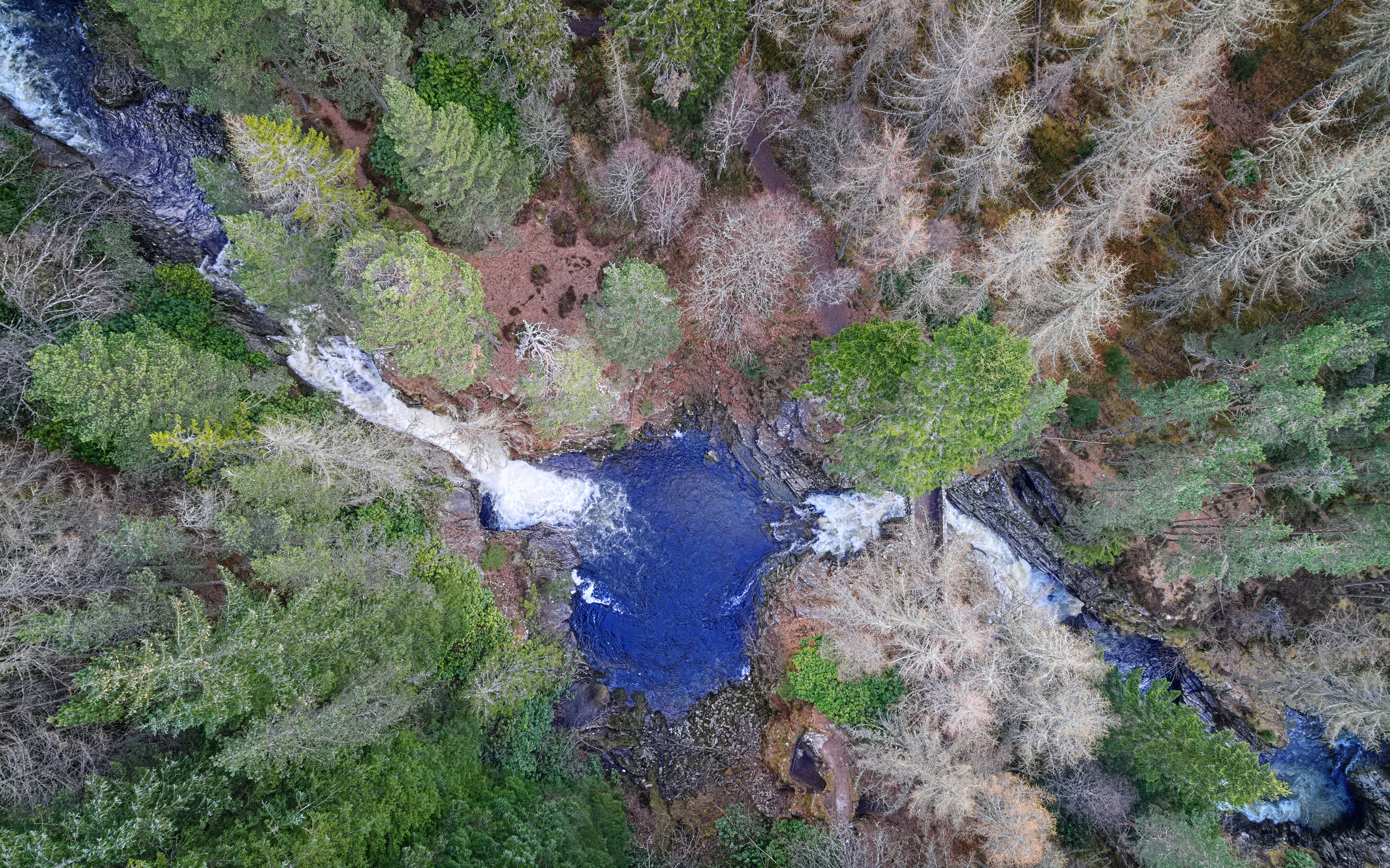
The final stop of the afternoon was at Edinample Falls along the South Loch Earn road – a small gorge but beautifully shaped with pleasant light through the surrounding trees and a decent amount of water flowing around the rocks.

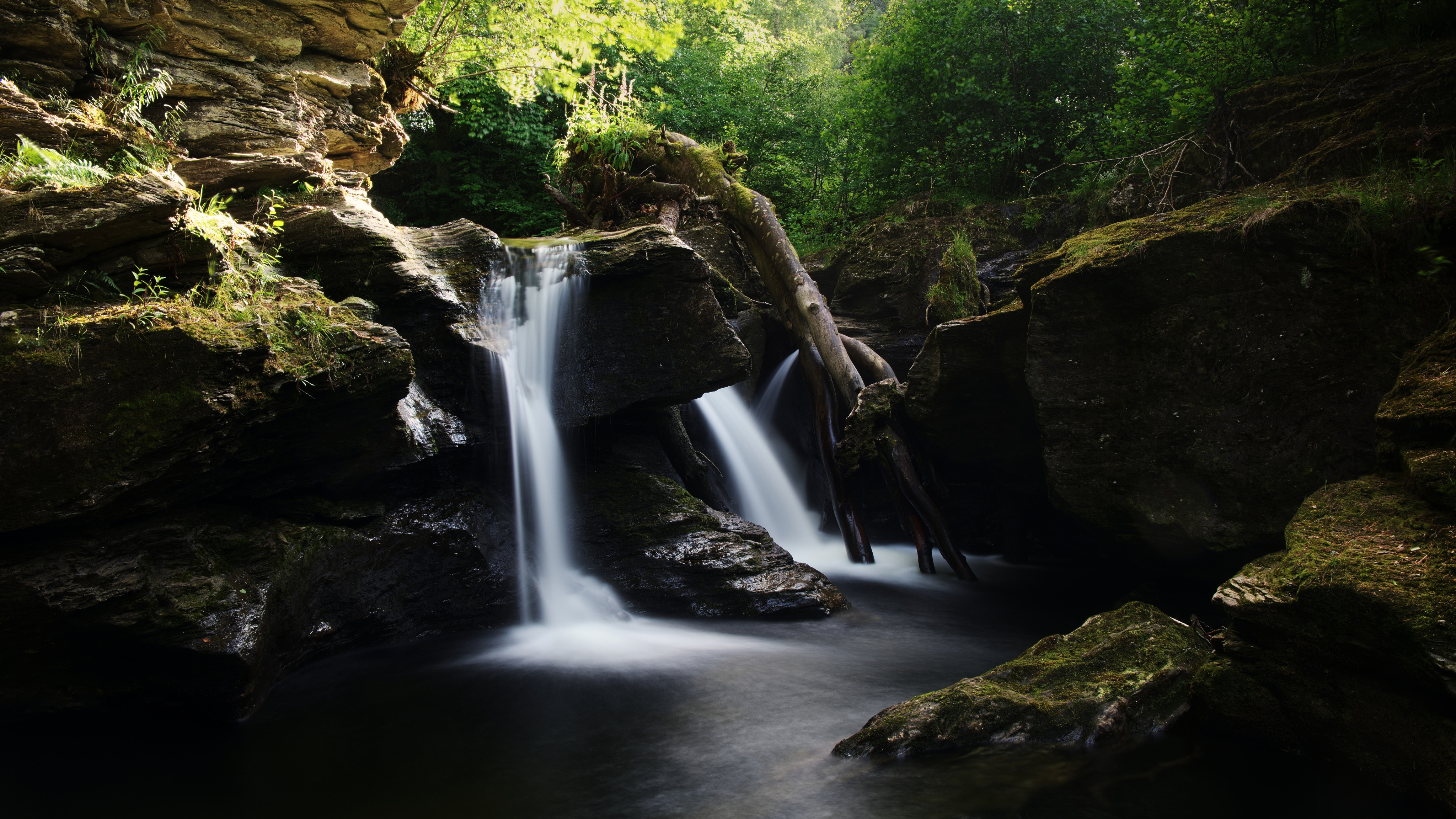
An overview of the waterfalls at Edinample – lovely sunlight illuminating the rocks nearby


when a landscape location goes sour

I don’t know how to tag some of these photos: on the one hand, a place that’s been a good walk in the trees for over a decade, but on the other, one that’s now showing the tarnish of human influence. Landscape photographer’s idyll or sad anger?

The Falls of Bruar present several well-known scenes. My own story is of having bought a tripod to do justice to a particular view and then using it to shoot a “hole in the ground in failed light” instead, thus getting one of my most-popular photos on flickr. I’ve been back probably 10 times over more years and enjoyed the stroll up the side of the gorge, admired the rocks, watched the three waterfalls doing their thing.

First there’s the regular cliché photo approaching the lower bridge – everyone gets the view from the top of the gorge opposite the lower bridge; I flew the drone down into the gorge and shot it from more on a level with the natural arch:

Nice rocks – psammite and semi-pelite as most of the Highlands, with the shear strata arising from the end of the Loch Tay fault-line.

Around the corner, there’s a viewpoint amongst the rocks of the second waterfall above the lower bridge:

Rising above the gorge one can see the pine trees lining the Bruar Water – it also shows how the middle cascades extend much further upstream than might be expected from the compressed perspective of ground level:

Abstract view of the lower Falls of Bruar

However, this visit was far from happy. Apart from some offensive uncouth ned muttering “hope you lose your drone” as he passed by, and the hordes of random unwelcome people thinking they were entitled to pester the dog, there are massive botanical problems: the two bridges have been closed so the path up the right side of the gorge is inaccessible due to tree works – possibly because of disease although I’m unconvinced this is the whole reason.

Bridge closed

Walking up the left side of the gorge instead, the area is infested with non-native invasive rhododendron bushes; the Forestry on the adjacent hillsides has been harvested leaving a horrendous unsightly barren landscape; the burns and tributaries beside the path are in a dire state of disrepair also.

Who wants to walk along here?

This is the trouble with well-known landscape locations; as photographers we like the illusion of wilderness, or at least that places are natural. Bruar has become no more than an ill-kempt garden with a water-feature running through the rockery. The light and shade and calming deep greens are no more to be seen.

I’m giving it a decade to recover before revisiting.

Around Glen Affric: water

I had a short holiday at the start of last November, a few days spent in Glen Affric. There are several aspects why it’s my favourite part of the planet, but for the purposes of this post, we consider the role of water in shaping a landscape, eroding its way through rocks to form river, gorges and waterfalls.

First, the impressive 150-foot drop of Plodda Falls from the top:

Second, some of the cascades in the River Affric, part of the way around the River Walk, rich autumn colours glowing in the morning sunlight:

And finally, a couple of 360-degree panoramas, partly to offer a behind-the-scenes view – they take a little while to download once clicked:

[sphere 2834]

[sphere 2836]

What I did on my holidays

To celebrate my increasing antiquity at the end of August, I spent a happy few days in the Lake District with Mum & Dad.

We stayed in a hotel around Borrowdale, with access to Derwentwater, close to Ashness Bridge. On the second morning there was wonderful mist in the valleys obscuring the view up the lake with just the top of Skiddaw showing.

We spent a happy morning clambering up the Lodore Falls – a steep hillside climb through heather and pine trees.

We visited the Solway Aviation Museum at Carlisle airport, home to an English Electric Lightning (I used to see them flying over Lincolnshire in my very early years), a Phantom and – joy of joys – a Vulcan bomber, XJ823, inside which one could see the cockpit and sit in some of the metal chairs.

And I went flying! Most unexpected – I’d been hoping for a scenic tour but instead got an hour’s flying lesson. As the instructor said, “push the left pedal to turn left”. And the rest was pretty plain sailing – as responsive as a car on a road with perfect camber, crossed with turbulence akin to sailing a boat. We cruised at 2500-3000 feet, skimming along just below the cumulus clouds, from Carlisle across to Bassenthwaite and down Derwentwater to Borrowdale, up over Watendlath Tarn and back around Thirlmere to Carlisle again. A most excellent experience. (Photos by Dad stuck in the back seat – I think he did a good job!)

On the Monday, Dad and I drove around some of our favourite mountain passes and landscape locations in the Lakes: Wastwater with the classic view of Great Gable at the end, round to Hardknott Pass – stop at the Roman Fort of Mediobogdum, admire Eskdale – then carry on up and over Wrynose. The weather was just right – not too much cloud, just cloud shadows on sunny landscape – and my favourite conditions, bright foreground with filthy dark stormy rainclouds in the distance. It was allowed to rain after that.

On the last morning I called in at Mum’s favourite spot on the planet, Friar’s Crag at the end of the road past the jetties out of Keswick.

That was some (long) weekend!