For the second day of my holiday last Autumn, I got up – again! – at a ludicrously early hour and drove from Tongue round to the Assynt peninsula, to my favourite viewpoint for sunrise.
It was some drive.
All the way from Tongue to Loch Assynt without seeing another car. Bliss.
Take the A838 road (abused as part of the ghastly NC500 coastal route) via Durness at 5am in the pitch black, the wind blowing a gale, rain + windscreen wipers on full speed.
Picture avoiding a herd cows intruding across the road. Avoiding more than 10 deer.
At that surreal pre-caffeinated hour of the morning, seeing a signpost advertising “serving local seafood” makes me picture a restaurant waiter taking a scallop’s order at table.
The music of choice was Arcade Fire Mountains beyond Mountains – a song bemoaning city life with its world so small – a mental image contrasting with my surroundings, passing rural Scourie, pop 132 – the sort of place that takes longer to say the name than drive through.
And so I arrived at Rhicarn – the landscape black, clouds a grey plasma, just a little bit windy…
And the sun rose. Quite spectacularly, casting brilliant crepuscular rays from the horizon and underside edges of clouds.
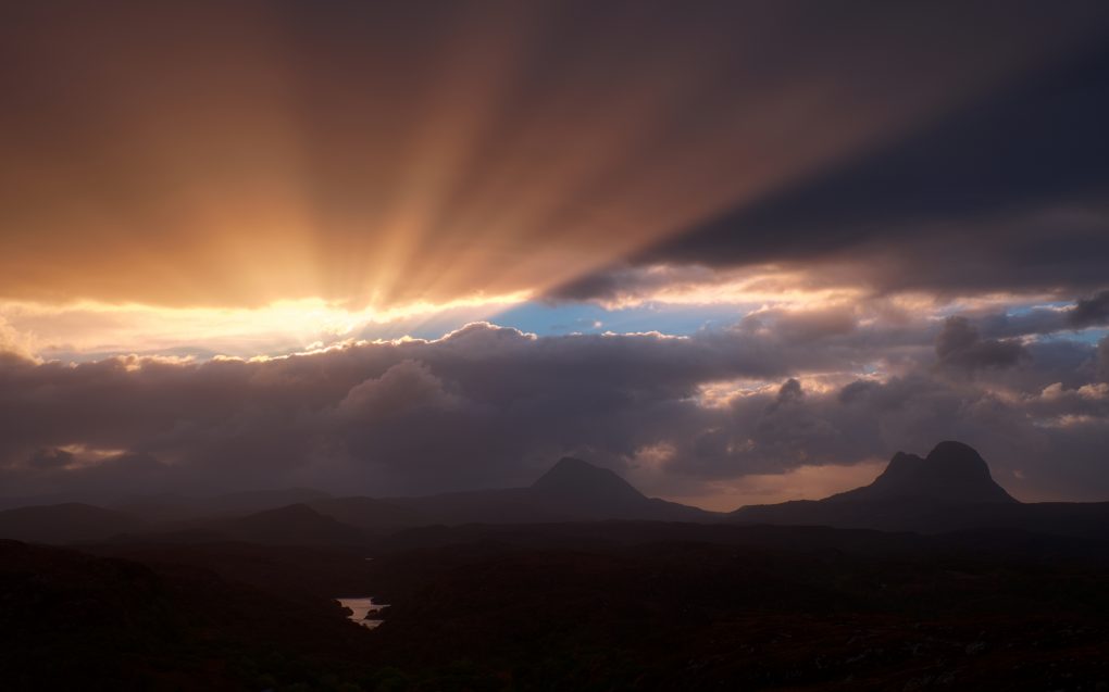
A brilliant display of crepuscular rays, shadows coming from the edge of a cloud as the sun rose beside Canisp. 
Beautiful morning light: crepuscular rays streaming from a cloud edge, illuminating the sides of Suilven and Canisp and the Manse Loch in the foreground. 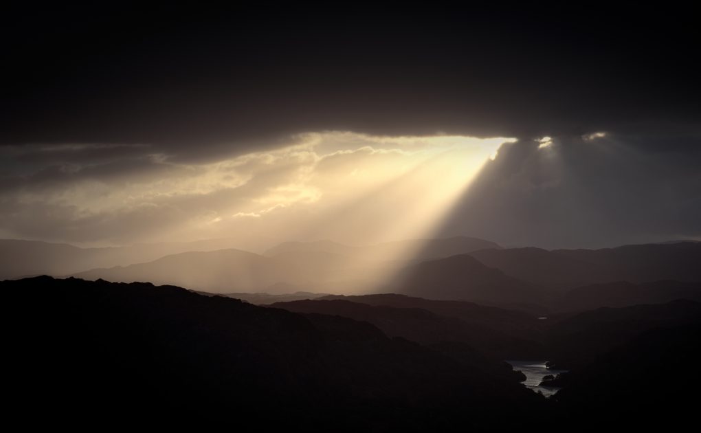
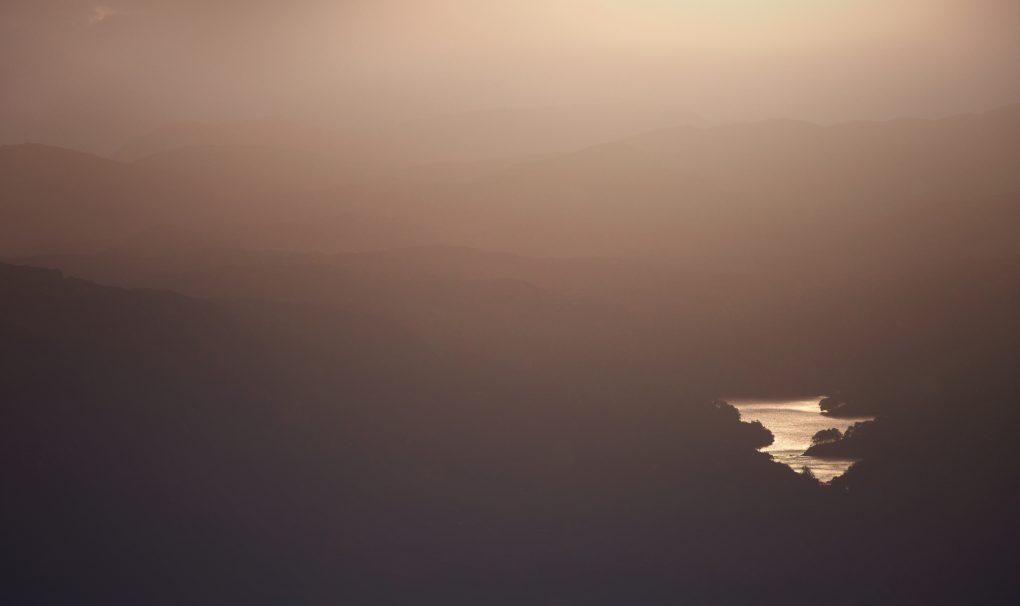
A thick cloud obscured the freshly risen sun – its edges casting crepuscular rays over the hazy landscape. Autumn at my favoured viewpoint, Rhicarn in Assynt. 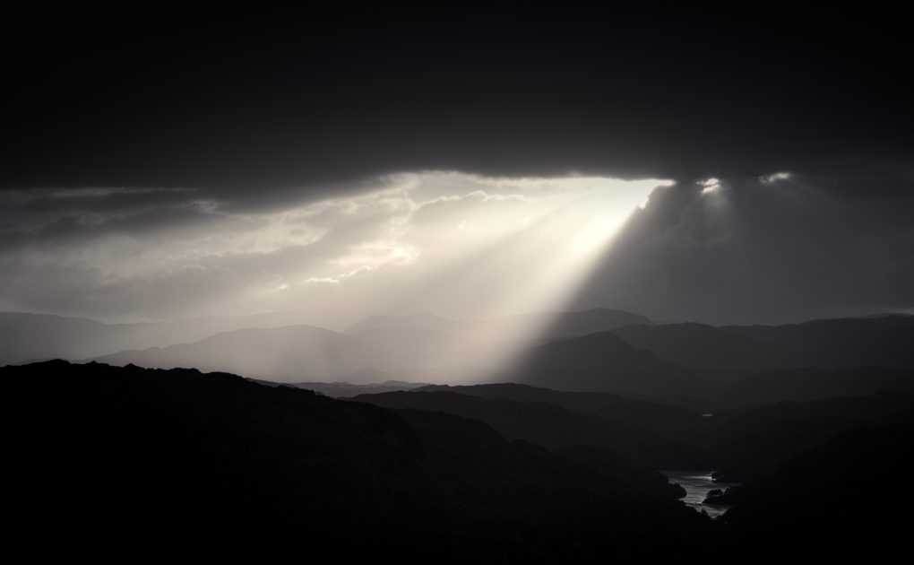
A thick cloud obscured the freshly risen sun – its edges casting crepuscular rays over the hazy landscape. Autumn at my favoured viewpoint, Rhicarn in Assynt. 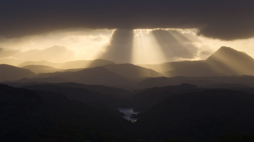
Loch Uidh a’Chliabhain and the Manse Loch in the foreground; beautiful receding layers of mountains in the middle; a stunning dramatic display of crepuscular rays as a cloud obscured the rising sun in the distance. Projection: Rectilinear (0) FOV: 23 x 16 Ev: 11.38 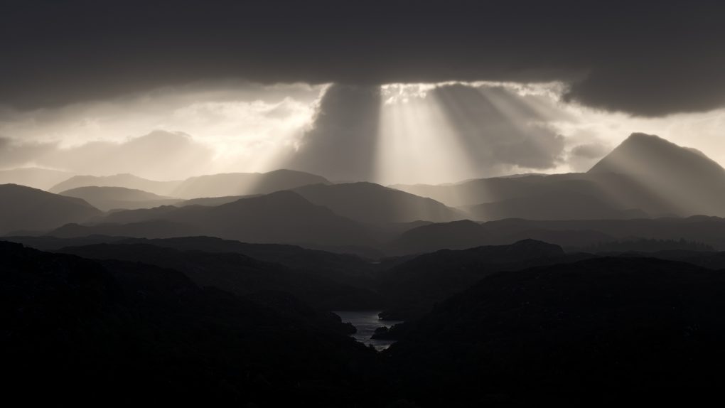
Loch Uidh a’Chliabhain and the Manse Loch in the foreground; beautiful receding layers of mountains in the middle; a stunning dramatic display of crepuscular rays as a cloud obscured the rising sun in the distance. Projection: Rectilinear (0) FOV: 23 x 16 Ev: 11.38
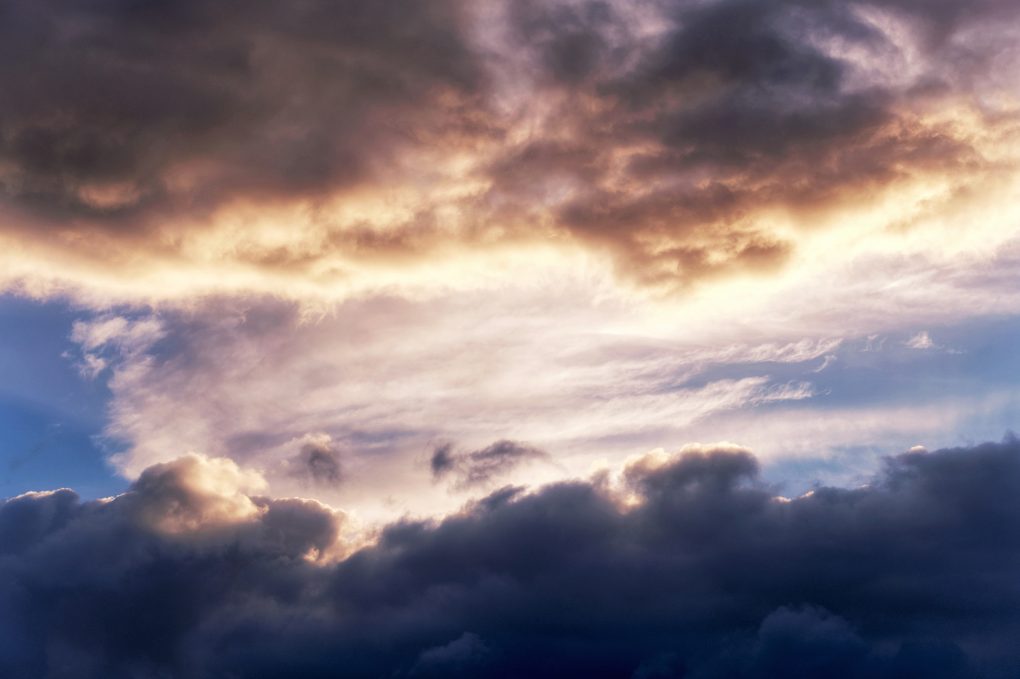
Throughout the sunrise, the light was spectacular – brightly illuminating colourful clouds.
…and casting a subtle hazy glow over the morning fog across Little Assynt, outlines of hills receding into the mist
As the sun rose, the ground heated just enough for the overnight dew to evaporate into a thick fog, filling the landscape enough to obscure the receding lines of hills into nothing but a bright haze beside the sun. Manse Loch / Loch Uidh a’Chliabhain remains clear, a mile into the foreground. 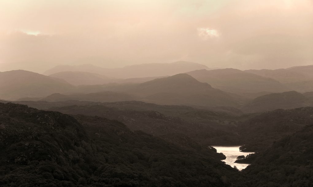
Iconic Scottish landscape: the Manse Loch and layers of hills and mountains receding into the hazy distance
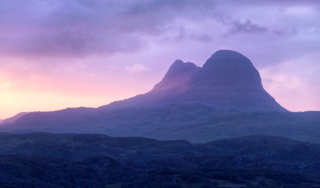
Perhaps my favourite image from the morning has to be Suilven, the unmistakable mountain on the horizon, catching a subtle patch of oblique sunlight on a flank.
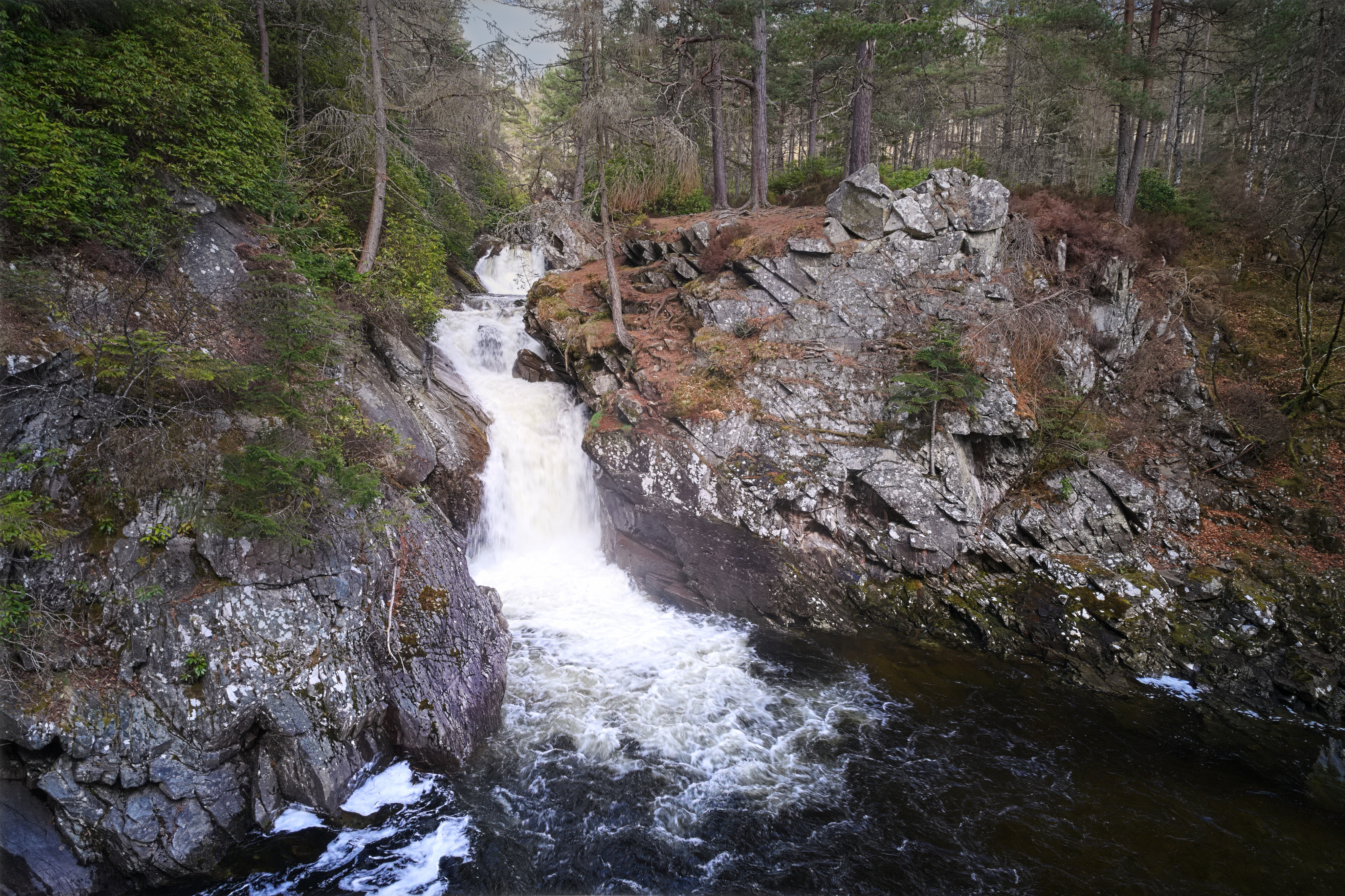
Once the sun rose, I explored the Falls of Kirkaig outside Inverkirkaig. A nice long walk through lumpy landscape, to a large thundering waterfall.
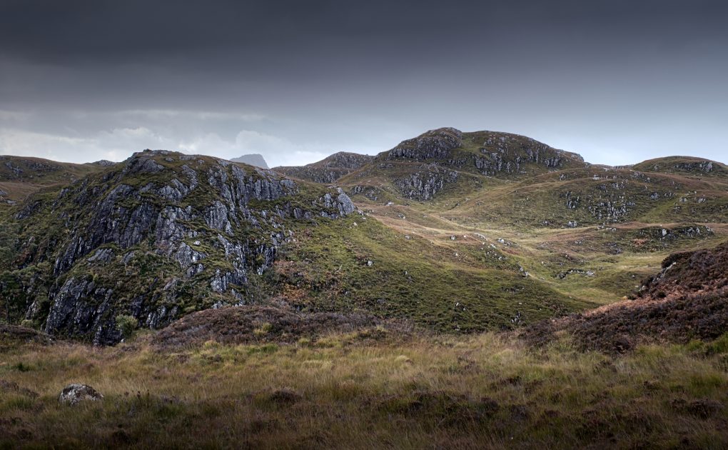
Undulating landscape; gneiss outcrops amongst the grass and heather beside the path above the River Kirkaig gorge. 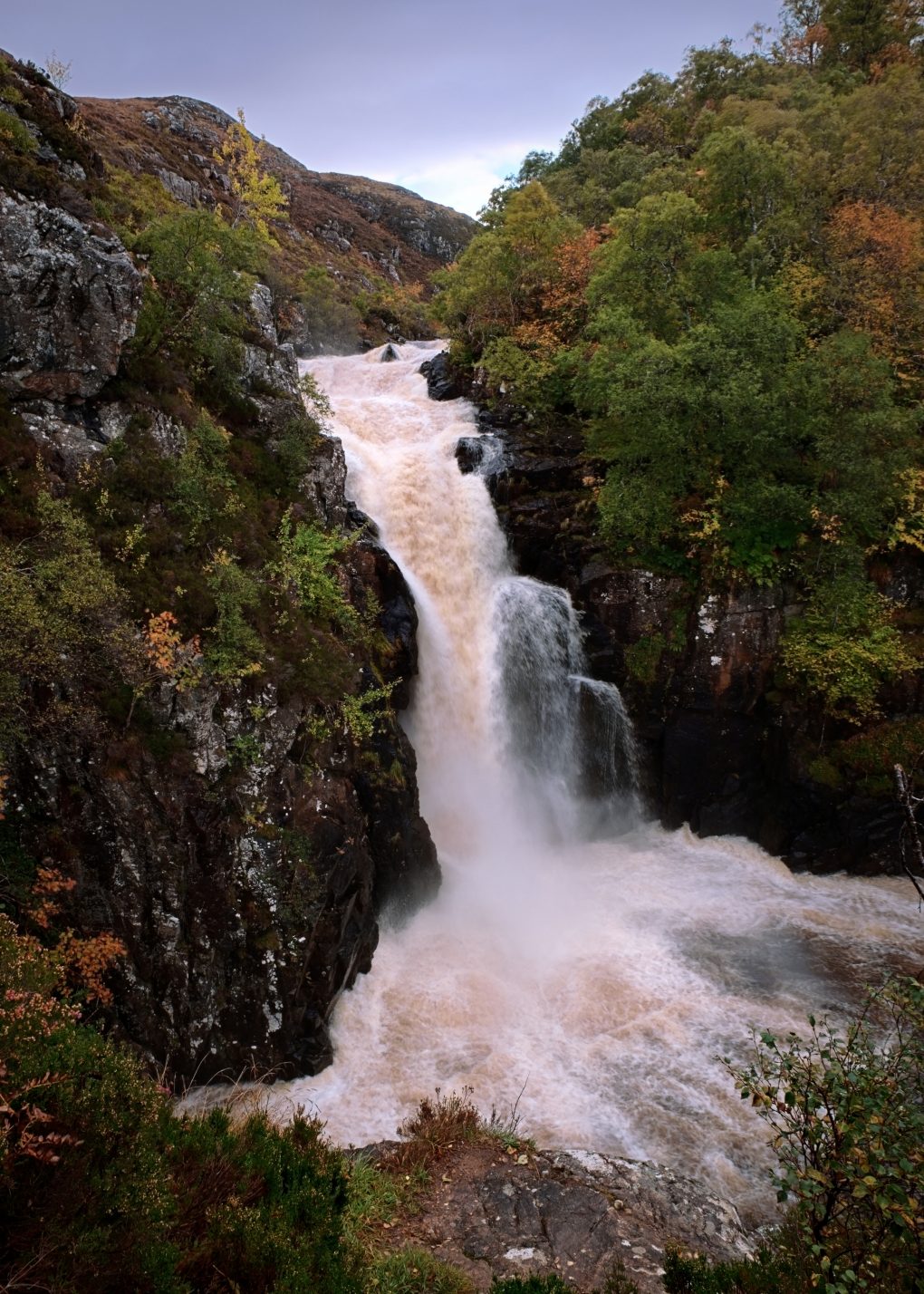
An impressive waterfall – 60ft tall and flowing deep and fast into its splash-pool below. It’s also one of the scariest places I’ve been in a landscape; this view is from a small platform area, a steep descent down the left face of the gorge. With my own dog for company there was limited space even to turn around and plant the tripod and camera bag. 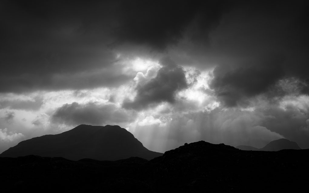
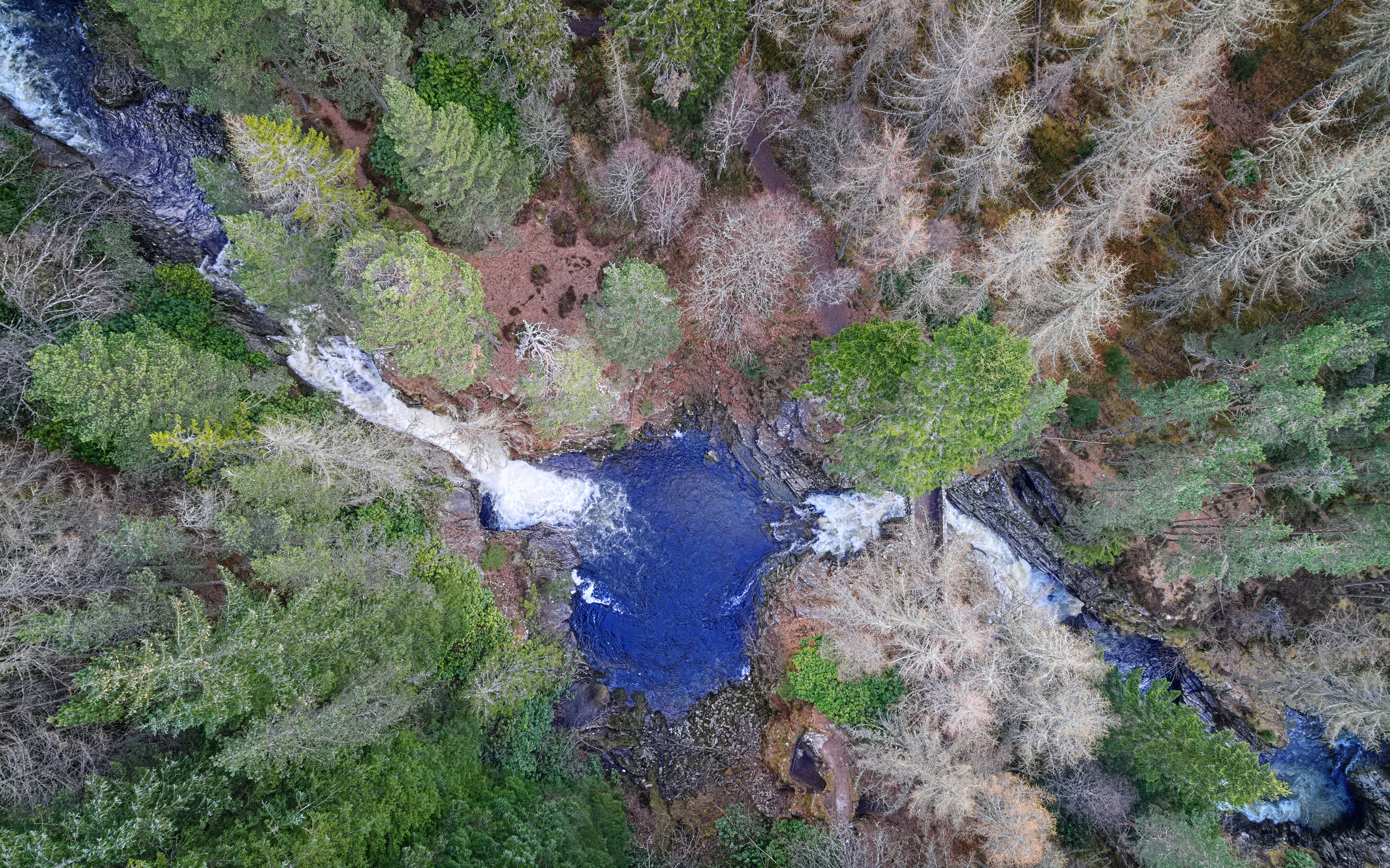
As if the river Kirkaig wasn’t full and fast enough in the bottom of the gorge, walking back along the top the clouds were pretty dramatic, the light behind coming through as crepuscular rays above the silhouetted hills.
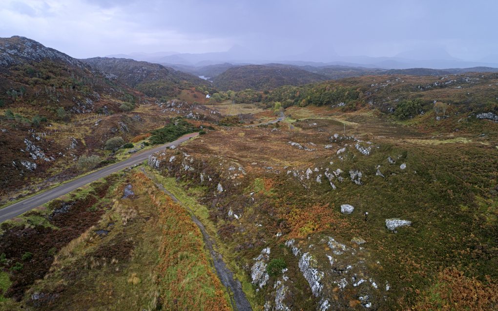
Returning to above Rhicarn, clouds had flowed in obscuring the mountains on the horizon, so I experimented flying the drone to admire the surrounding landscape.
There’s something about finding a thin strip of old tarmac that obviously used to be a road – it makes a connection with the story and heritage of a location. From researching on Pastmap, it appears there was not much road here at all throughout the 19th century – presumably a cattle drovers’ track or similar. Then the old tarmac was laid, following a circuitous path around the gneiss rock hills. Finally, some time after the 1960s, a new road, now the B869, was laid through it in a boring straight line, the old route relegated to a carpark yet visible and walkable either side of the road.
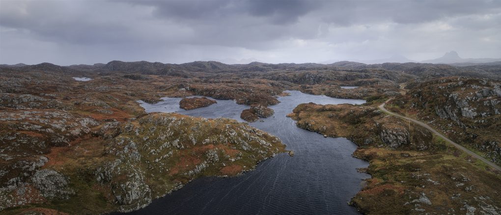
Behind this scene, on the way to Clachtoll, lies some beautiful Karst landscape (cnoc’n’lochan or knock-and-lochan), formed by underground erosion of softer rock, leading to a classic pattern of rocky knolls interspersed (almost 50-50 by area) with lochs.
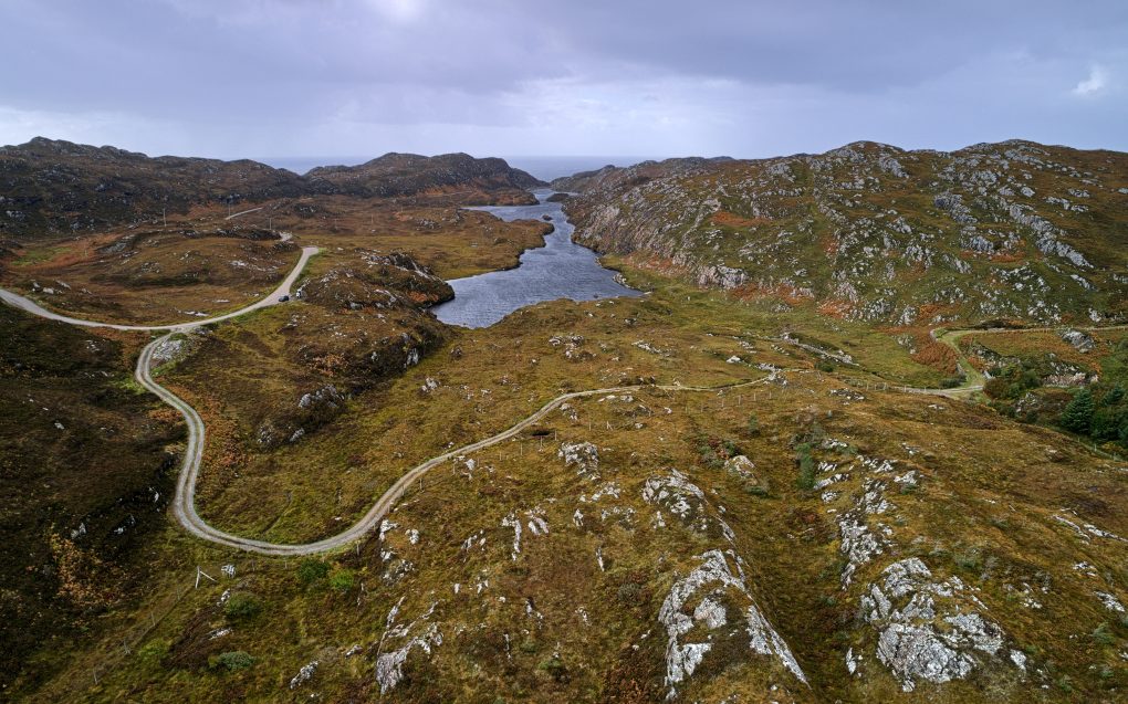
The joys of knock-and-lochan Karst landscape: it’s almost all equal parts gneiss rocky outcrops and lochs with roads wending their way through the shapely landscape. 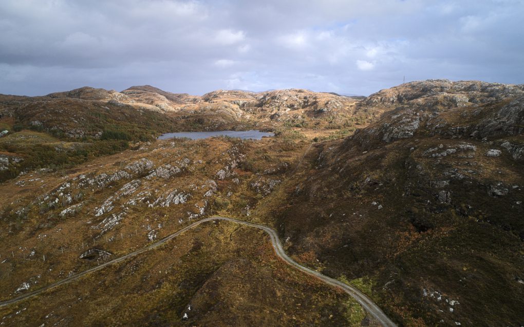
Further along the road lies the Maiden Loch, of which I’ve been very fond since first catching sight of it years ago. That first view was on a sunny afternoon, the sky blue reflecting in the water. I flew the drone over it, to admire the gneiss landscape all the more…
Some of the above photos are available on my photo gallery website: ShinyPhoto: Assynt