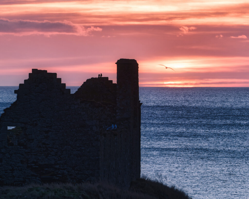
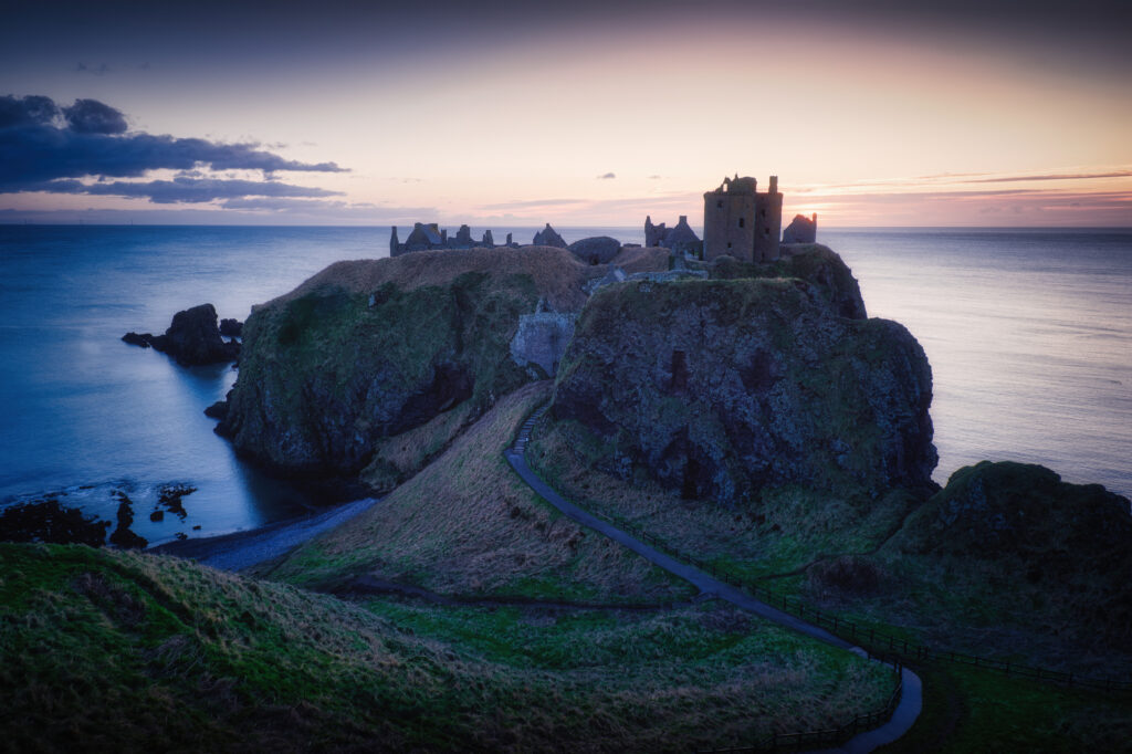
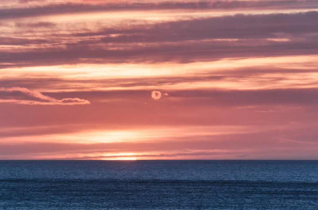
Sometimes you just have to head up the road to catch the sun rising over the horizon at a favoured castle ruin.
I have photos for sale of Dunnottar Castle over on shiny.photo.
Sometimes you just have to head up the road to catch the sun rising over the horizon at a favoured castle ruin.
I have photos for sale of Dunnottar Castle over on shiny.photo.
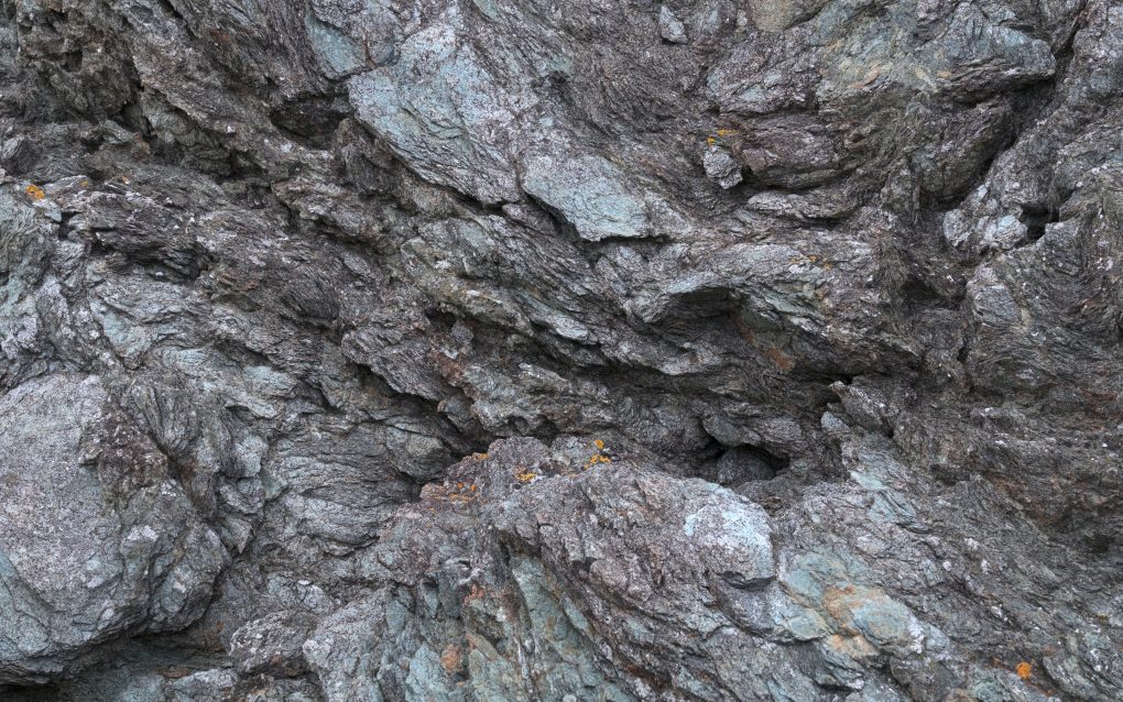
Some years ago I had a passing interest in the abstract shapes and forms rocks can take.
Recently I was out on the Aberdeenshire coast hunting photos with a friend, who, being impressed with the rocky coastline, wondered exactly where the Highland Boundary Fault emerged at its most north-eastern extremity.
After a bit of research (particularly exploring using the BGS‘s iGeology app), I tracked it to a small headland, Garron Point, beside the golf club outside Stonehaven.
From the outside it doesn’t look like much, but on closer inspection it is awesome.
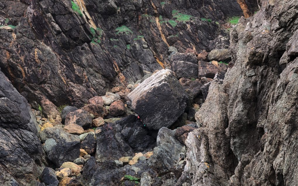
There are actually two faults – a small one at the north-eastern end of Craigeven Bay corner with Garron Point, forming a small spur off the Highland Boundary Fault which clips the coastline from the town out to sea.
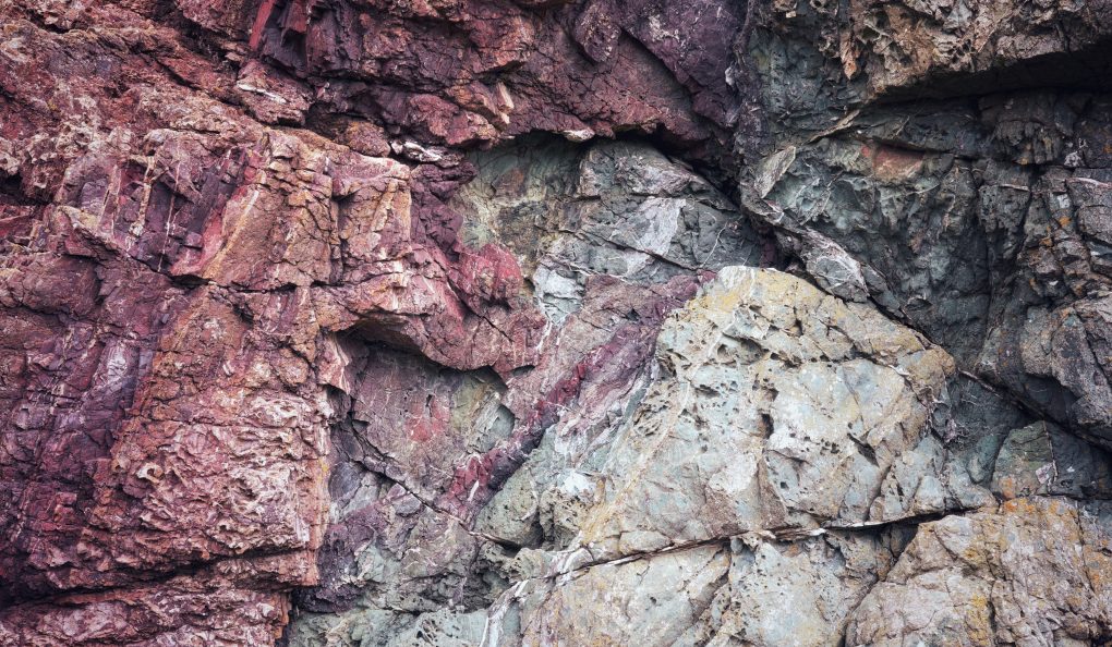
On the lowland side the bedrock is metabasalt, psammite and pelite (North Esk formation) – metamorphic bedrock formed around 461-485MYa in the Ordovician period. On the highland side is gritty psammite (Glen Lethnot grit formation) – around 541-1000MYa.
The fault itself can be tracked to a matter of a few feet – a view from beside one of the golf greens shows the junction of both faults, with a strip of incredibly deformed grey rock leading away some meters rather like a line of chewing-gum.
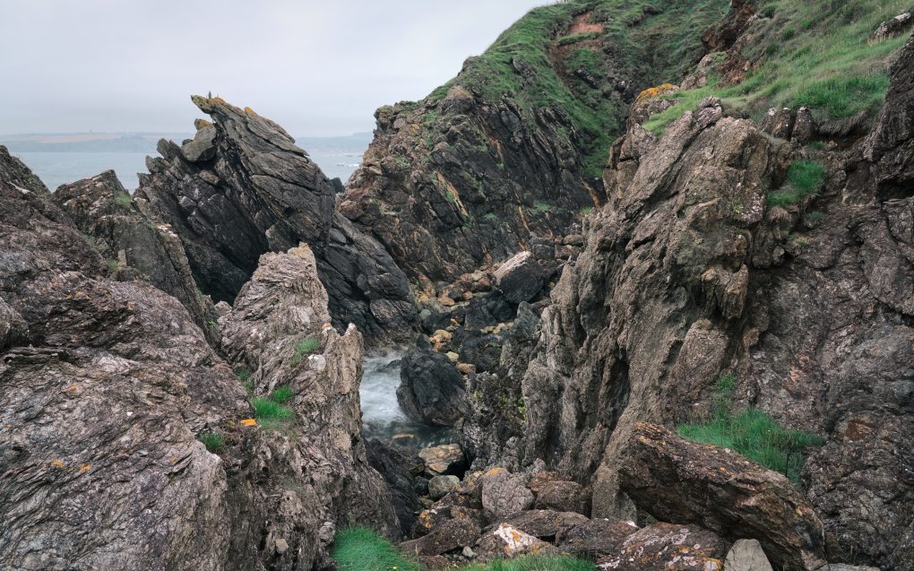
My favourite image is an abstract closeup – purply-red microbasalt meeting gritty blue-green psammite in a spray of cracks and marbling lines.
Prints are available on my ShinyPhoto photo gallery: Under Pressure
Dunnottar Castle is a ruined medieval fortress located upon a rocky headland on the north-east coast of Scotland, about 2 miles south of Stonehaven. The current ruins date from the 15th and 16th centuries, but there is believed to have been fortification on the site since the Early Middle Ages.
The ruins of the castle are surrounded by steep cliffs that drop to the North Sea, 50 metres (160 ft) below. A narrow strip of land joins the headland to the mainland, with a steep path leading up to the gatehouse.
I made these photos over the course of a couple of hours after the eclipse in March, partly because I know the place well, partly because I was reminded of it by a photo in the local photo-club, and partly because I wanted to reshoot it at greater quality with newer processing techniques. It’s a pity the path down to the shore is so muddy – perhaps I should revisit either in winter or early spring instead.
For the record, the workflow for these is: