Focus-Stacking with the Fuji X-H1

For years I’ve been a fan of superresolution – taking multiple images of a scene with subtle sub-pixel shifts and upscaling before blending to give a greater resolution photo than any one source.

One of the features I used occasionally on the Pentax K-1 was its pixel-shift, whereby the sensor moved four times around a 1px square; this gives an improved pixel-level resolution and full chroma detail at each point.

Having exchanged that for the Fuji X-H1, I still look to perform super-resolution one way or another. Hand-held HDR always works – in this case even better than either the K-1 or the X-T20 because the X-H1 permits 5 or 7 frames per bracket at ±2/3EV each, which is ideal.

But I thought I’d experiment with a different approach: focus-stacking. This way, the camera racks the focus from foreground to background in many fine steps. Keeping the focal-length the same, the effective zoom changes subtly between successive images. Essentially, where hand-held HDR varies the position stochastically in an X-Y plane, focus-stacking means pixels from the source frames track a predictable radial line in the superresolved image.

The X-H1 has focus-bracketing but leaves the blending up to the user in post. That’s OK.

First, an overview of the scene:

Scene overview: Fuji X-H1, 18-135mm lens at 127mm, f/8 narrow DoF

The X-H1 made 50 frames, focussing progressively from front to back. These were blended using enfuse:

time align_image_stack -a /tmp/aligned_ -d -i -x -y -z -C [A-Z]*.{tif,tiff,jpg,JPG,png}
time enfuse -o "fused_$base" /tmp/aligned_* -d 16 -l 29 --hard-mask --saturation-weight=0 --entropy-weight=0.4 --contrast-weight=1 --exposure-weight=0 --gray-projector=l-star --contrast-edge-scale=0.3

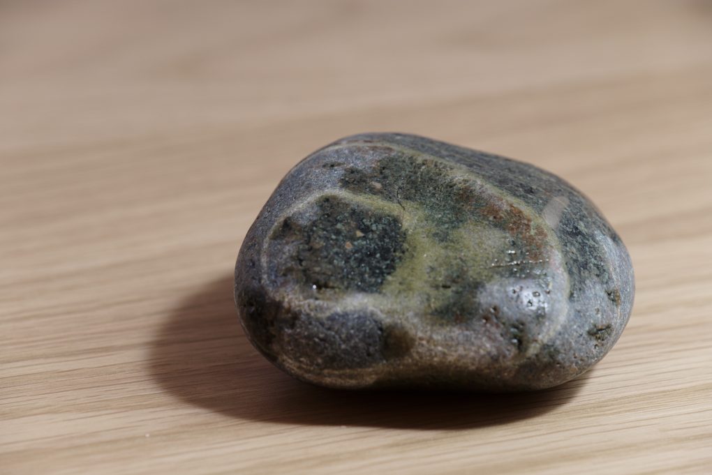
The results are a little strange to behold – while the effective DoF is much increased (the distant wood texture is clear) the rock detail is quite soft; I suspect some of the above numbers need tweaking.

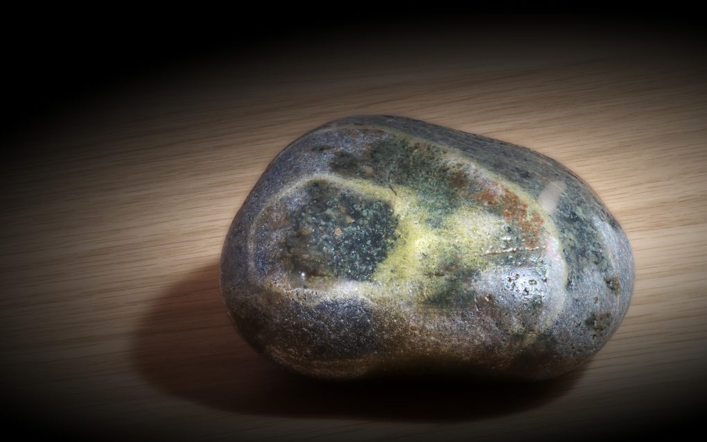
However, with a bit of work – both enhancing the local contrast and using in-painting to tidy up the rock itself – a pleasant image emerges:

The final polished result: banded rock on wood, Fuji X-H1

A definite improvement. I may have to use it in my landscape work a bit 🙂

Landscape and Geology – an NC500 road-trip

Back last November I spent a very happy few days staying up North; the first day was spent in Glen Affric (sunrise, trees, water and light).
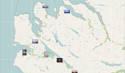
Photo Map

Photo Map – a long drive around Wester Ross

In the few years since I was last up there, there’s been a concerted push to market the road around the far north of Scotland as an “answer to Route 66” and thereby promote it as a tourist attraction.

The second day of my holiday saw lousy weather, completely overcast and foggy for much of the time. So I spent the day driving around Wester Ross wondering where the scenery had got to… trying not to think of it as the NC500 but actually enjoying several stops along the route that I’ve been to previously.

The first stop was the well-known view from a layby in Glen Dochart, above Kinlochewe to admire the sinuous road:
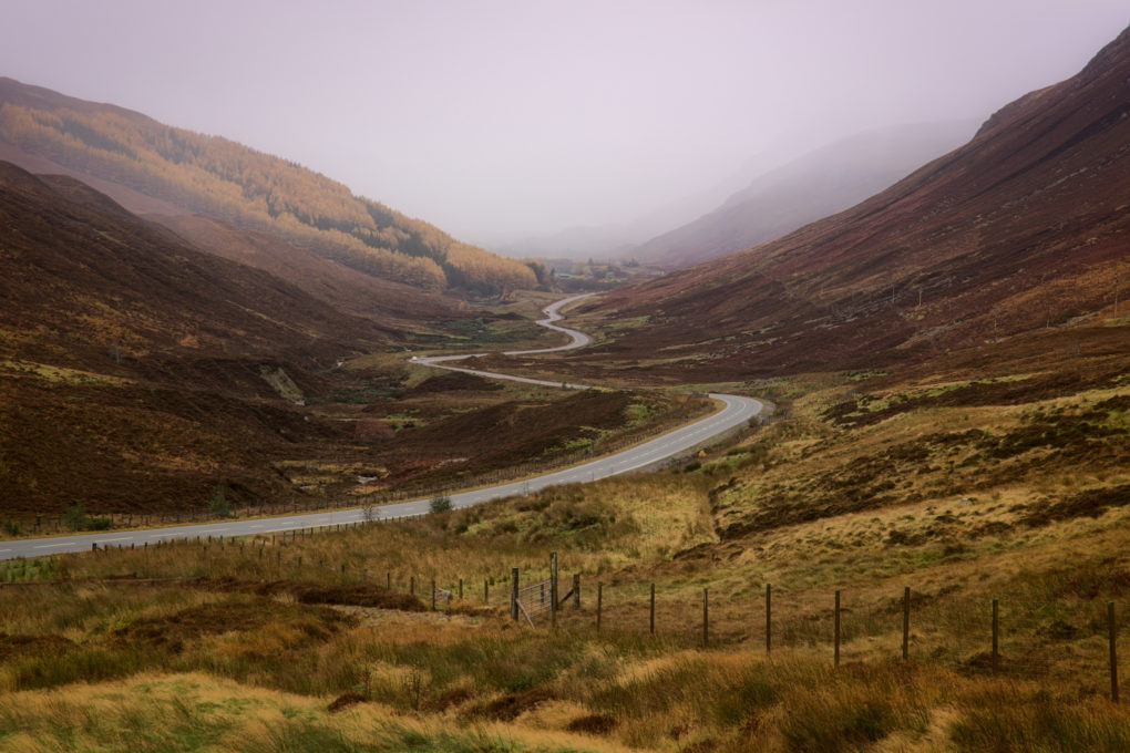
An obvious scene: the road wending through Glen Dochart toward Kinlochewe (not depicted: Kinlochewe, because of the mist).

Pity about the mist…

A little further along on the way through Kinlochewe are two mountains – Beinn Eighe to the left and Meallan Ghobhar and Coille na Dubh Chlaise to the right. We pulled off the A-road and Doglet had his breakfast more or less directly on the Loch Maree fault-line whilst admiring the quartzite rock strata.

There wasn’t much to be said for the views across Loch Maree, although the contrast of dull grey skies and warm autumnal orange and yellow colours was pleasant.

Some years ago, there was a TV documentary, a former politician’s search for the most natural woodland in the UK. After much searching around down south in the New Forest, he came north and explored Caledonian Forest remnants, finally finishing up on an island in Loch Maree – a rather bizarre arrangement of an island with a lochan with another island inside that – on which he stated the trees were least likely to have been touched by mankind. There is an obvious viewpoint, a small section of beach, at Slattadale toward the north-west end of Loch Maree, from which the group of islands can be seen.

Of all the photos I made during that day, this was perhaps the most classical landscape, in that I had the idea for these photos – the location, leading lines of foreground boulders, large expanse of silvery water and Slioch in the distance – planned in my mind for ages before revisiting the area.

What you don’t see is how, while I was making these photos (long exposures, totalling a minute’s exposure, focus-stacked) there was another photographer sitting 20yd away, cooking his morning breakfast – so the photos fail to include the clouds of fragrant bacon and fish smoke billowing past the camera…

Speaking of lunch, mine happened at Badachro, at the Inn. Highly recommended – everyone loved Doglet, which is a good start, and the burger was tasty as ever. Mostly the thing I like most is how the coastline is just like Plockton – west-coast rocky sea-lochs and seaweed – but without actually being Plockton that everyone else flocks to see.

And this is what it’s really like at Badachro:
[sphere 2974]

On a previous trip I had explored as far as Poolewe but not had a chance to go further; this time I stopped off at Loch Tollaidh to admire the rocky outcrops across the water (Lewisian Gneiss and other igneous rock).
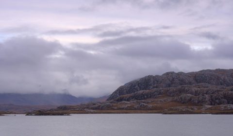
Classic Wester Ross landscape – huge lumps of Lewisian gneiss, beside Loch Tullie

Signs of industry: on the shore of Loch Tollaidh is a small jetty, presumably a put-in for boats to go inspect the small salmon farm. That and the remains of a very dead boat, wood bleached inland, caught my attention:

On travelling up the coast to Mellon Udrigle (what a wonderful name!) I was struck by the view across the Wester Ross Marine Protected Area to the mountains on the horizon on the mainland. On the left, a bit of misty cloud drapes over the top of Beinn Ghobhlach; to the right, there’s more mist flowing over Sail Mhor but the huge bulk of An Teallach was completely hidden behind the cloud.
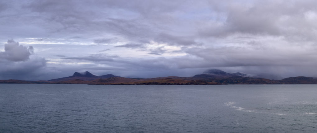
A wide-angle panorama: low-lying cloud (with a bit of precipitation) and mist flowing over Sail Mhor – the full bulk of An Teallach is completely hidden in the cloud beyond.
The mountain on the far left is Beinn Ghobhlach.

By the time I got back onto main roads, with a very long drive ahead, the light was fading fast toward dusk and the blue hour and clouds in front were thick and closing in fast, so I made one final photo for the day by the side of Little Loch Broom and scarpered fast.
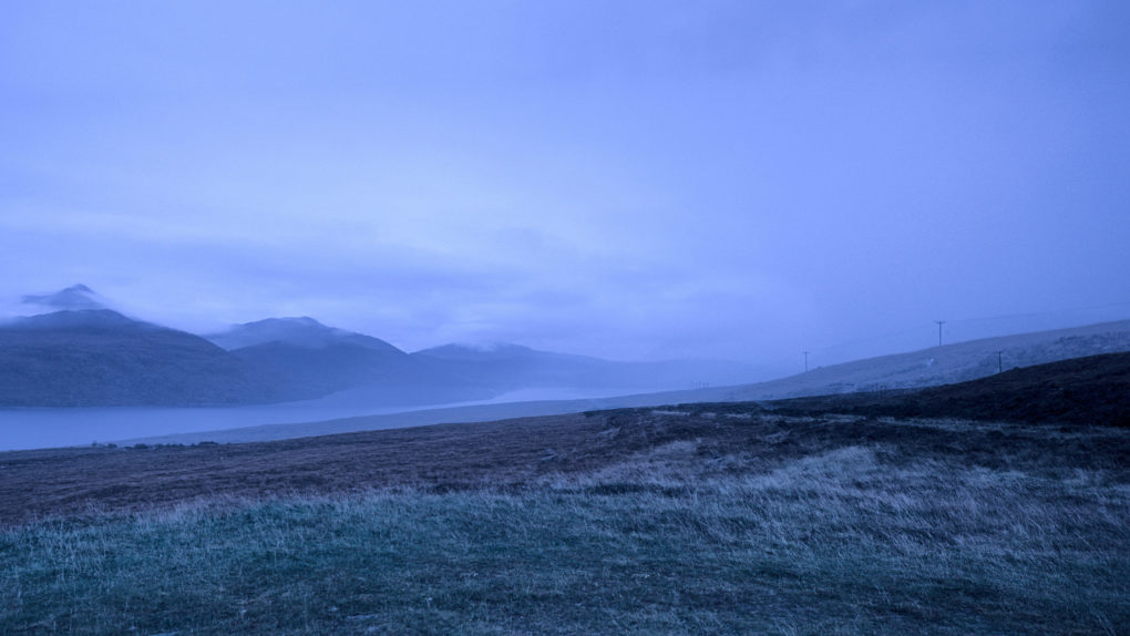
Lots of mist in the distance, travelling the A832 past Beinn Ghobhlach.
I was rather glad to get back in the car and head off before the weather got really bad!
A Favourite Walk

Around January I discovered a new walk near Dunkeld that quickly became a favourite way to spend a weekend afternoon. Starting from the Pass of Birnam, head up the track from Bee Cottage and turn left to go around the south side of Duncan’s Hill then rejoin the path up to Stair Bridge Viewpoint and the top of Birnam Hill.

As routes go, it gives a mixture of sheltered woodland tracks and sweeping landscape views, complete with my favourite feature – you can watch the rocks changing from till to slate to psammite and semi-pelite as you cross the Highland Boundary Fault. Small wonder I’ve done it half a dozen times dragging various folks along with me, gradually exploring further each time as the winter receded.

These photos are from an experiment with a Prakticar 24mm lens (M42 fit) – acquired for cheap from ebay and stuck on a wonky adapter which might explain some focussing issues. Several of them depict the line of the HBF through the landscape, with hills on one side in the Highlands and on the other in the Lowlands.

Crail: colour

Three views of the beach at Crail – for the geologists, the rock is old red Devonian sandstone. For everyone else, the seaweed is slippery and the water is wet.

Crail Harbour Rocks: then and now

Quite a few years ago, I had just acquired a large-format view-camera (a Shen-Hao); for a first excursion, I took it to Crail in Fife and made an interesting study of the boulders submerged at the water’s edge on the beach.

Fast-forward five years, and I returned to the same beach in Crail with a little Sony NEX-7 camera and retook the same image-brief:

  • Crail
  • closeup
  • water and rocks
  • multiple superimposed exposures

The differences a few yards, a few years, and a different day can make! Enough, perhaps, to justify titling the new image “Crail Harbour Rocks (2)”.

The Uses of Karst Landscape

Karst topography is a landscape formed from the dissolution of soluble rocks such as limestone, dolomite, and gypsum, characterised by underground drainage systems with sinkholes, dolines and caves and other features typical of such erosion.

A few weeks ago, Dad and I went for a drive around North Yorkshire, most particularly to the Butter Tubs – named either because they look like butter-tubs, or for the story that travellers used them to keep tubs of butter cool. They takes the form of a noteworthy (and mildly scary) pattern of crevices in the limestone about 20-25m deep, where the softer limestone rock of Hood Rigg has eroded away. The surrounding landscape affords a pleasant view where the Cliff Beck wends its way between the hills of Thwaite Common and Muker Common.

Plus the area was humourously(?) known as “Cote du Buttertubs” in the 2014 Tour de France that started in Yorkshire.