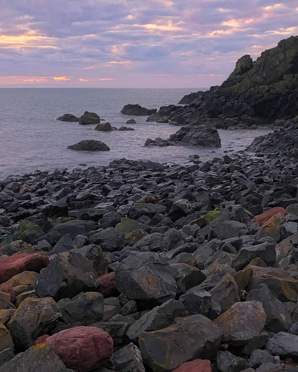
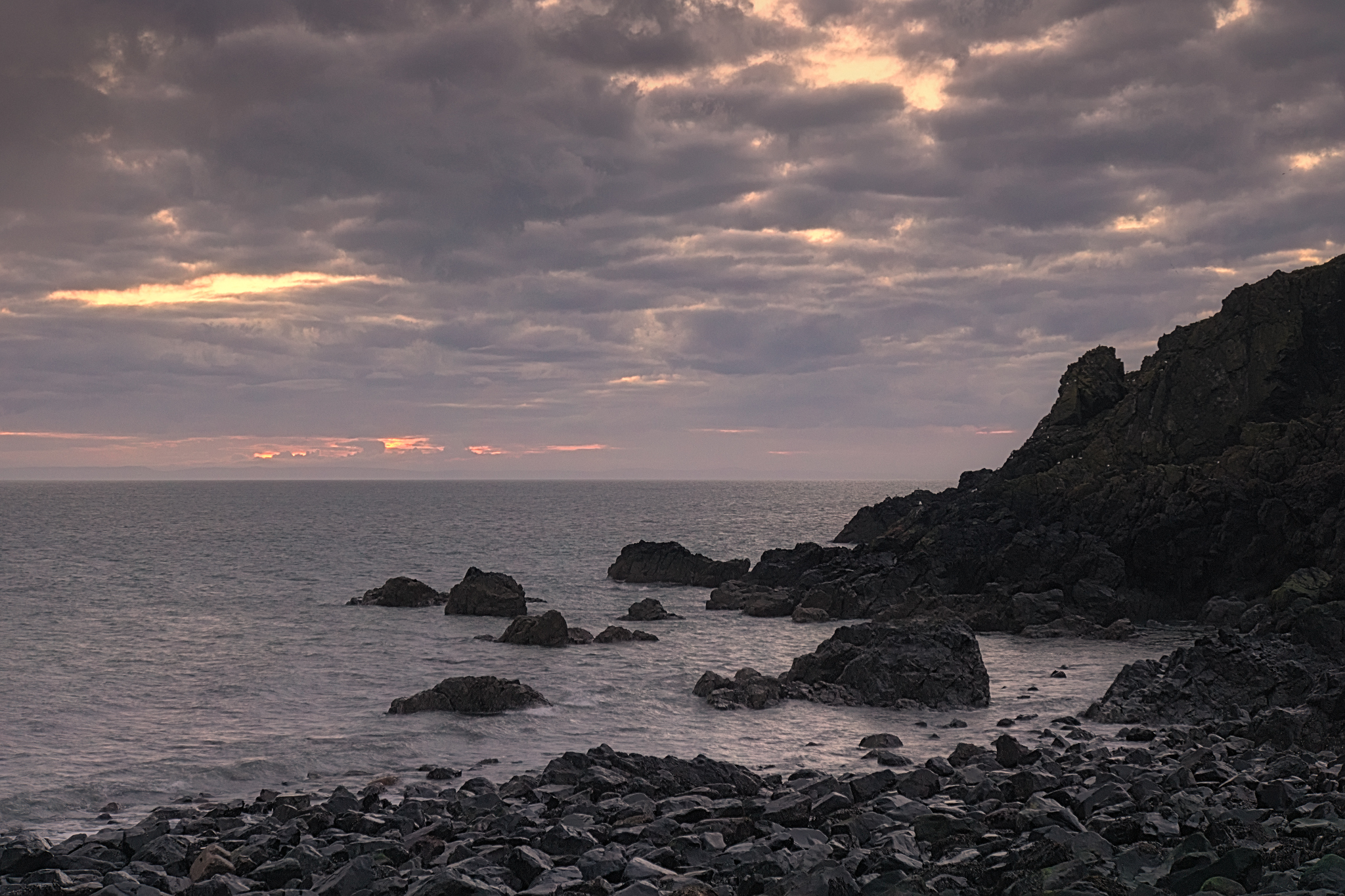
A continuation of, and the latest in, the “Crail Harbour Rocks” theme – I’ve already posted a comparison of the original study at this location from 2007 against a similar closeup from 2015; here we have a classic intimate-landscape view – optimum golden-hour light at sunset touching the rocks from foreground into the distance.
Tag Archives: rocks
Crail: colour
Three views of the beach at Crail – for the geologists, the rock is old red Devonian sandstone. For everyone else, the seaweed is slippery and the water is wet.
Crail Harbour Rocks: then and now
Quite a few years ago, I had just acquired a large-format view-camera (a Shen-Hao); for a first excursion, I took it to Crail in Fife and made an interesting study of the boulders submerged at the water’s edge on the beach.
Fast-forward five years, and I returned to the same beach in Crail with a little Sony NEX-7 camera and retook the same image-brief:
- Crail
- closeup
- water and rocks
- multiple superimposed exposures
The differences a few yards, a few years, and a different day can make! Enough, perhaps, to justify titling the new image “Crail Harbour Rocks (2)”.
Water: Around Loch Rannoch (4)
A final pair of images from the day’s trip around Loch Rannoch – the first taken at the start as I was setting off, the second toward the end of the day while I was hoping for a glamorous sunset but enjoyed a beautiful subtle sundown instead.
The view of the folly on the Eilean nam Faoileag crannog in Loch Rannoch is available on my landscape photography site, ShinyPhoto.
Water: Around Loch Rannoch (1)
It’s hard driving around Loch Rannoch – all the stopping and starting makes for lousy mileage. But that’s OK – the scenery is more than worth it.
The first time I came around here, more used to the road network than the geography of reality, I drove beyond the end of the loch (into the setting sun in these photos) up to Rannoch Station, and was surprised to see `Glencoe’ on the adjacent page on the map. No mistake – it’s only about 5 miles directly across Rannoch Moor, and yet by road it’s at least 83 miles and 2.5 hours’ drive.
Arbor Low
A few photos from a trip around Derbyshire.
Arbor Low is a Neolithic henge monument in the White Peak area of the Peak District, Derbyshire, consisting of about 50 local limestone boulders now mostly recumbent in a circle surrounded by a ditch and embankment.
The Uses of Karst Landscape
Karst topography is a landscape formed from the dissolution of soluble rocks such as limestone, dolomite, and gypsum, characterised by underground drainage systems with sinkholes, dolines and caves and other features typical of such erosion.
A few weeks ago, Dad and I went for a drive around North Yorkshire, most particularly to the Butter Tubs – named either because they look like butter-tubs, or for the story that travellers used them to keep tubs of butter cool. They takes the form of a noteworthy (and mildly scary) pattern of crevices in the limestone about 20-25m deep, where the softer limestone rock of Hood Rigg has eroded away. The surrounding landscape affords a pleasant view where the Cliff Beck wends its way between the hills of Thwaite Common and Muker Common.
Plus the area was humourously(?) known as “Cote du Buttertubs” in the 2014 Tour de France that started in Yorkshire.
What It Looks Like
Two views of Portpatrick from the middle of the harbour; one taken on the mobile and processed as usual with snapseed:
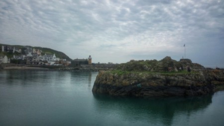
and the other on the Sony NEX-7 with an ND1000 filter to give a long exposure brushed silver water and hint of movement in the clouds, processed with Photivo and Darktable (amongst other things):
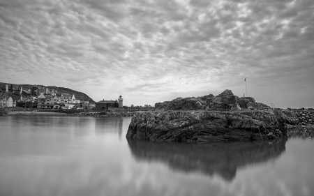
Portpatrick Harbour under a mackerel sky
When the music fades
Two landscape photos, fresh off the press, taken on Friday evening as the sun had just about set.
Quietness in a frame.
Wouldn’t think they were HDR, would you?
Cliffs

Taken at the foot of the Southern Upland Way climbing out of Portpatrick Harbour, looking down on a passing jackdaw to rocks below.
Portpatrick Harbour

A slightly different view of the coastal town of Portpatrick, taken from just above the harbour at the foot of the Southern Upland Way. There’s even seats beside the steps to sit and admire the view 🙂