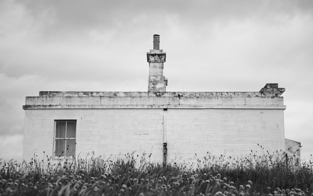
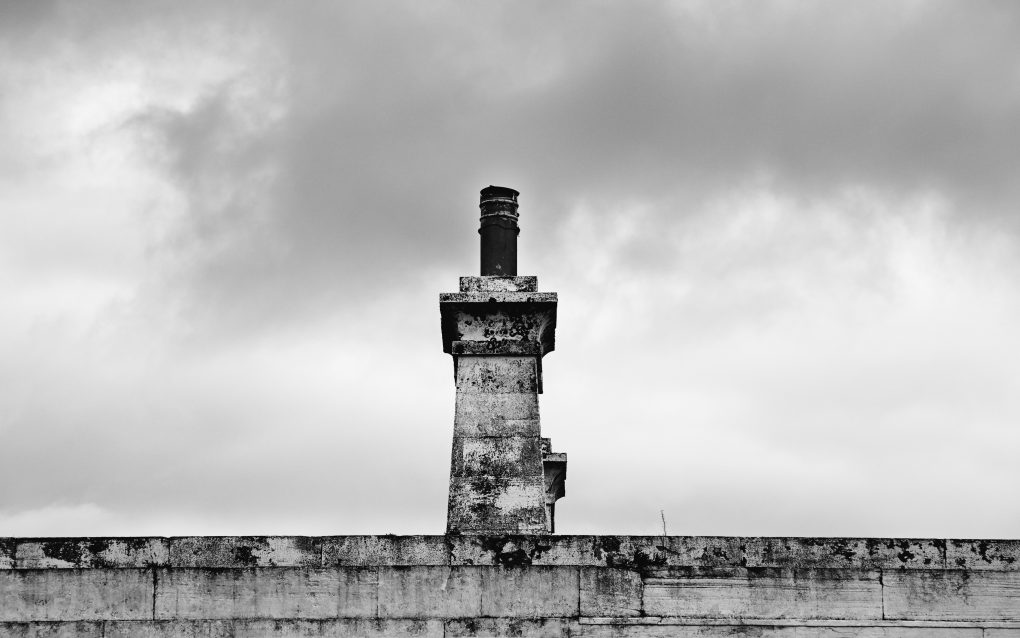
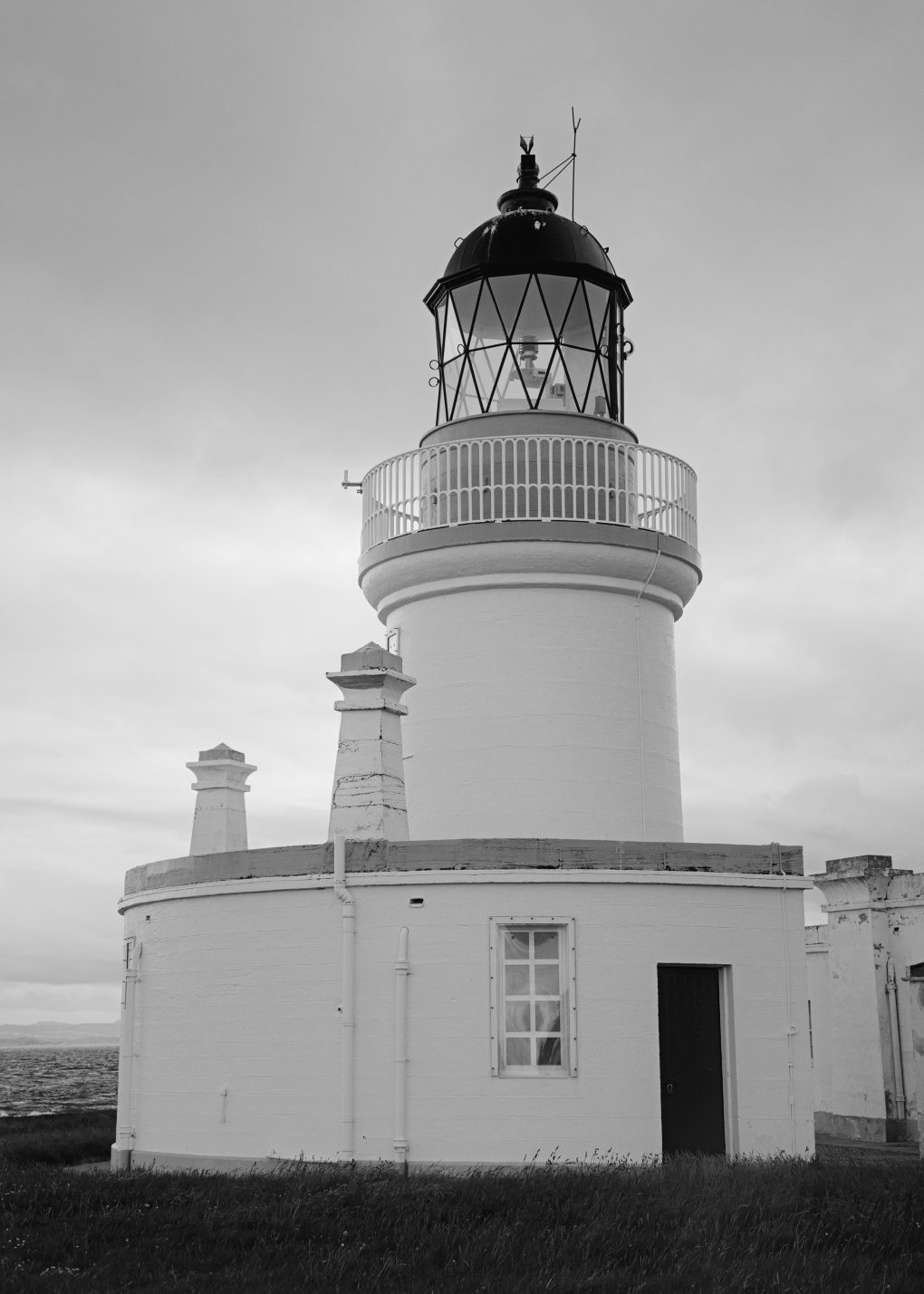
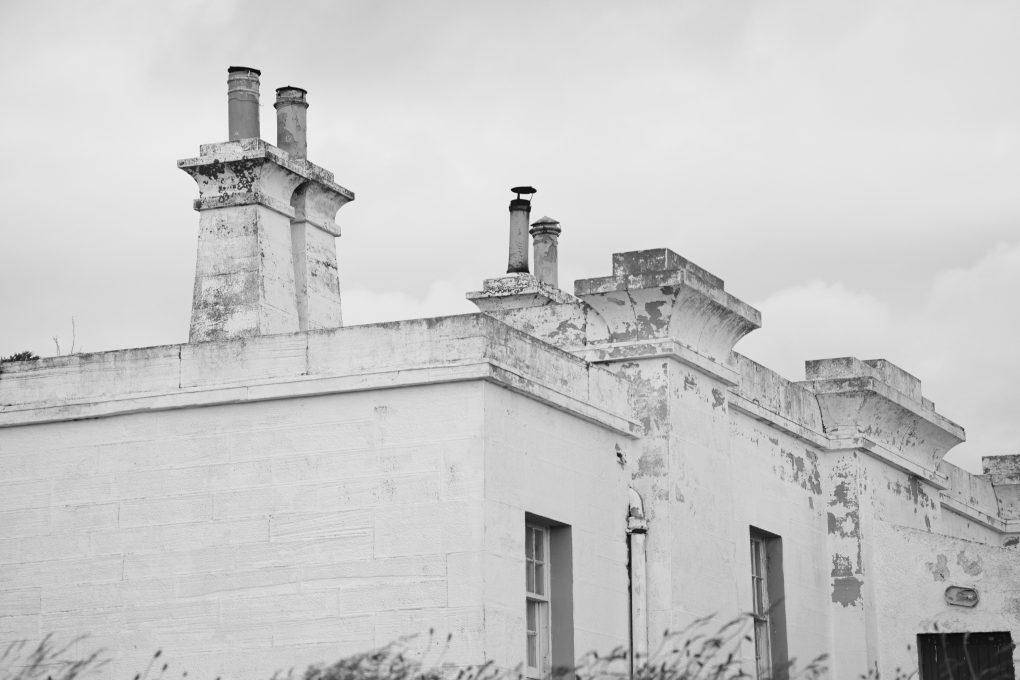
Last weekend it was ludicrously hot around home – 25ºC after lunchtime – so we drove all the way up north to the Black Isle for a stroll around Fortrose and neighbouring areas. We started with a stroll down to Chanonry Point where the lighthouse looked good in black & white.
Tag Archives: mankind-nature

Driving the A9
Saturday’s involved driving much of the length of the A9 from Perthshire to Inverness and beyond to the Nice Place™, and back down again.
On the return, I broke the journey in two locations I’ve previously admired but never stopped at: one, outside Bunchrew outside Inverness, to admire the clear view along the river estuary to the Kessock Bridge:
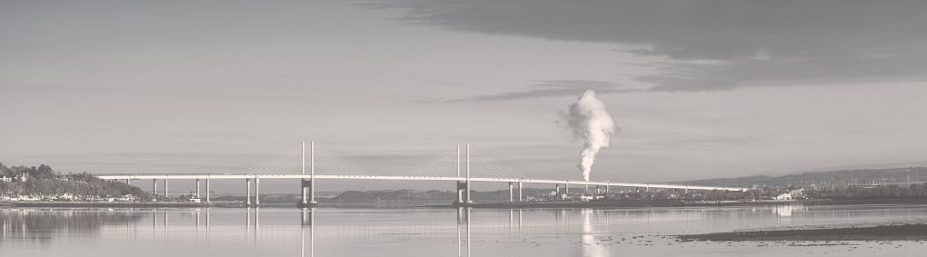
Many years ago I made a photo of this bridge spanning the river mouth from the shores much closer in Inverness. Since then the road along the south of the river out of the city has become a favourite drive, with its easy straights, gentle bends and occasional views back to the Kessock Bridge in the distance. 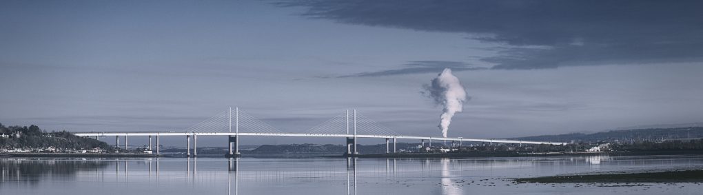
Many years ago I made a photo of this bridge spanning the river mouth from the shores much closer in Inverness. Since then the road along the south of the river out of the city has become a favourite drive, with its easy straights, gentle bends and occasional views back to the Kessock Bridge in the distance.
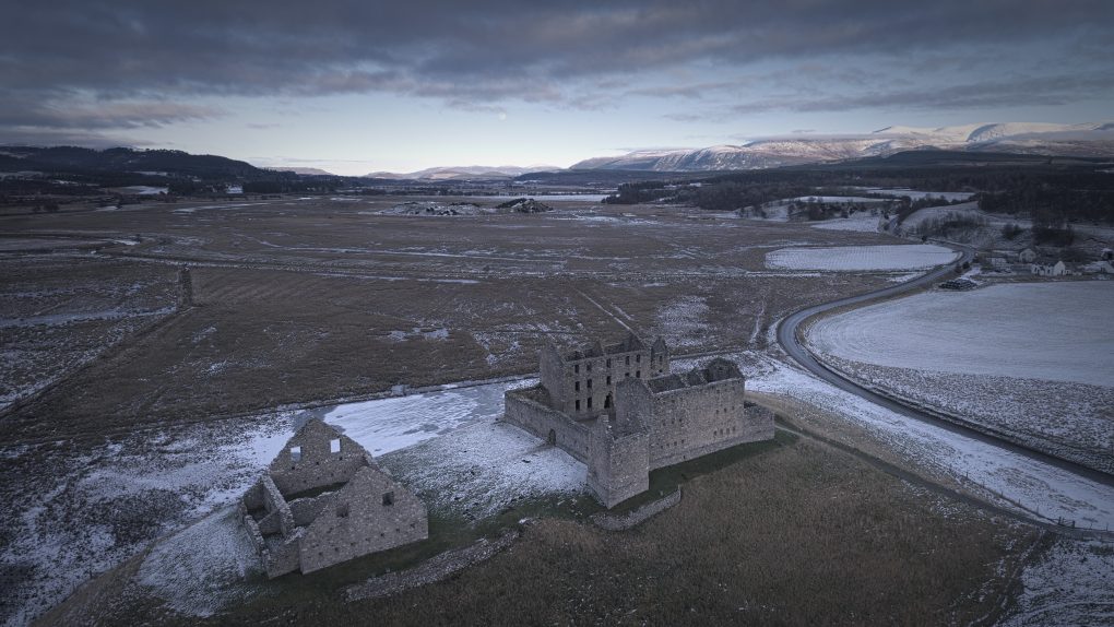
Odd: I’ve lived around Perthshire for over a decade and driven this stretch of the A9 many many times, but never explored Ruthven Barracks before. I was fortunate enough to arrive just as the moon was rising in the north-east – a lot larger by eye than it appeared in the photos, but it made a good backdrop to the ruined buildings. Otherwise, in the cold late afternoon light, the ground covered in a dusting of snow, it all looked rather bleak…
A view from behind the well-known Ruthven Barracks ruin looking straight up the Inshes along the River Spey to the moon rising in the distance. 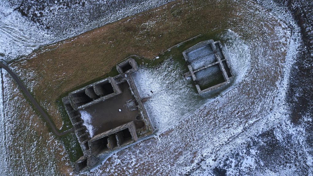
Classic use for a drone – fling it up and over a ruin and admire the former Ruthven Barracks innards from on high. 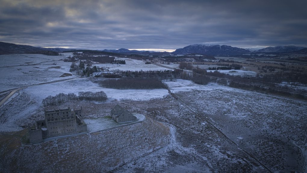
Ruthven Barracks, near Kingussie, Speyside.
For a final subject, just as I was packing up the drone to leave Ruthven Barracks, I noticed a splash of soft light on very low clouds clipping the Cairngorm mountains in the distance. Long lens; click; got it.
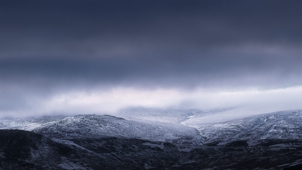
No eagles found flying this day – but the distant gorge is on Creag na h’Iolaire in the Cairngorms. An interesting photo to make – I had been standing beside the road, flying the drone around the adjacent ruins, when I spotted the low cloud and soft light in the distance. On closer inspection, one can just about make out the snow-covered slopes of the adjacent a’Chailleach peeking through the cloud. 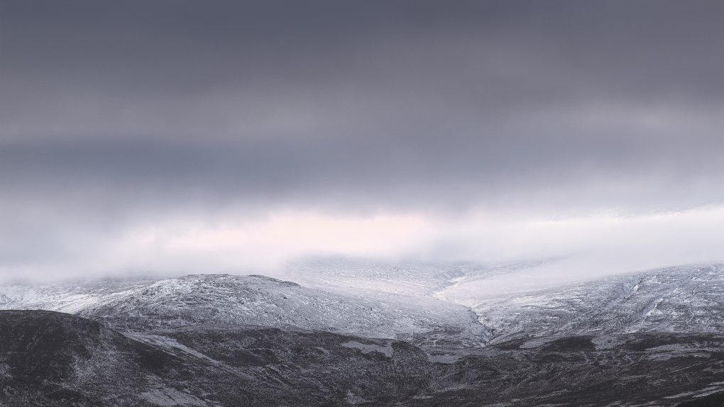
No eagles found flying this day – but the distant gorge is on Creag na h’Iolaire in the Cairngorms. An interesting photo to make – I had been standing beside the road, flying the drone around the adjacent ruins, when I spotted the low cloud and soft light in the distance. On closer inspection, one can just about make out the snow-covered slopes of the adjacent a’Chailleach peeking through the cloud.
when a landscape location goes sour
I don’t know how to tag some of these photos: on the one hand, a place that’s been a good walk in the trees for over a decade, but on the other, one that’s now showing the tarnish of human influence. Landscape photographer’s idyll or sad anger?
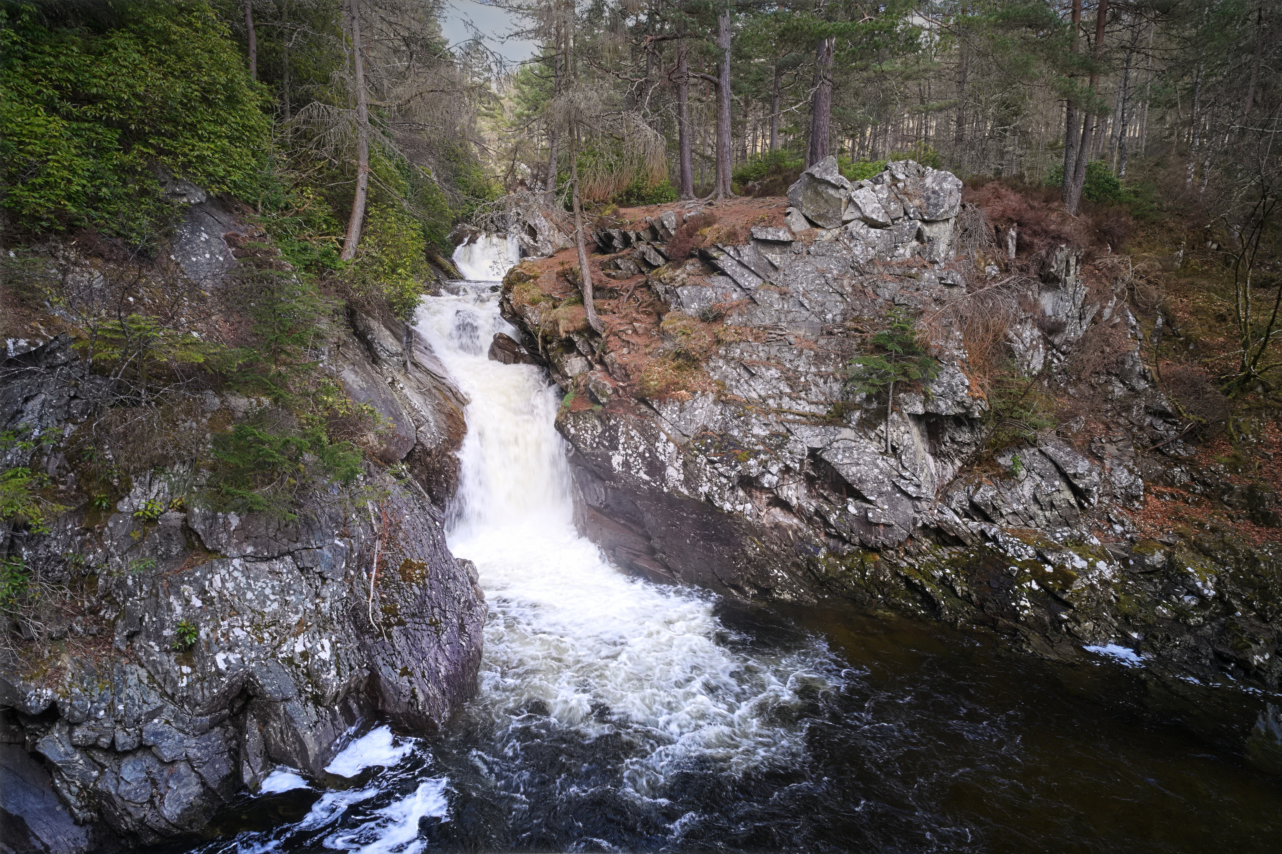
The Falls of Bruar present several well-known scenes. My own story is of having bought a tripod to do justice to a particular view and then using it to shoot a “hole in the ground in failed light” instead, thus getting one of my most-popular photos on flickr. I’ve been back probably 10 times over more years and enjoyed the stroll up the side of the gorge, admired the rocks, watched the three waterfalls doing their thing.
First there’s the regular cliché photo approaching the lower bridge – everyone gets the view from the top of the gorge opposite the lower bridge; I flew the drone down into the gorge and shot it from more on a level with the natural arch:
Nice rocks – psammite and semi-pelite as most of the Highlands, with the shear strata arising from the end of the Loch Tay fault-line.
Around the corner, there’s a viewpoint amongst the rocks of the second waterfall above the lower bridge:
Rising above the gorge one can see the pine trees lining the Bruar Water – it also shows how the middle cascades extend much further upstream than might be expected from the compressed perspective of ground level:
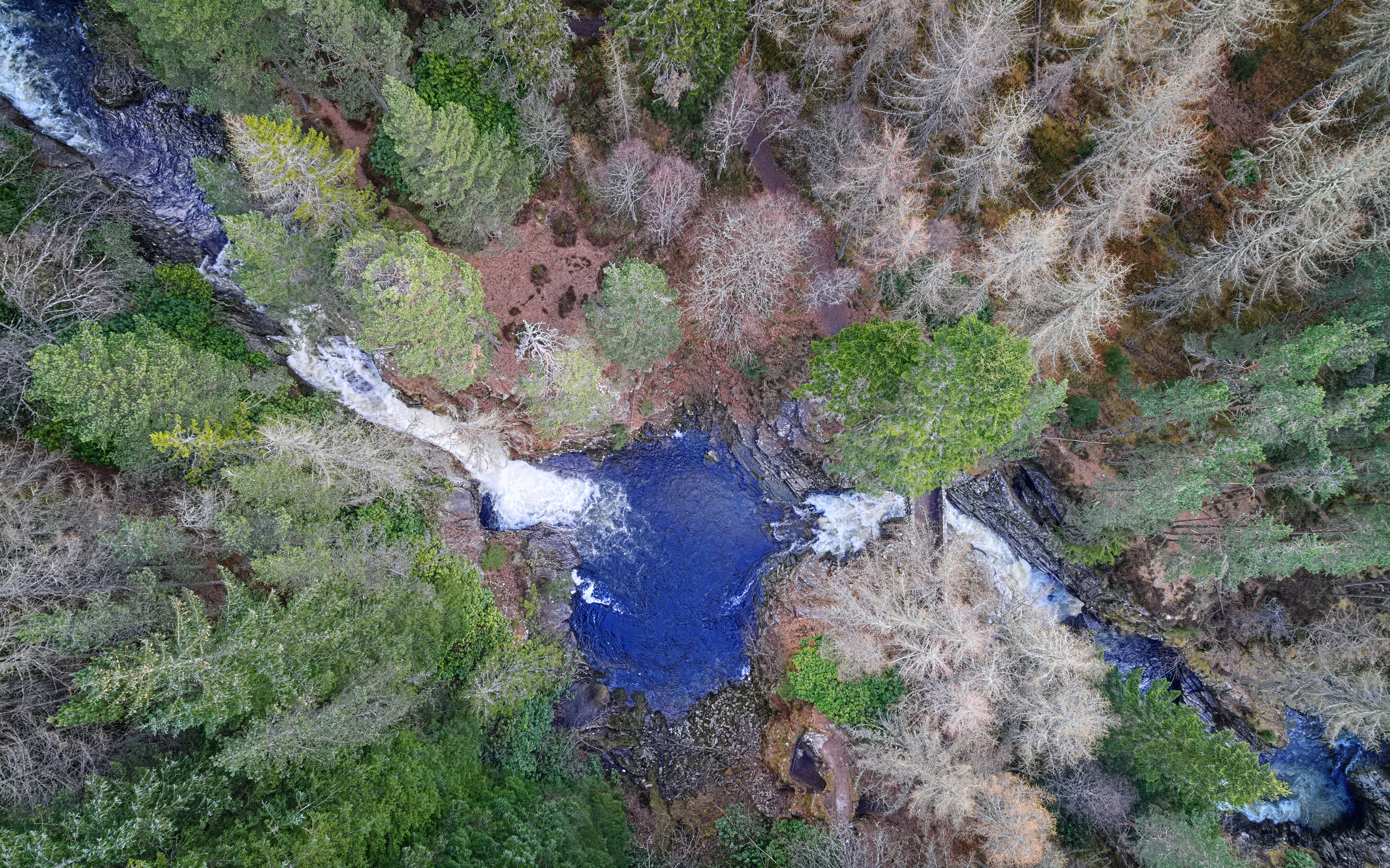
Abstract view of the lower Falls of Bruar
However, this visit was far from happy. Apart from some offensive uncouth ned muttering “hope you lose your drone” as he passed by, and the hordes of random unwelcome people thinking they were entitled to pester the dog, there are massive botanical problems: the two bridges have been closed so the path up the right side of the gorge is inaccessible due to tree works – possibly because of disease although I’m unconvinced this is the whole reason.

Bridge closed
Walking up the left side of the gorge instead, the area is infested with non-native invasive rhododendron bushes; the Forestry on the adjacent hillsides has been harvested leaving a horrendous unsightly barren landscape; the burns and tributaries beside the path are in a dire state of disrepair also.
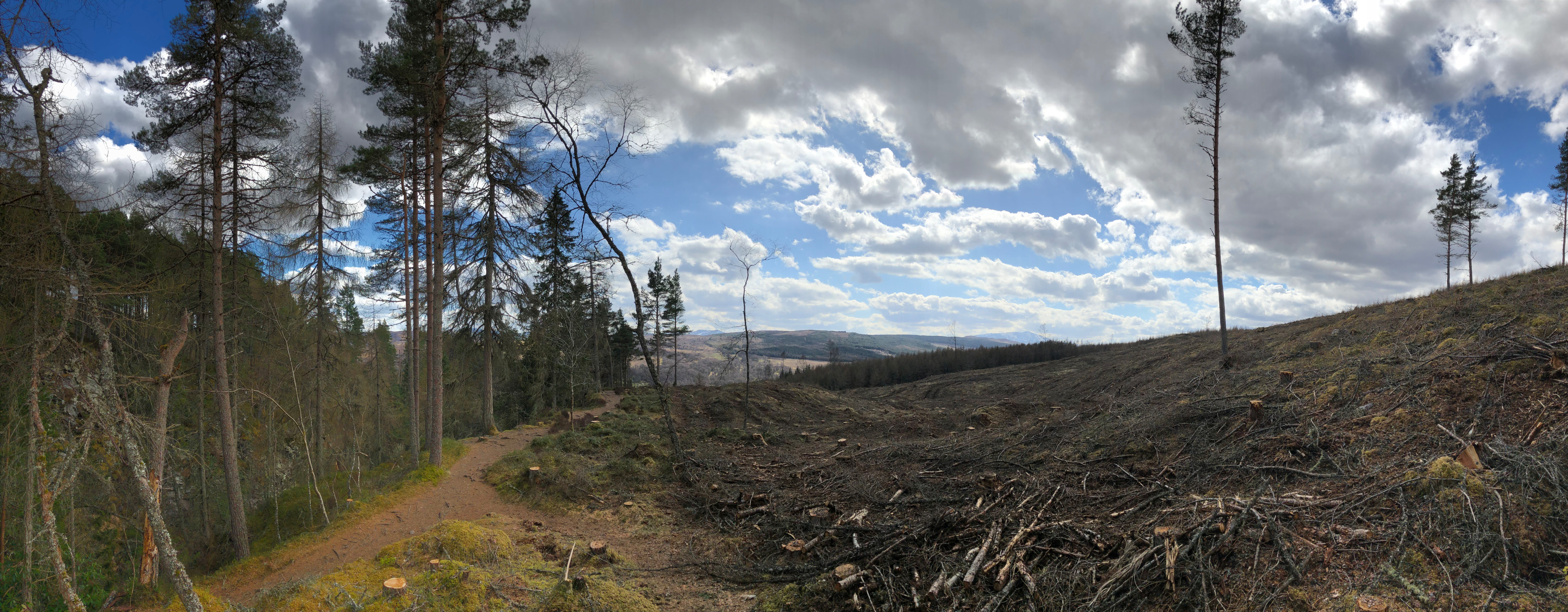
Who wants to walk along here?
This is the trouble with well-known landscape locations; as photographers we like the illusion of wilderness, or at least that places are natural. Bruar has become no more than an ill-kempt garden with a water-feature running through the rockery. The light and shade and calming deep greens are no more to be seen.
I’m giving it a decade to recover before revisiting.
Tillicoultry Quarry
Continuing the theme of mankind’s interaction with nature: exploring Tillicoultry Quarry by drone for some interesting angles on the rock aggregate – semi-abstract patterns, textures and colours.
As before, I made a 360º panorama above Tillicoultry Quarry too.
Above St Monan’s
The zig-zag harbour wall at St Monan’s is one of those iconic photographic locations where it’s impossible to pitch-up with tripod on top of the wall without being joined by multiple other photographers all seeking to perpetrate much the same cliché photo.

A much-shot photo, the zig-zag harbour wall at St Monan’s, Fife
Being stuck in Fife already, I called in at the village and sent the drone up to explore.
One of the first things I noticed is a tiny sign on one of the harbour wall ladders, warning the walk-way is closed. On aerial inspection, it’s possible to see the extent of damage it’s obviously suffered in the winter weather.

Winter weather erosion: the corner of the zig-zag dead-centre in the frame is obviously damaged
I was also very pleased to take a couple of new shots from the aerial perspective, straight down on the zig-zag – it shows how much the land-locked view compresses perspective. The water showed up a beautiful shade of green in the sunlight – and one can make out interference patterns of the waves and their reflections off the harbour wall:
I also nabbed a couple of views of the village, particular the Auld Kirk to the west and the view back across the harbour to the east.
The First Morning of Winter
I spent the morning of Dec 22 – the first day of winter – up Kinnoull Hill. There was beautiful mist rising from the River Tay as it meanders through the Carse of Gowrie.
I experimented with a few new compositions too: semi-abstract views of the hills of north Fife, the motorway/A90 junction and the river north of Perth as well.
My favourite two images were the fairly conventional view from above the cliffs, looking past the folly along the Carse of Gowrie. It’s not that comfortable a location to shoot – to get a clear view of the tower, one has to stand in a gorse bush…
Mill Glen, Tillicoultry
I hadn’t intended to go around the Mill Glen… but with a choice of three Hill-foot villages, I said Tillicoultry when it should’ve been Alva. Never mind. At least this Mill Glen has a tolerable view of distant refineries off the top.
In the Woods
The Black Woods of Rannoch are a particularly favourite stroll. One of the Caledonian Forest reserves (the only one I know in Perthshire), they boast many native and rare flora species – Scots Pine, birch, rowans, alder, willow and juniper and lichens and fungi – as well as being home to wild deer (as I discovered when a stag suddenly trundled right across the path barely 20yd in front of me).
Interaction with mankind is a different matter. There’s something about the flow and depth of river water in the weir that creeps me out, but the text on the last sign-post says:
The Black Wood of Rannoch Canals
Before you you can see a ditch cut through the heather. This dates from around 1800 and once formed part of a York Building Company scheme to remove timber from the Black Wood of Rannoch. In order to extract the logs they devised a system of canals (the ditch before you was the lowest of the three canals).
The scheme provided a great deal of work and employed most of the men and women of the district. Over four miles of canals had to be dug using picks and shovels. The trees then had to be felled before being floated along the canals and then down a chute to Loch Rannoch. The logs were tied together in rafts for the journy down the loch to Kinloch Rannoch, then sent singly down the Rivers Tummel and Tay to their final destination at Perth and Dundee.
If the project had been a success, the Black Wood of Rannoch would have ben completely destroyed. In the event, the plan to float the logs down the rivers did not work. The scheme was abandoned, and the wood saved.
Employment just does justify desecration. The woods are too special.
Seeing the New Year in with style
Over the course of New Year’s Eve I saw several aurora alerts. On checking, it was even visible as a pale grey band running above the neighbours’ houses, so I grabbed a camera and tripod and found a convenient path with a clear view to the north.
This was taken at a minute past midnight – some evidence of fireworks in Crieff with a wonderful aurora arcing over Strathearn.
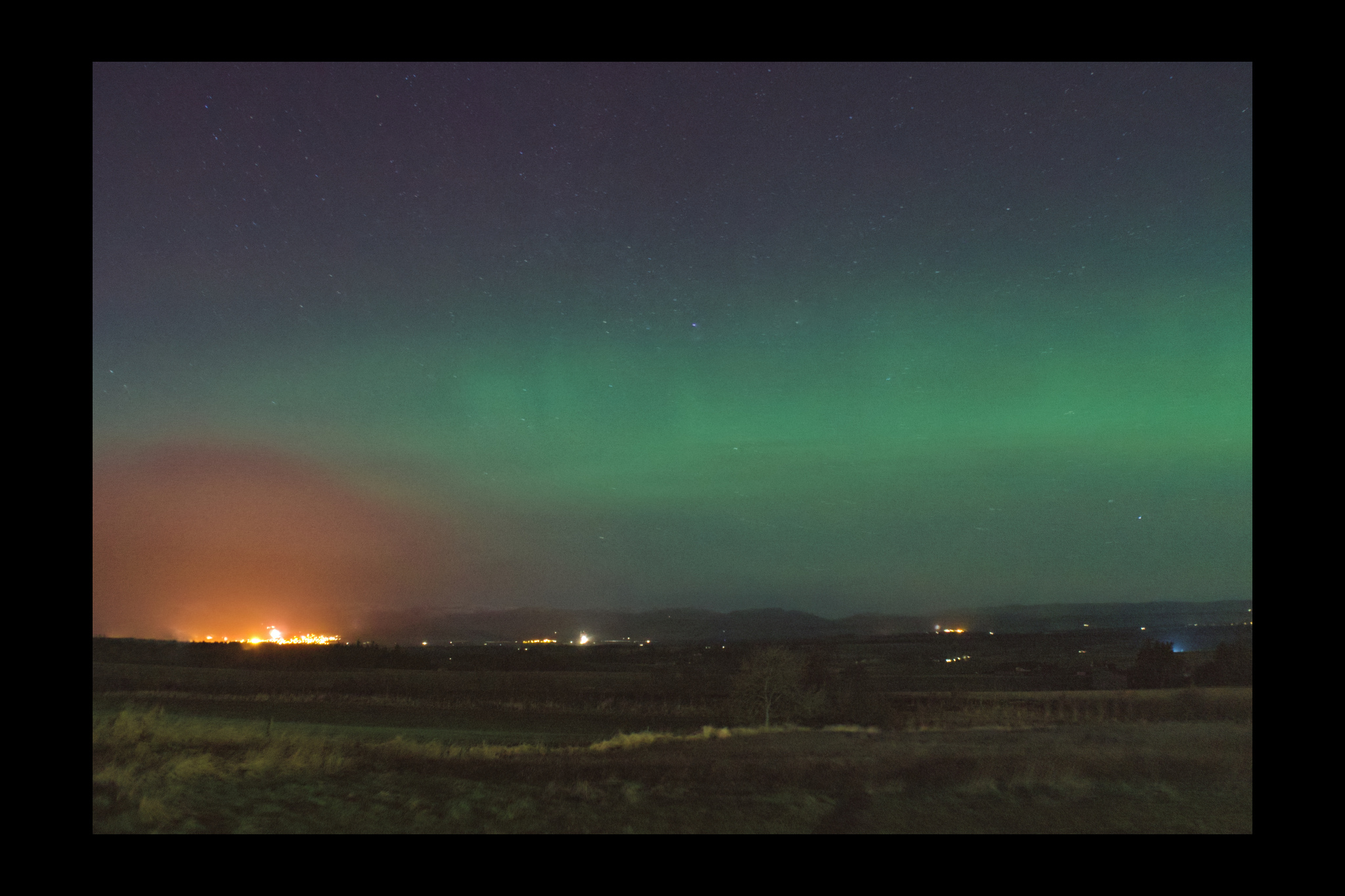
Ringing-in the New Year with fireworks in Crieff from Auchterarder… with an aurora arching overhead.
Glen Affric: Mixed Thoughts
Sadly, it’s not all good news at the glen – a few years ago, the Forestry Commission installed two paths, one wending its way between the trees like a play-park and the other using non-native sandstone paving flags to enlarge the walk beside the river – in the process, cementing its way through the pine trees’ roots. I am not impressed.
The other two photos in this set are a bit strange by my standards, too: shooting directly into the sun with only a few seconds to capture a crepuscular ray, I extended my usual HDR bracketing from 1EV to 2 stops either side; it’s taken me the last 6 months and no fewer than 10 re-processing iterations to make the best I can of that scene and the results are necessarily unrealistic in order to capture detail in both foreground and sky. The scene is from the path along the south side of Loch Affric to Kintail, beside Loch Salach a’Ghiubhais (“dirty loch of the pines”) – I have no idea what they did to merit such a title, as it seems a pretty gorgeous place to me.
Inverawe Impressions (2/10)
Part 2 of an ongoing series of posts about the Inverawe estate in Argyll.
This time, we concentrate on mankind’s intrusion into nature. For the most part, the laird leaves the woodlands alone, untouched; however, the Forestry Commission clear-felled the slopes of Ben Cruachan, initially leaving the mountainside bare but there are now young trees beginning to grow in the barren patches. The unfortunate consequence has been damage to some of the water-courses, resulting in culverts that used to flow with beautiful clear peaty water now stagnant and clogged-up with algae.