Glen Clova

A couple of years ago, a photo-friend and I spent a happy afternoon exploring Corrie Fee in Angus; I remembered emerging from the trees in an impressive bowl of a glacial corrie. In August, I sought to repeat the experience, starting from the carpark nearby, but in my haste to get off the ghastly Forestry Commission track (more like a hard gravel road ploughed through the forestry, complete with yellow metal gantries), I wound up taking a different path. It also emerges from the trees into a bowl of a glacial corrie, but felt different and I couldn’t work out whether it was the wrong exit from the woods or what.

Came home and checked the geotagged images to find it was not Corre Fee but Glen Clova instead. That would explain a lot of things! And unsurprisingly, I now use ViewRanger to navigate whilst hiking.

Still, a couple of hours bumbling around in the grass finding interesting photos in a dramatic bit of landscape on a moody afternoon… Can’t complain.

As I was stumbling around in the foot of the glen, I stumbled across this lovely little burn tumbling its way through the hillside:

The surrounding rocks are quite dramatic – I was amazed at the green and purple hues of moss and primitive plants growing on the crags around

And much as I know the forestry is entirely artificial now, it still drapes over the landscape like a cloak.

A Sunday Afternoon Escape

A few photos from an afternoon escape in August – one of my favoured routes, starting with the trek from Amulree along Glen Quaich – a moderately long stretch becoming quite a tricky road, steep with S-bends:

As always, the view from the moor along the top was awesome – particularly with ominous dark clouds – I experimented a bit with a variable-ND (crossed-circular-polariser) filter to lengthen the exposures up to 30s:

From there, descending yet more wiggly bends on the way toward Kenmore, there’s a tiny track off the road to a small carpark nestling in amongst the heather. The hillside above there affords a glorious view over the Appin of Dull – there was even a bit of light on Loch Tay looking the other way as well:

The Nice Place(TM)

It’s been a bit of a dream, a life-mission of a bucket-list item, but the other week I flew over some of the Caledonian Forest at Glen Affric – the drone’s maiden flight, as it happens, and a new way to admire the trees from a different angle.

A scene I hope to revisit more often as flying skills evolve.

Autumn at Glen Affric (2)

Having visited my favoured spot overlooking the Caledonian Forest, I proceeded up the side of Am Meallan to the well-known location with a view over the lodge and along the length of Loch Affric.

It’s definitely an autumn morning location: the sun rises behind you, skimming up and over the tops of mountains beyond Loch Beinn a’Mheadhoinn, rising as it heads south; accordingly, patches of bright sunlight interspersed with cloud-shadows lap like waves across the undulating landscape from distance right over you.

Of course I had to make a timelapse video of it:

Loch Affric timelapse 2017-10-14 from Tim Haynes on Vimeo.

And two more photos to summarize the morning:

Sunlight and cloud shadow – an outcrop of Scots Pine and birch trees on Sgurr na Lapaich

Proper colours. The most beautiful shade of green pine foliage interspersed with orange/yellow warm birch trees, all lapping up the early morning light.

A classic view – soft heather and bracken leading past Loch Affric to the mountains beyond (Kintail / Glen Sheil in the very far distance).
I had befriended a fellow photographer down at the glen earlier; the first I knew that they had followed me a few minutes later up to this memorial viewpoint was the word “WOW!” exclaimed a few feet behind me.

Autumn at Glen Affric (1)

For about 13 years I have been of the opinion that it has not been a year without at least one trip to Glen Affric.

My favoured time is autumn, late October, to catch the trees in the Caledonian Forest reserve at their most colourful.

Arriving before sunrise, the light is all dull  and the scenery a moody shade of gloomy – the last vestiges of moon stars remaining in the cobalt blue sky.

One of my favourite scenes at Glen Affric – two ncie birch trees amongst purple and green heather.
Sadly this shot has been marred in recent years by the installation of a large wide path cutting right through the heather between bench and trees; this photo used to be easier to compose but now I’m too conscious of having to position the frame to avoid the path just below; it’s becoming too much of a trick-shot for my liking.


Slowly, over the course of an hour after the posted sunrise time, the sun will gradually rise behind Meall Dubh beyond Loch Beinn a Mheadhoinn, casting a beautiful light on the forest:

Having arrived so early, it is a delight to bask in the first proper warm sunlight of the day:

One of my favourite birches – always think it should be called “Dancer” for some reason – basking in the first warm rays of sunrise amongst the heather.

Birnham Hill

One of my favourite views is the Highland Boundary Fault running through the landscape, immediately in front of me standing at Stair Bridge Viewpoint part-way up Birnam Hill.

It looks particularly pleasant with light and cloud-shadows zipping over the trees too:

Photo-Walk 2017

For several years, on and off, I’ve attended an annual Photo-Walk based in Inverary, Argyll. This year was no exception – always good to catch up with friends I’ve met on the walk previously.

As always, Argyll is a favoured place and Autumn a favoured season; the combination of light and landscape makes for enjoyable drives.

An auspicious viewpoint – right next to the public toilets on Inverary front – but it makes for a cracking view up the loch toward a spot of sunlight illuminating the hills around Ardkinglas.

This time the organizer, Richard, had brought a couple of props – most notably a bottle of Isle of Jura Superstition and I had one or two ideas in mind “just in case” we ended up at a particular favourite waterfall.


We made our way down the slippery embankment to the burn, where I set up tripod amongst the boulders to maximize the lead-in lines of water flowing around the rocks up to the waterfall – tripod placement was fairly tricky with a wide-angle (24mm) lens and the slippery lumpy terrain to negotiate – and then as the camera was busy taking 20s exposures (4x with pixel-shift) I trotted back and forth through the water firing a flash-gun down onto the bottle of whisky and surrounding rocks (manual triggering at 1/8 power with the diffuser out and reflector down to stop the light itself registering in the scene).

Product Placement
I quite like Isle of Jura whisky… not necessarily on the rocks though.

I had originally experimented focussing in on the bottle itself and using a wide aperture to restrict depth of field, but that did not fall naturally through the scene – the waterfall was still sharp behind – so I stopped-down to make everything in focus and relied on post-processing tricks in Affinity Photo to draw the eye onto the bottle differently instead – some Orton effect and various soft-light Gaussian blurs, masks and elliptical gradient fills to boost the saturation, make it all glow and still leave the bottle sharp and bright. The final toning came from Snapseed of all things.

I’ve done a little product-photography before but never tried blending [bad pun intended] it with landscape work, let alone pairing it with light-painting, but I think it worked – certainly compared to the straight shot, the bottle with its amber glow just makes it.

Morvern 5/4: The Road Back

And so we come to the last post in the series, a set of photos not entirely in Morvern but more on the way back up the shores of Loch Sunart and Loch Linnhe to the Corran Ferry, across and down to Loch Leven at Ballachulish.

There’s something wonderfully uplifting about rattling along these wee roads on beautiful sunny days, admiring the light.

Morvern 4/4: The Viewpoint

After the long drive, the walk in the woods, the angst of the cleared township, the second part of the walk resumes through the woodlands up hill to the viewpoint, looking out over Loch Doire nam Mart to the caves in craggy Beinn Uamh and beyond. On a sunny day with a few white clouds in a crystal-clear blue sky, it doesn’t get much nicer than this.

After a second walk through the woods around Aoineadh Mor, towards the top of the hill one comes across this beautiful view: conifer trees, Loch Doire nam Mart and more trees scattered on the slopes of craggy Beinn Uamh, all beneath a crystal clear blue sky.

Well, it does get a little better – Doglet had his dinner on the shores of the loch in amongst the rushes. Lucky chap.

Morvern 3/4: In Search of Purity

Time to explain the motivation for this excursion to the Morvern peninsula.

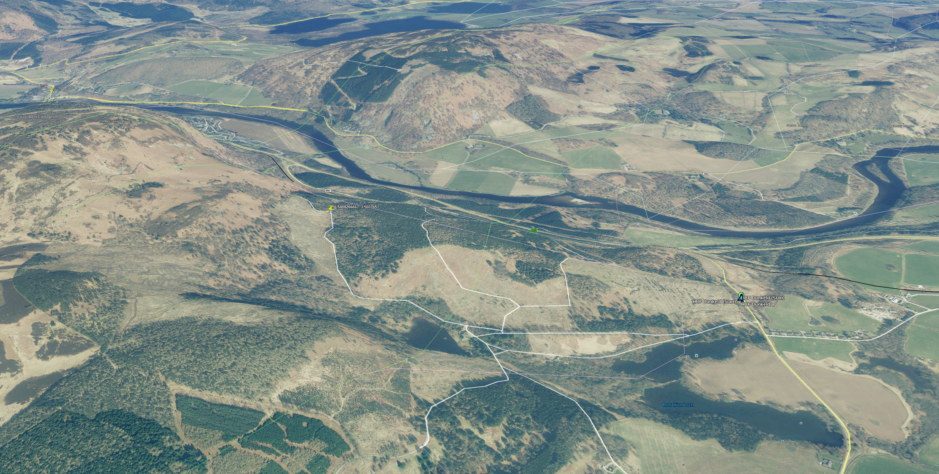
A few months ago, I was exploring what Google Earth had to show for the West coast of Scotland. A lot of photographers gravitate toward the north-west, around Sutherland, and rightly so – the geography up there is impressive. However, coming a little south past Ardnamurchan, there is also epic geology – evidence of volcanoes, beautiful mountains, the works. And so I stumbled across this glen past Loch Arienas and Loch Doire nam Mart, thinking there might be a view to enjoy part-way along the glen up one of the mountains to the left, perhaps.

On a little research, I saw the OS map of the area showed Aoineadh Mor, a former township dissolved in the Highland Clearances. Interesting history. So I drove – about 4.5 hours from Perthshire out through Fort William around Loch Eil and down at some length on wiggly single-lane 60-limit roads – and arrived at the small roadside carpark about 4.30pm.

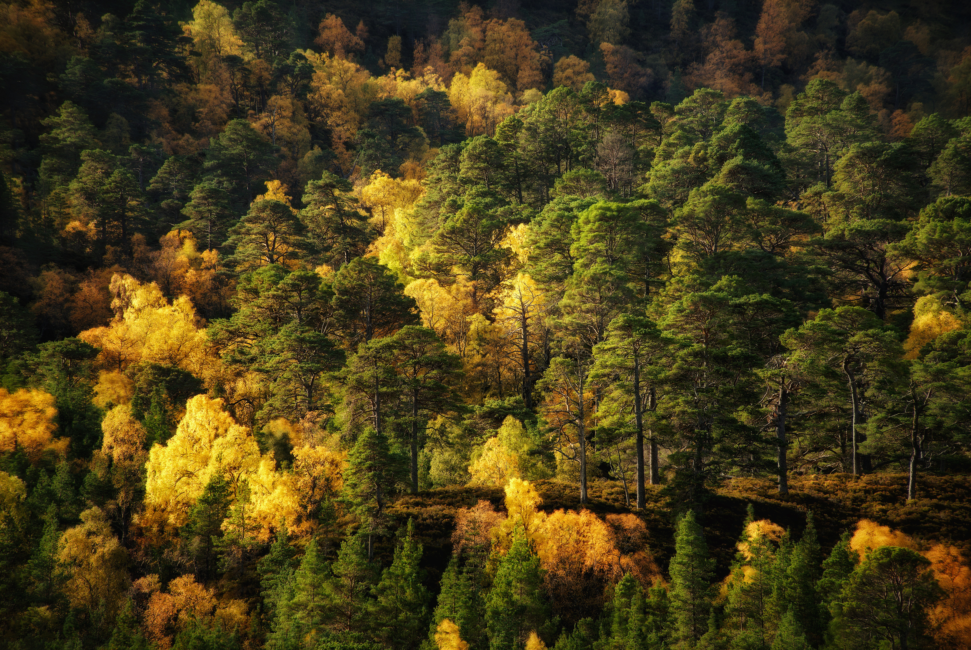
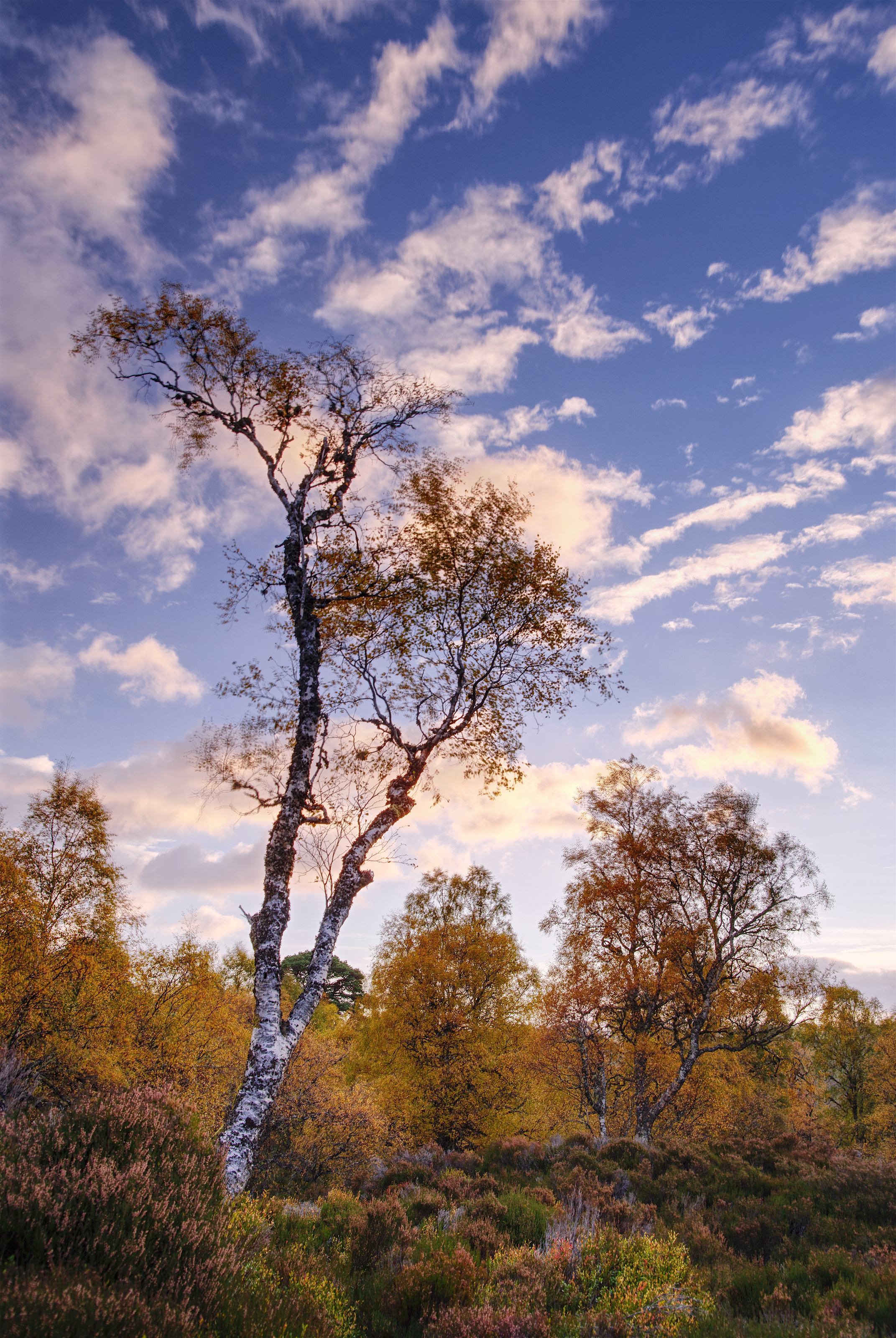
The walk through the woods was beautiful: birches and oak trees catching the low sunlight.

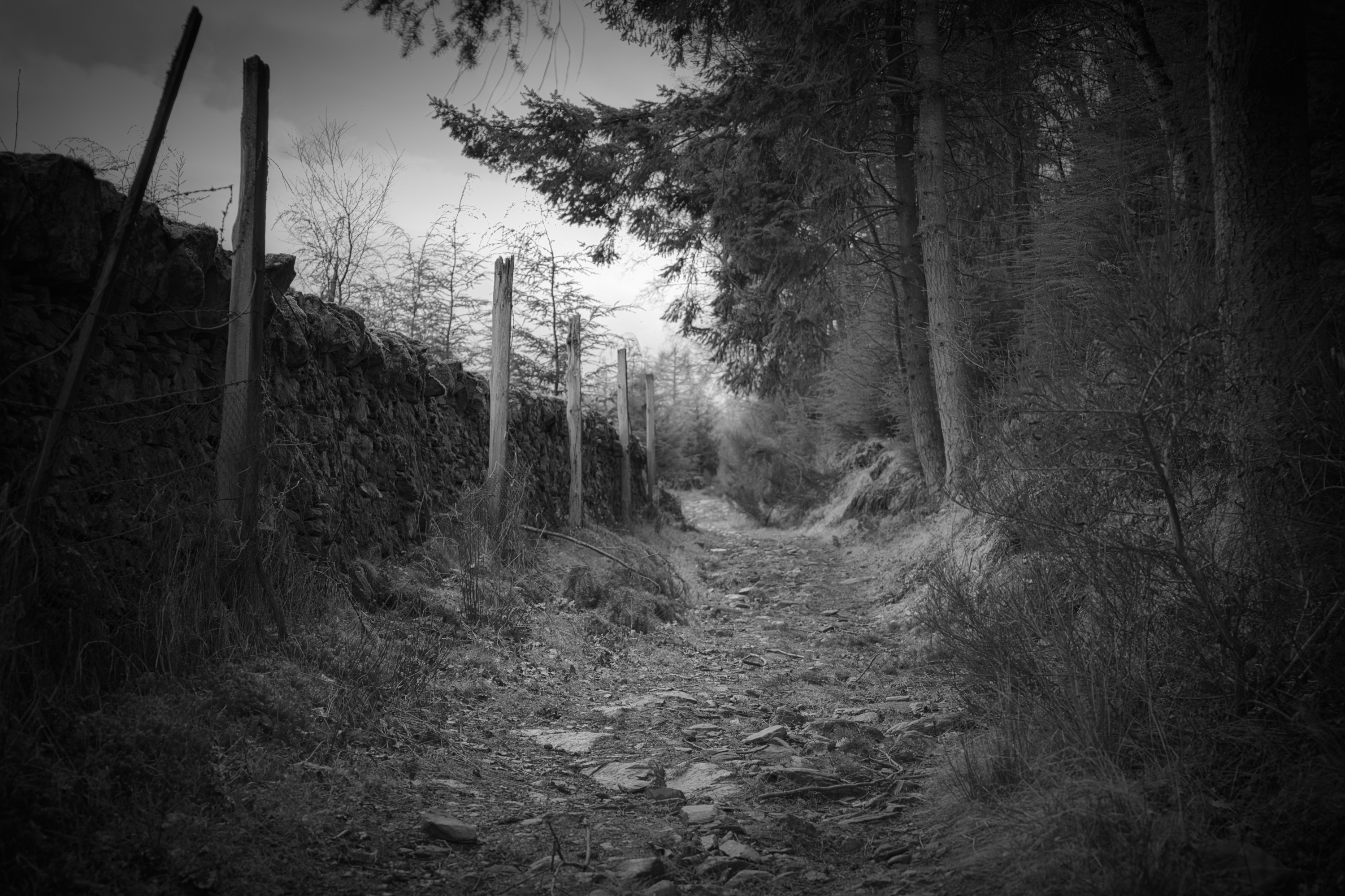
Now it gets real. On emerging from the woods, the first evidence of habitation one sees is this broken dry-stone wall:

The Perimeter is Breached

which shouts the beginning of the story loud and clear: a township left to ruin, increasingly taken over by nature.

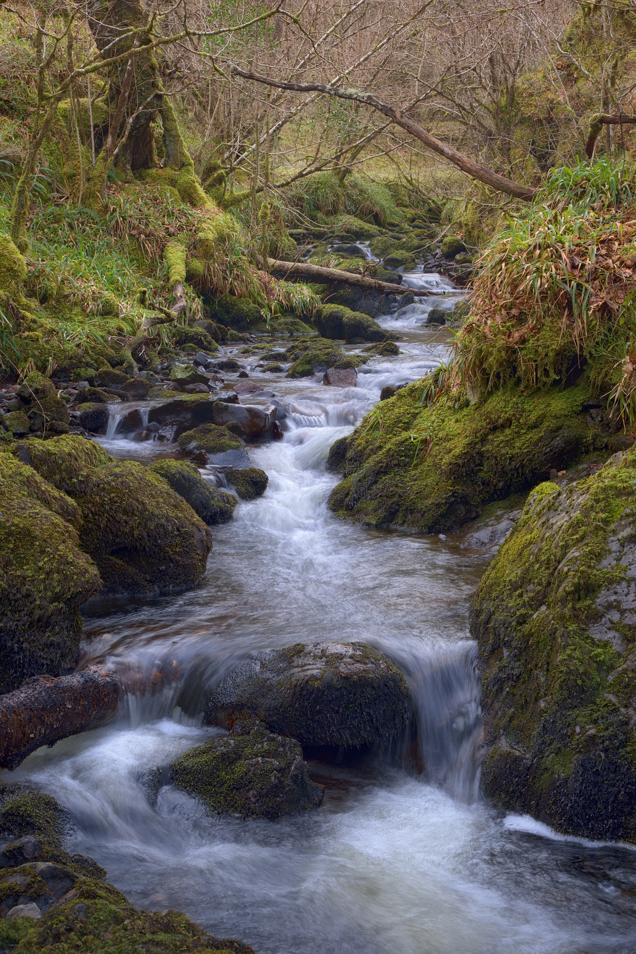
From what I gather, up to the 18th Century, Aoineadh Mor [approximately pronounced, and sometimes spelled, Inniemore, although the Gaelic ao vowel sound is inimitable in English] was a thriving crofting community on the slopes of Sithean na Raplaich where the burn (Allt Aoineadh Mor) flows down to the lochs.

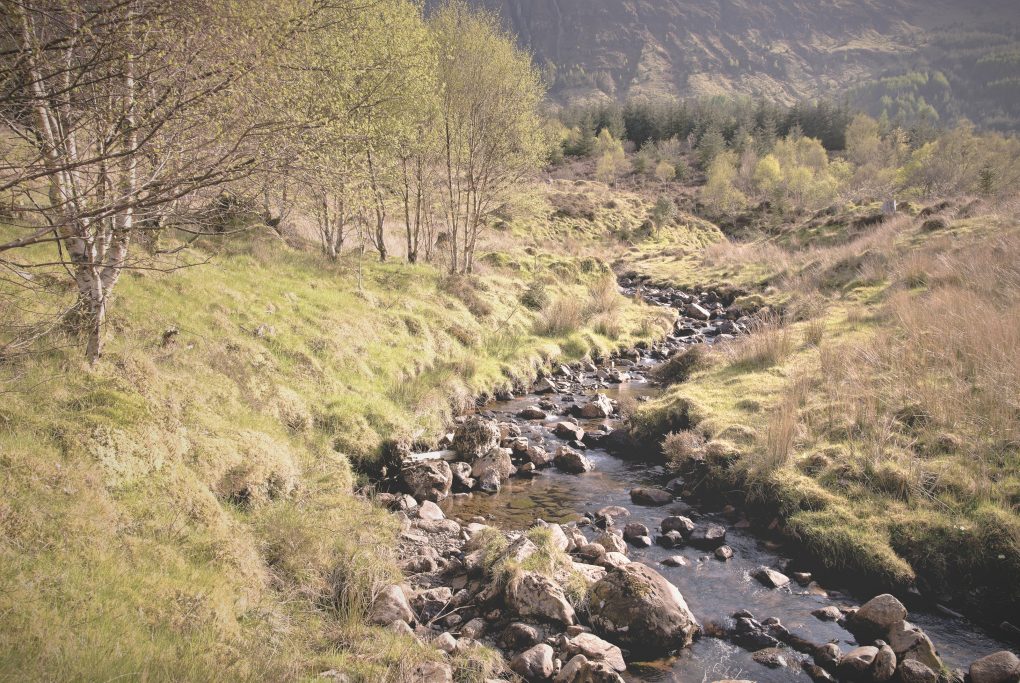
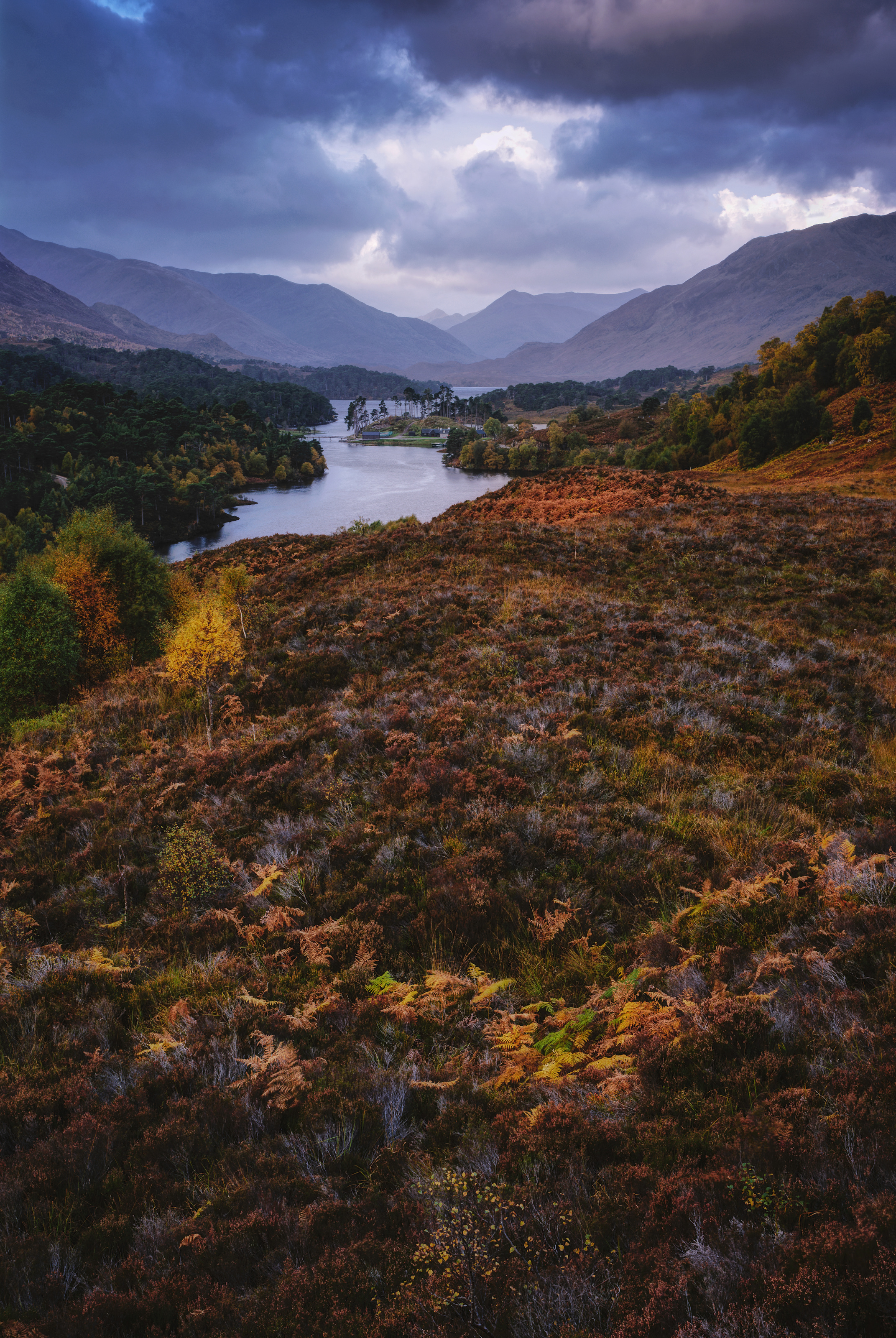
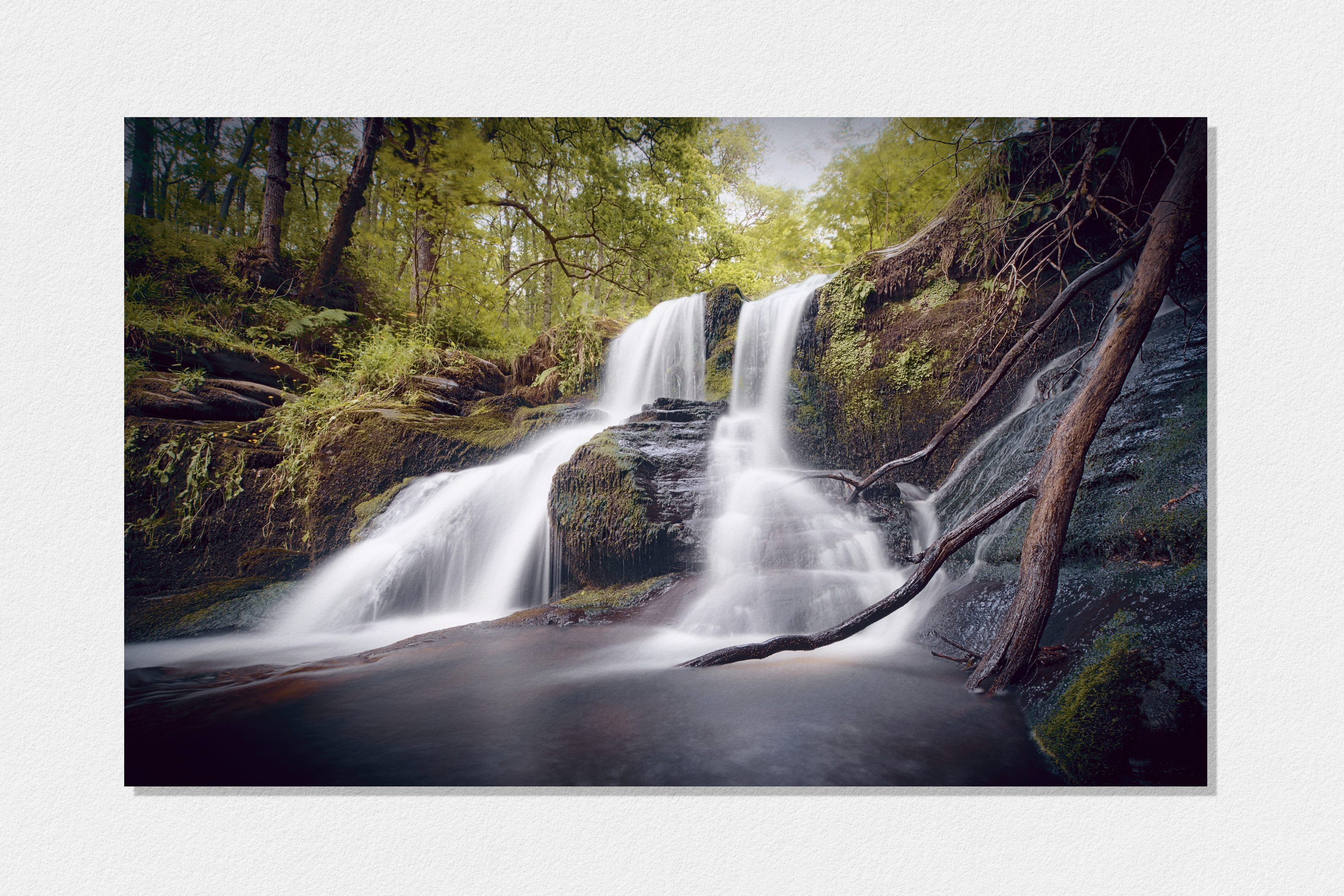
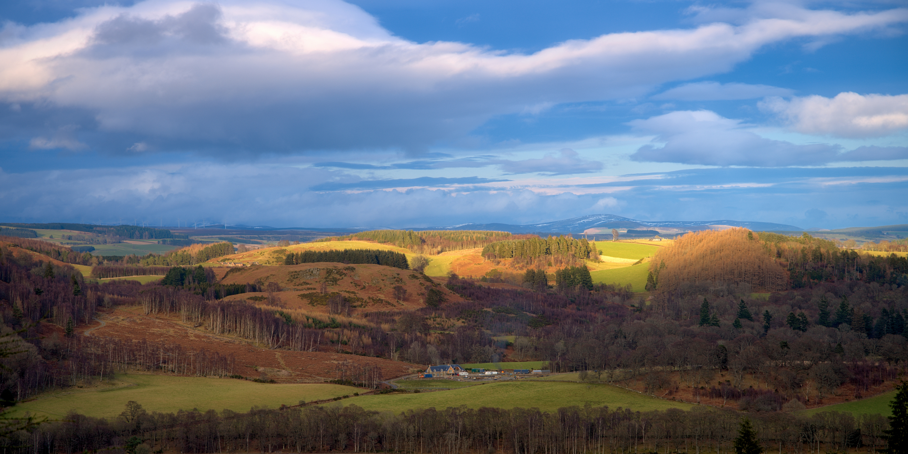
It is a wonderfully beautiful setting – the Allt Aoineadh Mor burn burbling down the hillside, through the former township of the same name.

In 1824, Christina Stewart, newly owner of the Glenmorvern estate, forcibly ejected the crofters in order to farm sheep on the land for supposed greater profit, as happened in many places during the Highland Clearances.

The names of two of the last crofters to leave, James and Mary, have been given to two paths through the surrounding forestry.

By 1930 the sheep were also no longer profitable and the area was planted with trees as the cash-crop of the time. After 60 years, in 1994, the Forestry Commission uncovered the township.

And so my history intersects with the place in 2017.
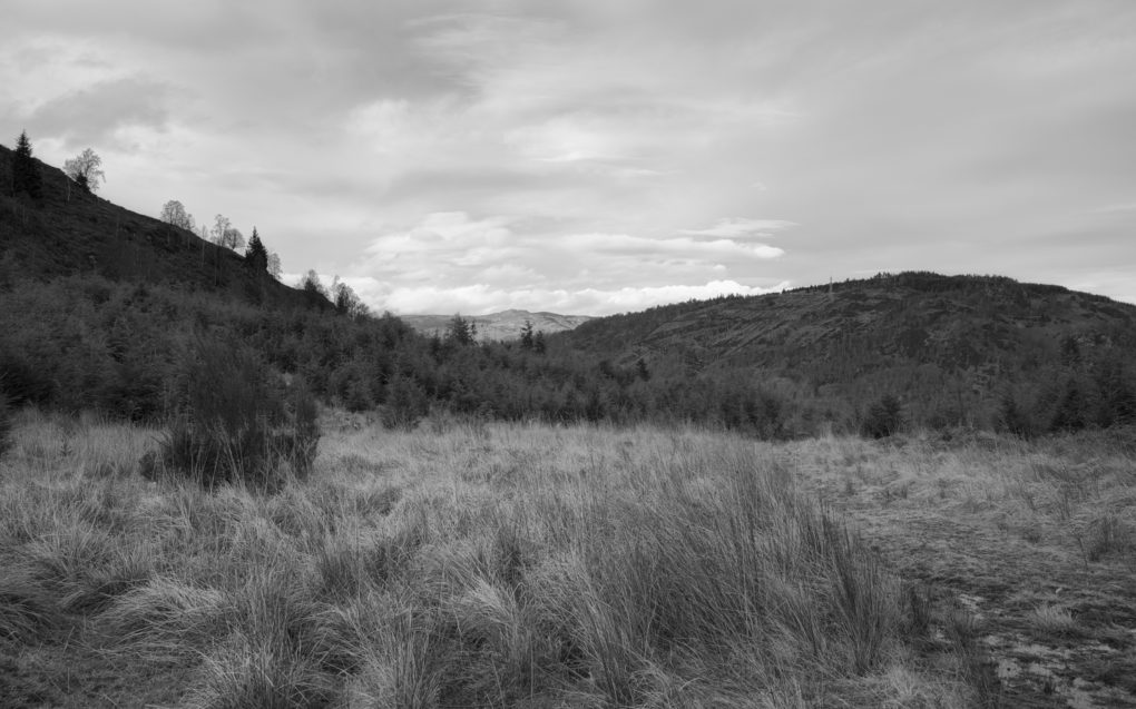
It is both quieting and disquieting simultaneously: quiet in that there is an open space, there are trees, light, water, all the elements of landscape we photographers like; yet disquieting in that the area is not really pure – on scratching beneath the surface, there seems to be a greater innocence in the subsistence existence of crofting, with subsequent industries of sheep farming and forestry tainted by crass desire for profit to varying extent. And so the hillside is not really wild but barren; the land not just beautiful but exploited.

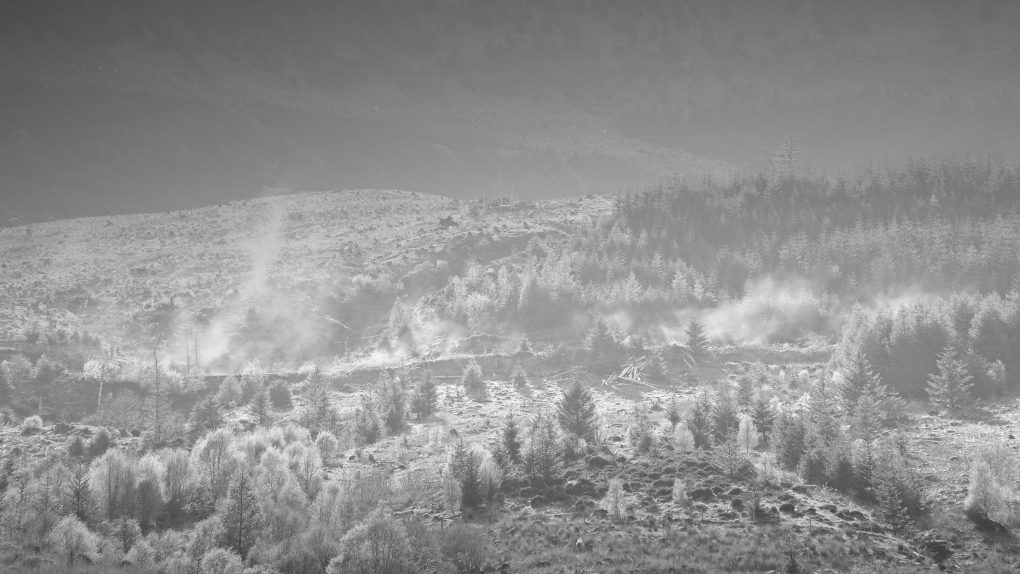
Dust kicked-up by a passing logging lorry travelling a path through Forestry Commission conifer woods, taken from the former township of Aoineadh Mor.
http://scotland.forestry.gov.uk/activities/heritage/historic-townships/aoineadh-mor-inniemore/marys-story

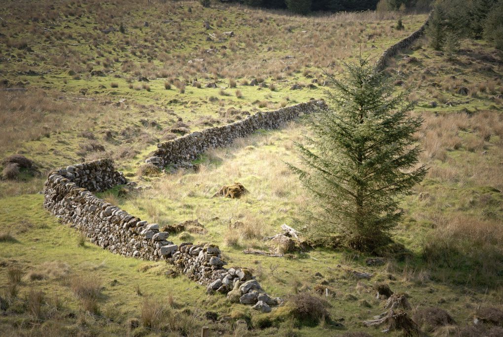
These conflicting forces of land, money and habitation are summarized in this photo, where we have nature’s pine tree felled in the foreground, a generation of mankind’s ruined croft superseded by the unnatural choice of conifers blown in as seed on the wind, leading to blue skies beyond.

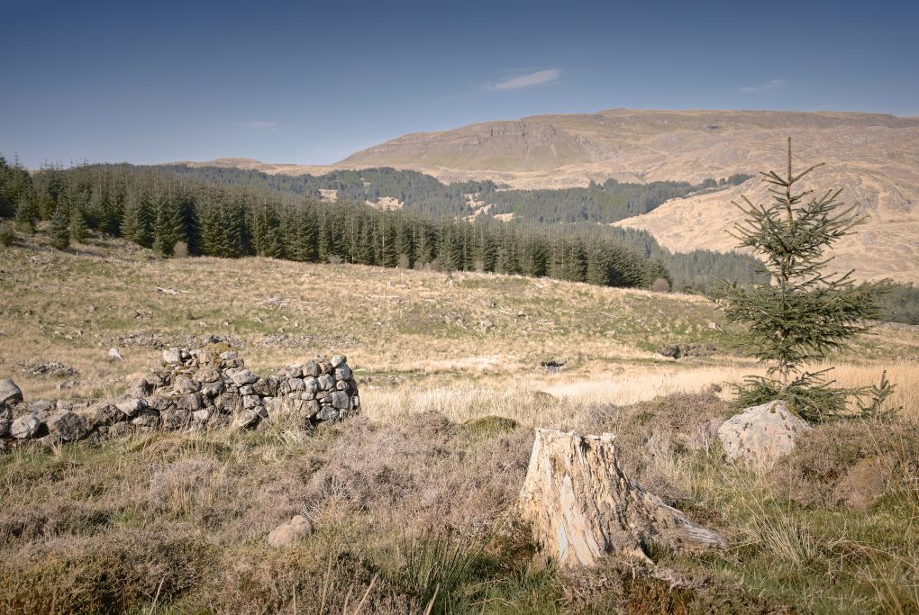
This used to be the township of Aoineadh Mor, a scattering of stone crofts on the braes beside a beautiful river surrounded by forest. 
Now the Forestry Commission has taken over, with several monoculture forests on the surrounding mountains, even wild-seeding into the former township.

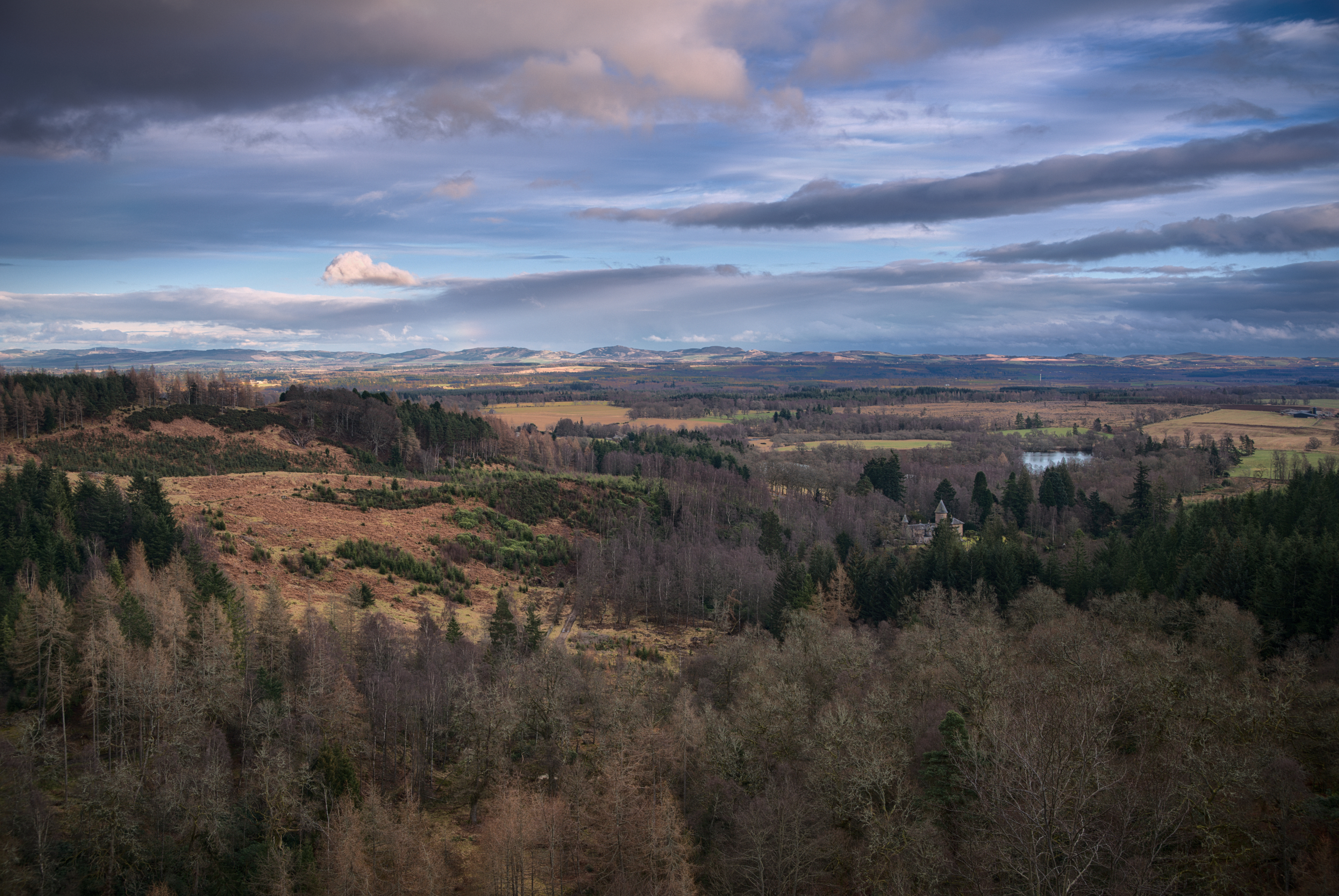
For what it’s worth, a few more photos all taken around the township:

References:

As I walk along these shores
I am the history within
As I climb the mountainside
Breaking Eden again –
Runrig, Proterra

Morvern 1/4: Approach

The West coast of Scotland – Lochaber, Argyll and further north – is well known for its amazing scenery. Earlier in the year I had a look around on Google Earth and thought the landscape looked pretty impressive opposite Mull around the Ardtornish area on the Morvern peninsula.

It certainly did not disappoint. Even having just driven 4 hours all around Fort William, across and round Loch Eil at great length (single-track road with passing places and a 60 limit), I had to stop to admire the crystal clear blue sky and lines of mountains receding into the distance:

There followed a short drive down to Loch Arienas, which was also just beautiful – blue water reflecting blue sky:

Just One Photo

Black Spout Waterfall, Pitlochry

Some days you only need to come away with one landscape image to justify an excursion.

On Saturday I set sail with Doglet and a friend and strolled through Black Spout Woods around Pitlochry, up to the viewpoint across the gorge where you can see the full height of the waterfall, and then round to the more accessible bit near the top of the falls, which still takes a fair amount of scrambling around on the river bank to get down to.


A nice stroll through the woods, a view across the gorge to the full height of the waterfall, some scrambling around on the banks to get down to this level (a small fraction of the total height down from the top) with friend and dog… A good way to spend an afternoon

Technicalities:

There are three conscious aspects to this shot:

Composition

I wanted to make the most of the 15-30mm lens, so with a bit of wiggling around at the scene I found a spot right in front of the cascades that would showcase the 16mm ultra-wide field of view with a strong foreground. Nothing clipped; there’s negligible cropping except for lens-correction. There’s something in each pair of corners: the strong diagonal line of the dead tree-trunk in the foreground is echoed by the three distant trees in the far top-left; the negative space of the burnt-out sky has an echo in the expanse of run-off water in the bottom; treated as three stripes, there’s a balance between the height of the frame given to the run-off, to the bright white cascades, and to the woods+sky at the top.

Sensor controls

I made 10 source images on the Pentax K-1, varying the exposure as follows:

f/13.0 1/50s; f/14.0 1/8s;
f/16.0 0.4s; f/16.0 0.5s
f/16.0 0.5s; f/16.0 0.8s
f/16.0 1/4s; f/16.0 1/8s
f/16.0 1/8s; f/18.0 1/6s

This set of exposures spans a large contrast range from bright grey sky down to dark shadows in the rocks; it varies the shutter speed so at least a few will make the water look like brushed cotton; it varies the aperture partly to cater for the range of shutter speeds, and partly so as much of the shot as possible has a frame with maximum detail before diffraction. Enough data that enfuse could find a good midtone maximizing local entropy (detail) at every pixel.

Each of the above had pixel-shift enabled for greater resolution, totalling 40 frames of 36MPel resolution. The shutter was open for a combined total of 12s.

Post-processing

I used my open-source Pentax K-1 pixel-shift workflow on each of the 10 images above, and then reused it again to blend all 10 together into a combined HDR average. Opening this in darktable, I proceeded to correct lens-distortion, finalize the crop (16:10 aspect-ratio, one of my favourites for landscape), set detail modules (no need for noise-reduction! some balancing of detail, local detail, equalizer modules though) and exposure, toning (including tonemapping and low-pass filter) and colour (Velvia). There are not many localized modifications, but there are significant grad-ND filters both down through the trees and, opposing that diagonally, up from the bottom of the frame, along with two instances of the vignetting filter (one significant, one just clipping the corners); there is also extra local contrasted masked into an area around the dead tree trunk. Finally I opened the image in The Gimp and ran the G’Mic filter suite including colour-grading twice (once conventionally, once with extra highlight/shadow duotone effects, blended together – this has the side-effect of changing the tonality in the green leaves to make it look brighter/sunnier than it actually was). A tweak to the curves to lift the overall gamma and then I overlaid my favourite texture image, a photo of a sheet of Hahnemuehle Photo-Rag paper, in soft-light mode to soften the contrast and add a small amount of texture into otherwise barren areas.

Why this Workflow?

Working this way hits a sweet-spot in terms of convenience and image-quality.

I did not fall in the river. That’s a good start.

With such a wide field of view, every centimeter counts when choosing the location. With the 15-30mm lens I was able to experiment, iteratively varying location and focal length, until an optimum position was found, all the while seeing exactly what the final composition would be in live-view.

Pixel-shift – moving the sensor around in a 1px square pattern – works as a great way to increase the resolution.
The alternative would be to shoot a panorama, but that would still require HDR blending of frames as well as risking motion-artifacts in the trees; with just HDR on its own, the ghosting of the leaves from averaging multiple frames is a more pleasant indication of movement rather than errors in stitching. Additionally, shooting a panorama would require just as much care over camera position but would not allow a preview of the composition.
As a hybrid option, with cameras that lack pixel-shift or equivalent technology, one could compose approximately and then vary the tripod position subtly to emulate hand-held camera-shake; this is almost identical to pixel-shift in terms of super-resolution, but varying the camera position risks introducing artifacts from lens-distortion and parallax between foreground and distant parts of the scene, that pixel-shift avoids.

Additionally, shooting every frame 4x over, automatically, increases the overall exposure time into multiple seconds, even in daylight, which avoids the need for Big Stopper-type filters (especially handy on a lens that would require a special holder for such).

Argyll Woodlands

One of my favoured walks around Argyll is a couple of miles south of Taynuilt, the White Ant trail around Glen Nant.

Ben Cruachan dominates the surrounding landscape – especially on a cool winter’s day:

Last summer I was pleased to fulfil a client’s requests for several of my photographs; one of the black & white prints was originally made in Glen Nant, a little burn flowing gently amongst the green undergrowth. On revisiting it, I’d forgotten how the original had been made whilst lurking, troll-like, under a small wooden bridge:

A repeat of a photo made some years ago – I’d forgotten that I was actually hiding, troll-,like under a small bridge to make the original!

No trip to Argyll would be complete without visiting old friends in Inverawe. In particular, Old Friend, my favourite willow tree, is still standing as characterful and gnarly as ever.

And all is well with the world

Birnam Hill: Hunting the Highland Boundary Fault

I’ve been to Birnam Hill and Duncan’s Hill area at least six times, so it made a good testing ground for the new Pentax K-1 camera.

It wasn’t the best of days for landscape photography – a bit early in the day for what little light there was to be really photogenic – but there was a moment when the sun broke through and illuminated some birch trees on top of Duncan’s Hill most beautifully:

For some years I’ve known the Highland Boundary Fault crosses the A9 around Dunkeld/Birnam area, but never really pinpointed the exact location.

On my first visit I walked around Duncan’s Hill through Birnam Wood and Rochanroy Wood: I observed a particular lump of rock exhibiting clear strata sticking out of the hillside:

As I passed the edge of the established woodland, there was a pronounced drop of about a metre to the level of the new conifer trees to the right. And I wondered if this was a particular noted geological formation.

Highland Boundary Fault, Birnam Hill

Three paths: this one leads down the line of the Highland Boundary Fault

On more recent visits I geotagged the location and compared with the British Geological Survey’s maps to see the rock types change either side of the dip – till, changing to slate and grit and then to psammite and semipelite typical of the Highlands.

On further investigation with Google Earth, the photo on the corner of the dip is right on the line of the Highland Boundary Fault itself, running up from Rohallion Loch through the lodge, round north-east turning easterly across the A9 south of Birnam.

My photo pinpointed right on top of the Highland Boundary Fault

The previous photo pinpointed right on top of the Highland Boundary Fault

Got it! Clear confirmation. Right on the money, first time 🙂

The path continues across a pronounced dip in the landscape before continuing up the other side to Stair Bridge Viewpoint and the King’s Seat on Birnam Hill.

Of course my favourite clear pure waterfall was still running:

The path affords some excellent views back of the Highland Boundary Fault cutting across the landscape:

Highland Boundary Fault to the east of Birnam

And finally, as far up the hills as I wanted to go that day, at Stair Bridge Viewpoint I was rewarded with a clear landscape vista over Rohallion Lodge to the Lowlands to the south:

View from Stair Bridge looking over Rohallion Lodge to the Lowlands to the south