Going 3D: First Steps with Blender

Finally! It’s been only a dream for about 10 years but I have a new photo workflow – and one involving photogrammetry not just photography, too:

  • Fly a drone around an object – typically using point-of-interest mode whilst shooting video.
  • Run some structure-from-motion analysis using Open Drone Map
  • Import the resultant textured dense mesh into Blender
  • Play around with the scene, add lights and cameras…
  • Result!
Boarhills Church, East Neuk, Fife - 3D model rendered in Blender

Boarhills Church, East Neuk, Fife – 3D model rendered in Blender

OK, so it’s not quite as good as the native HDR off the drone but it will allow for even more flexibility in future artwork 🙂

Nature’s black and white

Just one photo – from Sunday afternoon, flying the drone along Glenshee just down the A93 from the ski centre at the Cairnwell.

Some years ago, Dad and I went up the Cairnwell and as we were at the top, watched a Hercules flying down the glen, below us, banking left at Spittal of Glenshee. Nice to be able to fly the area myself now!

Technicalities: 2 deg Celsius outisde, very low cloud base (easily within the drone’s permitted altitude but best avoided); an HDR panorama of 4 frames ISO 100, f/3.5, 1/400s (varying), processed in dcraw and stitched and finished in Serif Affinity Photo.

Above St Monan’s

The zig-zag harbour wall at St Monan’s is one of those iconic photographic locations where it’s impossible to pitch-up with tripod on top of the wall without being joined by multiple other photographers all seeking to perpetrate much the same clichĂ© photo.

A much-shot photo, the zig-zag harbour wall at St Monan’s, Fife

Being stuck in Fife already, I called in at the village and sent the drone up to explore.

One of the first things I noticed is a tiny sign on one of the harbour wall ladders, warning the walk-way is closed. On aerial inspection, it’s possible to see the extent of damage it’s obviously suffered in the winter weather.

Winter weather erosion: the corner of the zig-zag dead-centre in the frame is obviously damaged

I was also very pleased to take a couple of new shots from the aerial perspective, straight down on the zig-zag – it shows how much the land-locked view compresses perspective. The water showed up a beautiful shade of green in the sunlight – and one can make out interference patterns of the waves and their reflections off the harbour wall:

I also nabbed a couple of views of the village, particular the Auld Kirk to the west and the view back across the harbour to the east.

Autumn Holiday Day 2: Assynt: Rainbows, Rocks and Stories

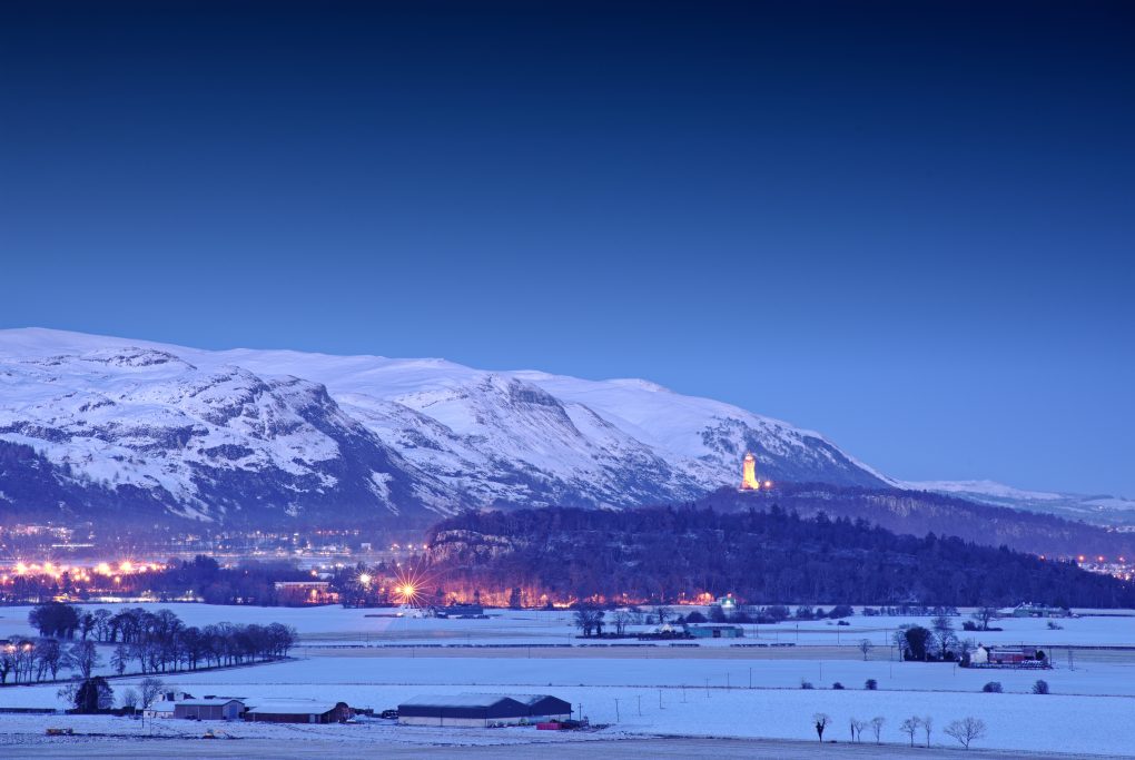
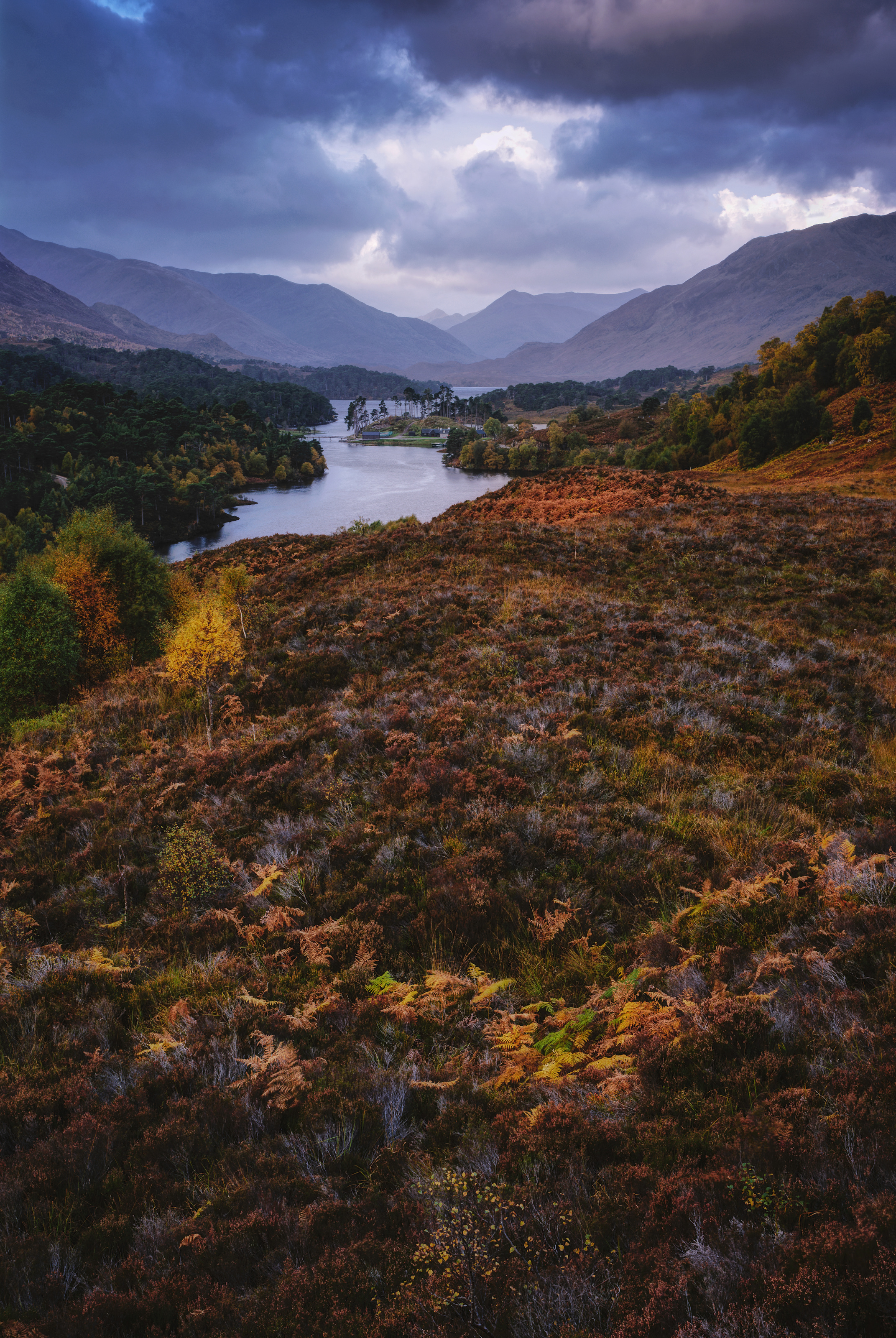
The first day of the holiday was spent in Glen Affric and working my way up to Rogart; on day 2, the weather looked best to the north-west so I drove over to my favourite Assynt for the day.

Assynt: Land of Rainbows

Even before I’d got in the car, I saw the first rainbow of many across the glen:

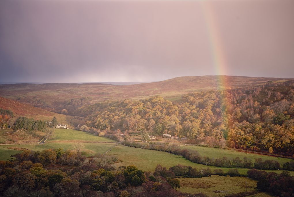
A sign of things to come: before leaving the lodge for the day, a nice rainbow appeared along the glen.

The road was every bit as narrow-veering-nonexistent as I remembered – always makes journeys feel that much longer than the mere count of miles covered – and increasingly the previous night’s snow-fall intruded onto the edges of the tarmac. Good challenging fun.

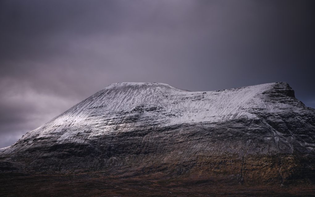
I only stopped once to make a photo of Ben More Assynt from across the landscape:

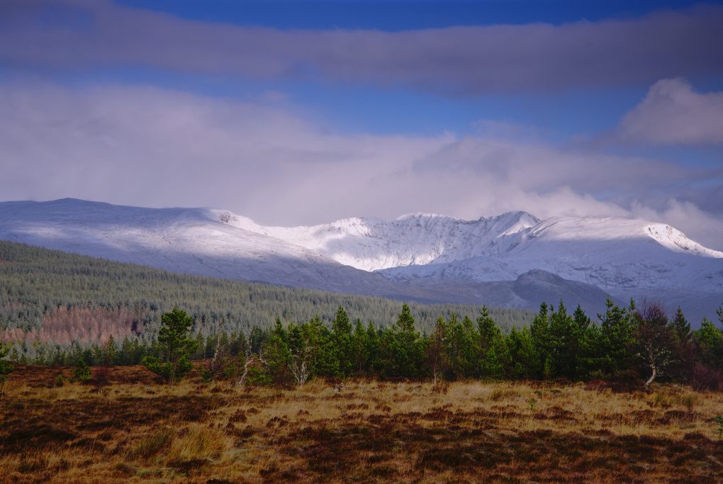
The first snow of late autumn covering Beinn Mor Assynt, illuminated in a nice pattern of dappled morning sunlight.

As I passed Inchnadamph heading toward Loch Assynt, the weather turned very mixed – phases of sunshine and hail alternating every couple of minutes – with some fantastic rainbows. It didn’t take long waiting in a layby before another one illuminated Ardvreck Castle – drive around the corner of the loch and walk down the castle and in next to no time, behold another rainbow. You certainly learn to read the signs pretty quickly – as soon as a bow appears, put your jacket hood up as the rain will be along shortly.

I also took a couple of photos of the Inchnadamph Caves, a distinctive rock formation on the Moine Thrust zone, in which bones of Eurasian lynx, Arctic fox, reindeer (dating back 47,000 years), polar bears (the only evidence of their presence in Scotland) and humans (back to 3000BCE) have been found:

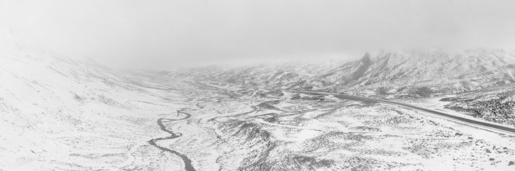
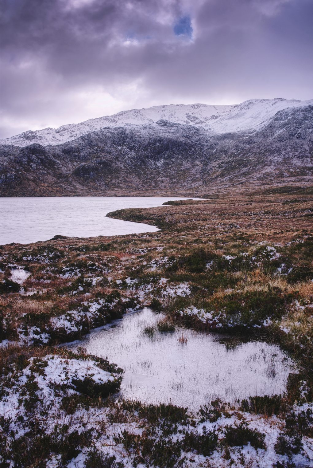
Continuing north up the B894 a little way, even in dull cloudy light the surrounding mountains were beautiful, sprinkled with a heavy dusting of snow. I stopped at Loch na Gainmhich and explored around the frozen peat-bog by the roadside a bit:

Sky above
The bulk of Glas Bheinn across
Loch na Gainmhich filling the corrie
Peat bog covered in heather
Frozen puddle
And it wasn’t even winter yet – just the first snows of the season giving a thick dusting coat over the mountains. With the sun hiding behind clouds, the light was a beautiful dull grey.

Turn around and what do you know, but there’s another vibrant double rainbow seemingly making its way over the landscape as well:

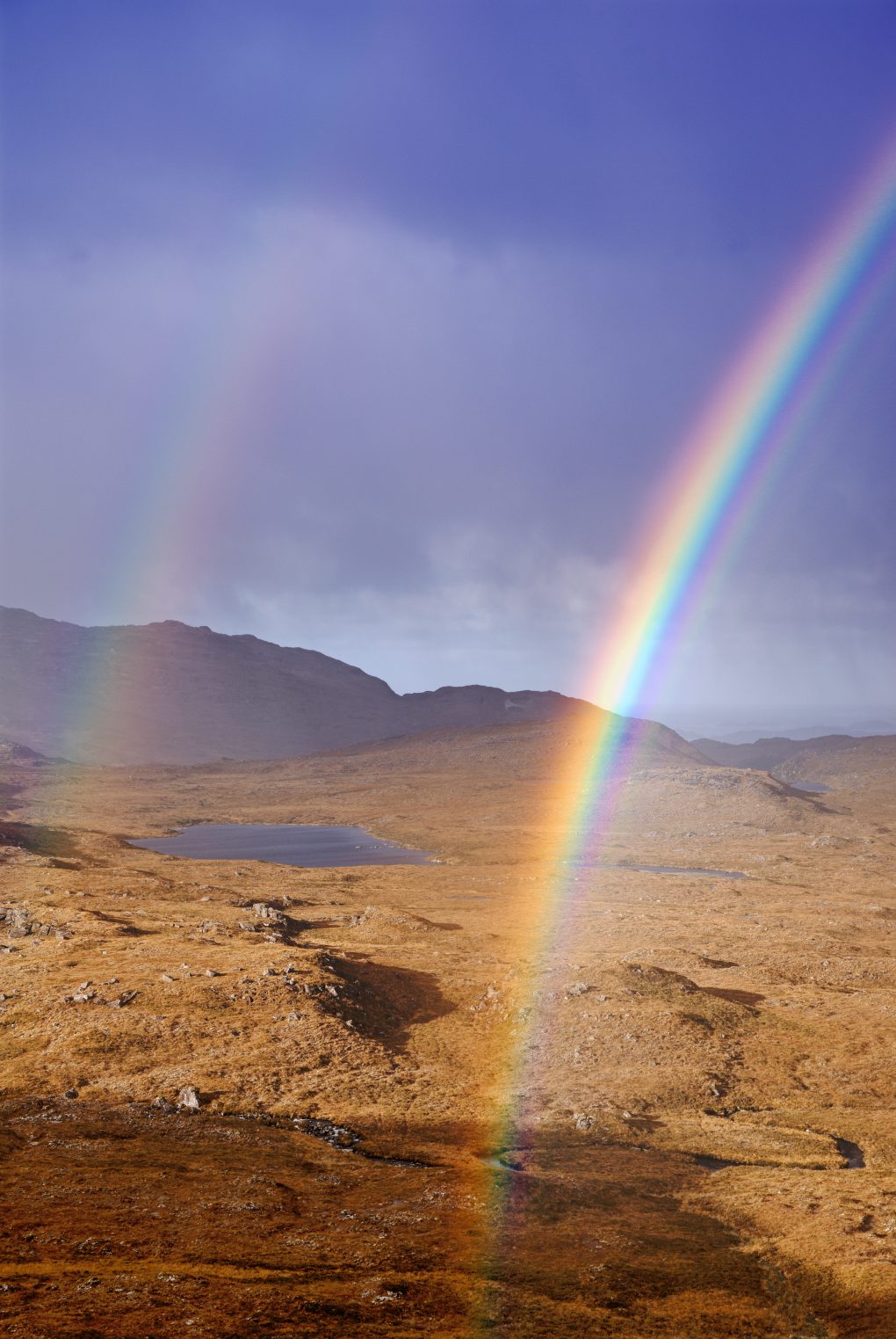
I stood beside at the top of the hill beside Loch Gainmhich looking over the undulating landscape to Loch nan Eun, watching the rainbow and its secondary bow evolve.

Assynt: Moody Wailing Widows

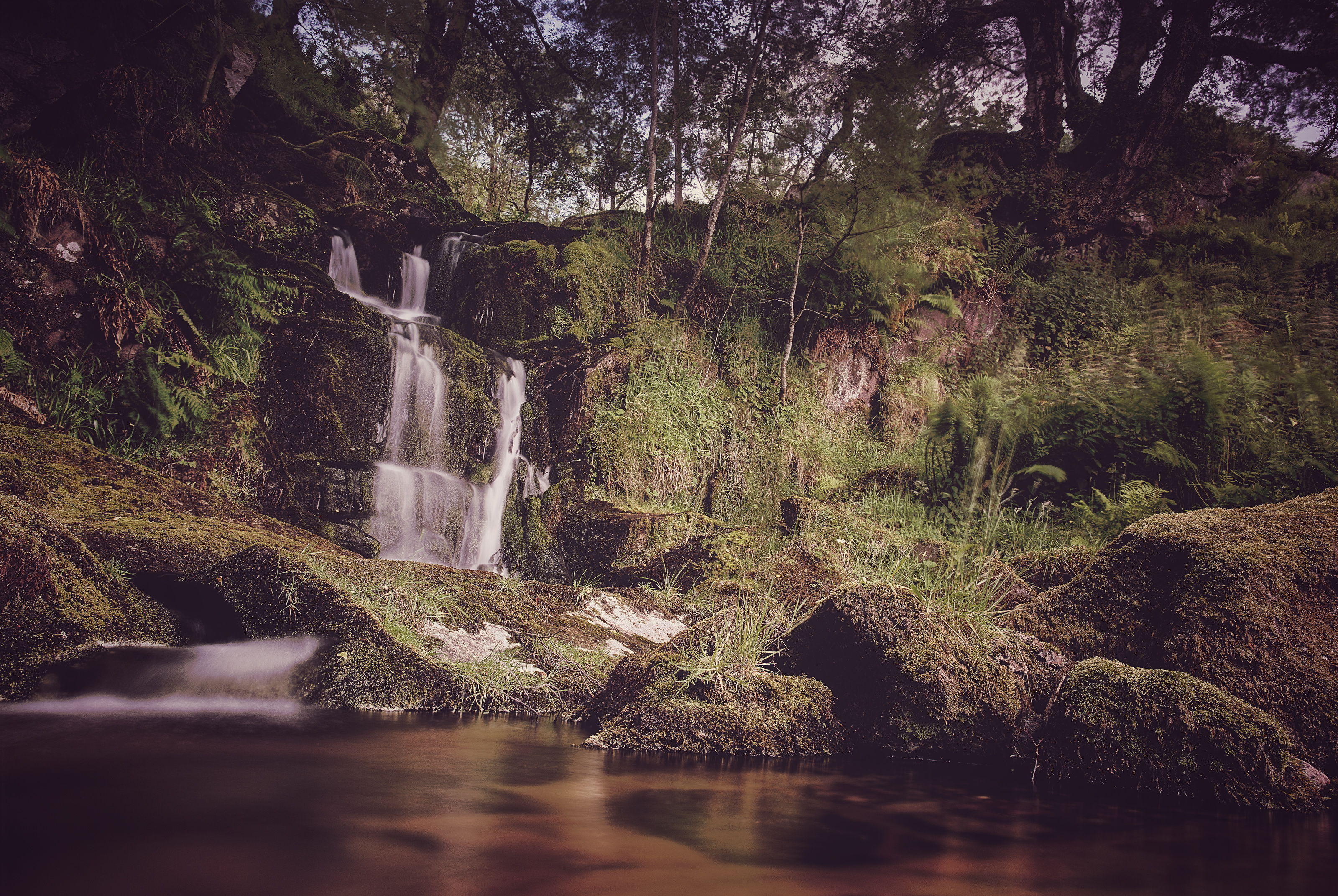
Having seen photos online of the Wailing Widow waterfall very near to the road, as the Allt Chranaidh leaves Loch na Gainmhich, I spent hiked over to the edge of the loch and, faced with a stiff wind and slippery frozen peat-bog underfoot, decided it wiser to approach the falls from the bottom of the 30m gorge instead. Not the easiest terrain either way – many large boulders, some slipped down from the sides of the gorge, requiring scrambling to cross with tripod and camera gear. From the little carpark barely off the road, there’s just a moderate river running away:

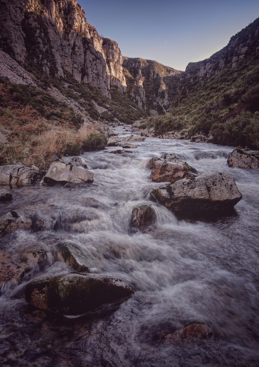
I’ve visited Assynt several times over the years but was quite surprised to discover a “new” waterfall via various online contacts, and one right by the roadside at that.
There is a track to the top from round the corner in the road, but a hike across frozen peat-bog in high wind was not the safest so we approached from the bottom of the gorge instead.

The first sight of the falls is quite starkly atmospheric:

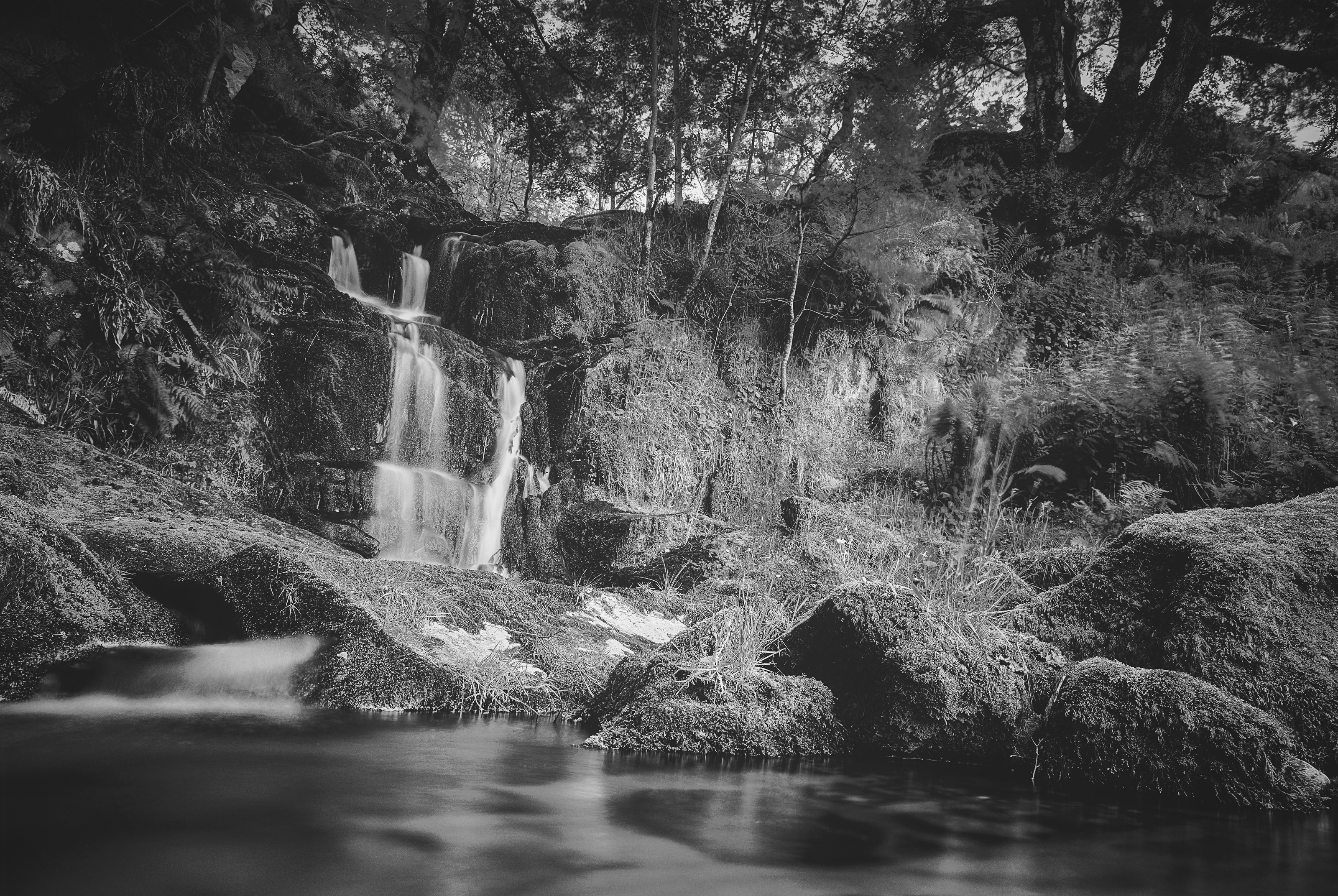
I made it quite close to the splash-down, where it was tricky taking photos for all the spray covering the filter:

In Assynt, you can’t even sit down in the driver’s seat without admiring the landscape – in this case, as the clouds passed overhead a small gap let a little light illuminate the flanks of Quineag, grey rock dusted with snow:

A view from the car window, of all places – just as I was preparing to drive off, this little patch of light on the great snow-covered grey sides of Quineag caught my eye.


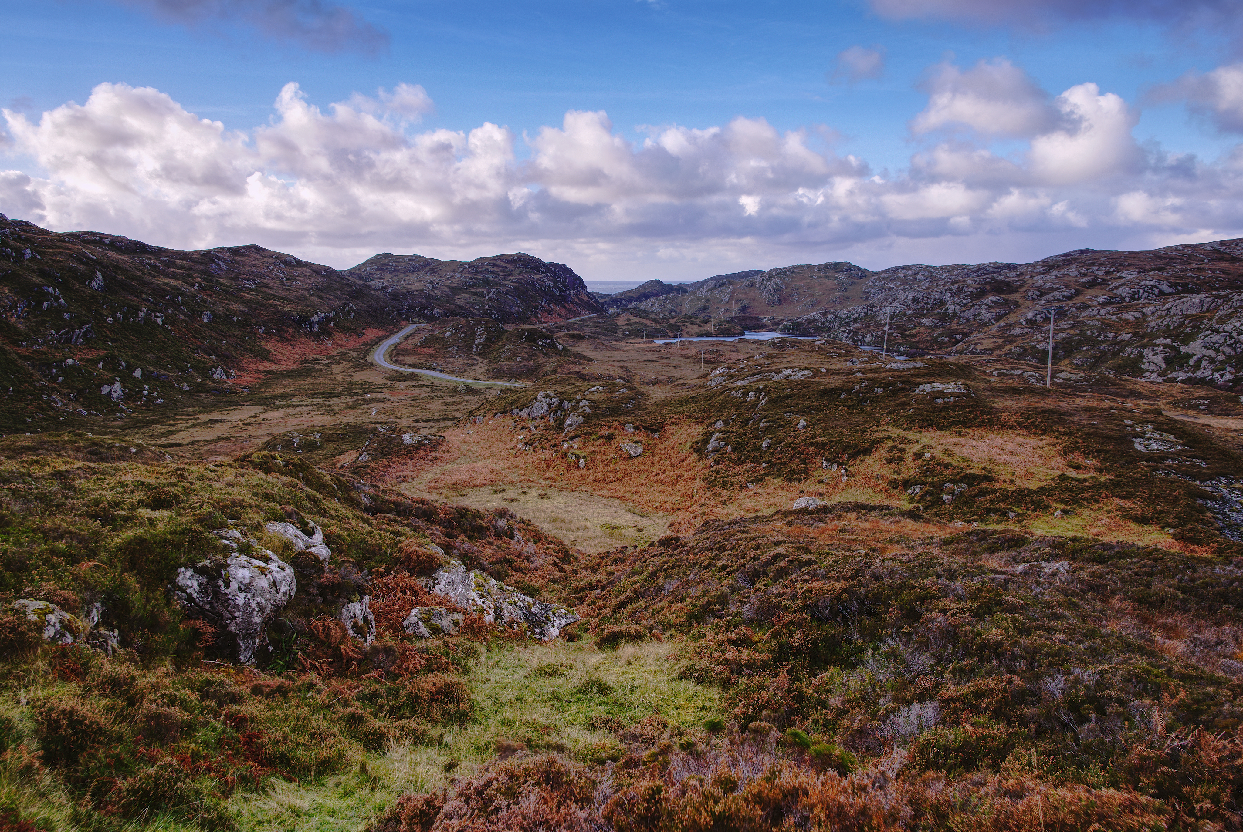
From Unapool I drove back along Loch Assynt and out into the Stoer / Clachtoll peninsula, some of my favourite rugged landscape.

Assynt: Land of Heritage

The area around the B869 fairly reeks of history. Starting way back, the geology is awesome: gneiss bedrock (two kinds – Lewisian and Scourie group) interspersed with several minor fault-lines and the Scourie dyke swarm (metamicrogabbro).

This makes for a lumpy cnoc and lochan landform characterized by many rock hillocks interspersed with lochs and lochans in between.

Some of my favourite landscape, absolutely typical of the north-west coast of Scotland: Gneiss, in this case from the Scourian group dating anywhere from 2.5 to 4 billion years old; originally igneous but also subject to later metamorphism.
This whole part of the Assynt peninsula, enjoyed by the “loop” road B869, is a large swarm of metamicrogabbro and amphibolite dykes (formed 1.6 to 2.5 billion years ago).

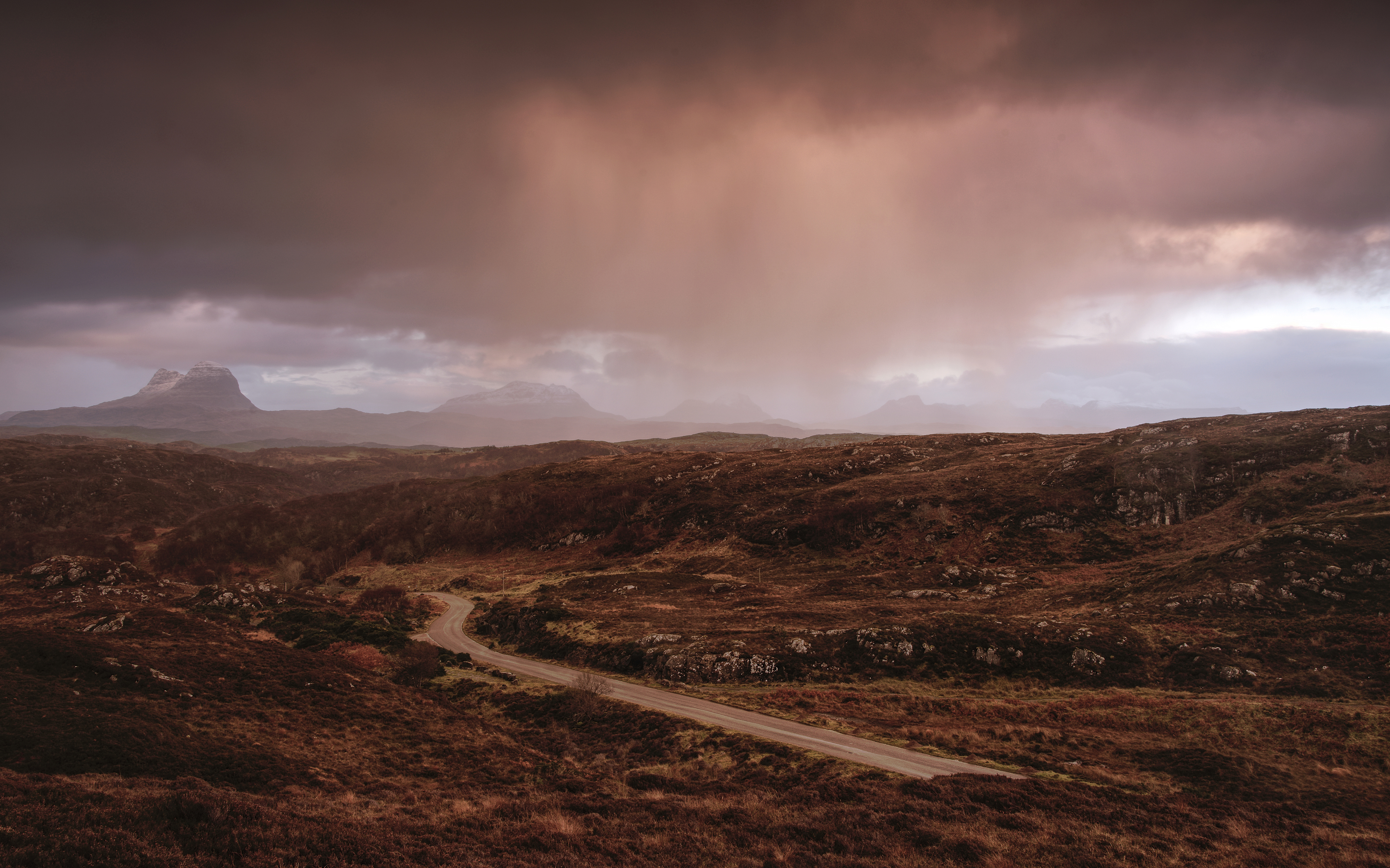
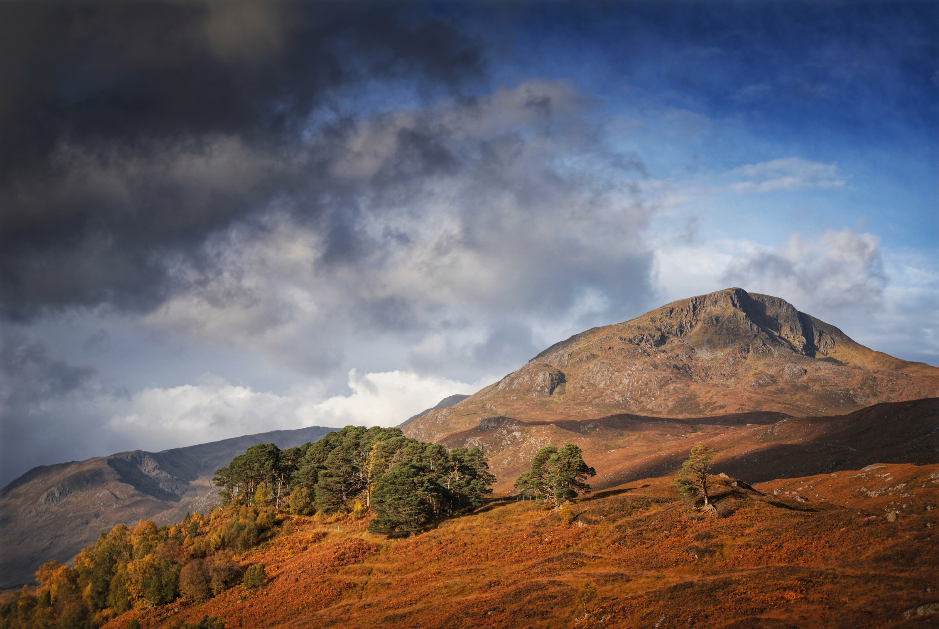
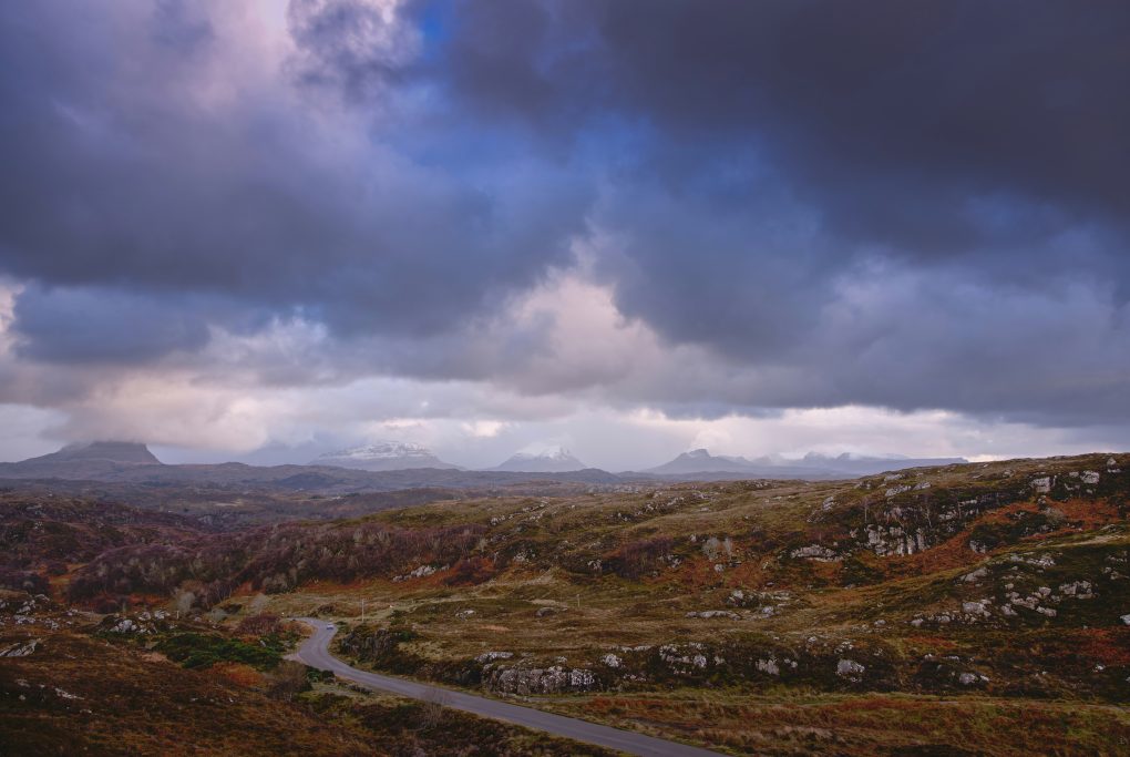
On a sunny day, the blue sky reflects beautifully in the lochs by the roadside; however, this was not to be this time. Behind the above photo, the road continues wending its way around sharp corners and up and over a rise to one of the most awesome viewpoints I know, with five mountains of Assynt spanning the field of view along the horizon. The weather was not the greatest – rather than a clear vista, there were clouds rolling across the landscape from behind, intersecting with mist rising off Suilven.

Spending a couple of hours standing watching the scenery (and occasionally getting rained-on in the process) afforded me time to ponder the road in front. Travelling up the B869 there are a couple of tracks to either side with entrances blocked by boulders. Obviously there used to be an old route – very narrow at barely a car’s width, with a couple of sharp S-bends, tarmac degrading and obscured by heather/bracken/undergrowth – and the new tarmac has been laid in a much straighter line, with the viewpoint carpark repurposing some of the old route. It makes me wonder what the place would have been like one or two centuries ago, how the road might have evolved from a drovers’ track or similar.

Suila Bheinn

I walked along as much of the old road as I could find, conscious of a sense of heritage and change in land usage.

There’s a shrine on an Assynt hillside
Made of earth and salt and rain
Now you walk out in the morning
With your sacrifice of change

– Runrig, Saints of the Soil

Assynt: Tasty Colour

Having heard about the beach nearby I left Rhicarn and explored a different road, to Achmelvich.

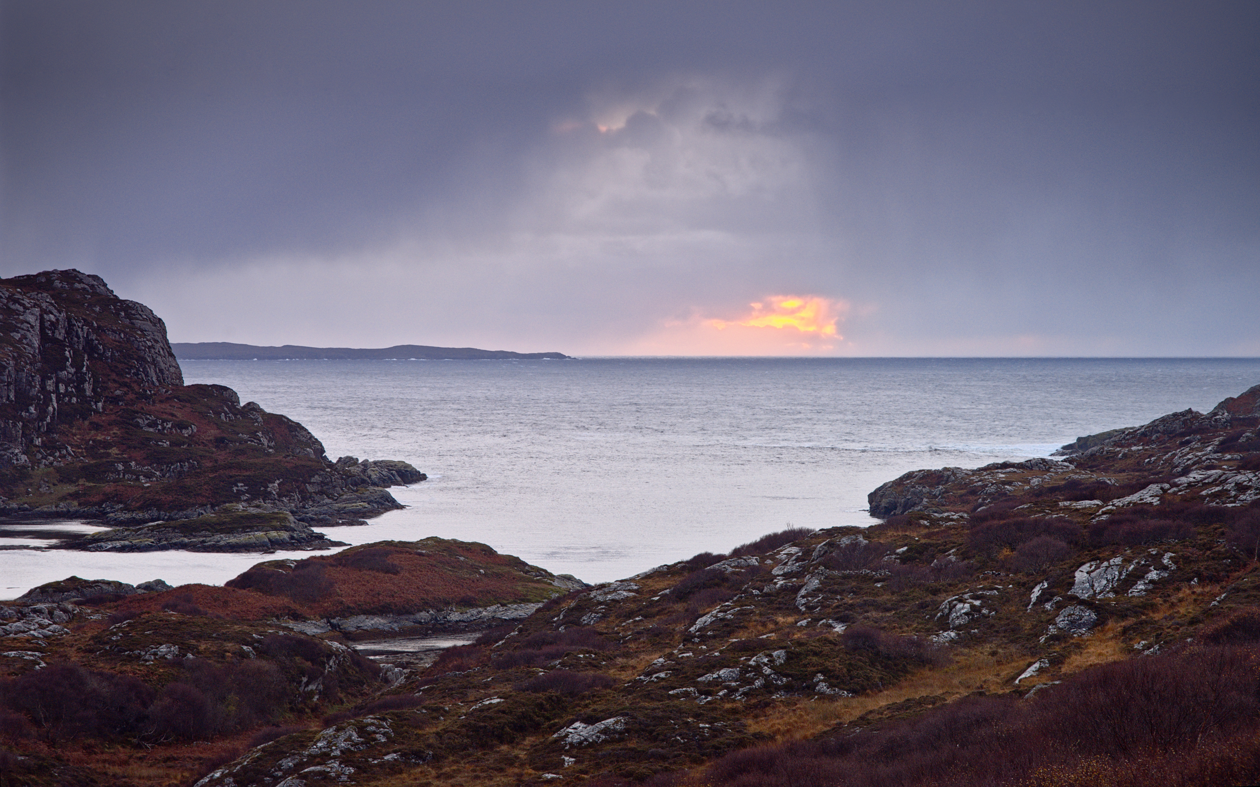
On the way, the sunset was stunning. A brilliant red-orange ball floating above the horizon, offset against the cold slate-grey clouds and paler blue water of Loch Roe. Even partially obscured by cloud, the colour contrast was awesome – and with a whiff of sea-salt on the breeze, put me in mind of a west-coast single malt whisky…

Driving the last stretch of the road to Achmelvich, the sun set right in front of me, a large orange-red ball above the water. The combination of colours, cold blue slate grey sky and warm yellow-orange heather, coupled with the sea breeze put me in mind of a fine west-coast single malt whisky…

The only real downside of the day was Achmelvich itself. The beach at the end of the road is very pretty, clear pale sand, the water beneath the waves’ foam having a beautiful clear blue-green colour. However, the beach is surrounded by a ghastly caravan park which in itself suffices to detract from the scenery. The place is littered with anti-dog signage – at one point I counted no fewer than 6 signs in visible sight with a picture of a dog saying the animal “doesn’t know better” concerning handling of litter, followed by several “dogs on leads” and “no dogs beyond this point”. I found the attitude quite aggressively hateful and will not certainly not patronize the caravan park because of it.

Still.

The light of the world keeps shining
Bright in the primal glow
Bridging the living dust to dust
Such a long long way to go
– Runrig, Saints of the Soil

Assynt: By Night

Having finished with the southern half of the Stoer/Clachtoll peninsula, I made my way back to Rogart for the night, but passing along Loch Assynt in the dark I had to stop and take a photo of a cluster of Pine trees near the shore. With a sufficient and necessarily long exposure (2 minutes!) to register anything, I like how the trees look almost stuck onto a smooth silver surface.

My fondness for the area – its geology, its weather (however extreme it felt!), its light and its rugged landscape remains unabated.

Last Light, Stirling

Driving up the M90 past Stirling there is a little mound of a hillock at Craigforth, opposite Cambusbarron, which I thought might afford a nice view of the city at dusk.
In practice the mound is owned by a large insurance company with lots of restricted access by road, so I found Scout Head hill a couple of miles down the A811 near Gargunnock.
The snow was nearly a foot deep in parts so it took 1.5hr to walk 3 miles, uphill and down, to say nothing of 1.5hr making photos off the top.

The light was totally awesome. As expected, the hill’s shadow crept across the landscape, chasing the warm sunlight up the Wallace Monument and Stirling Castle, leaving Dumyat as the sky turned pink/purple/blue in the Earth’s Shadow.

I made a little timelapse video:


Beautiful winter landscape; the shadow moved its way across the landscape, with the last light making its way over the Wallace Monument and Stirling Castle before heading up Dumyat

I flew the drone away from the camera location and made an HDR panorama of Stirling from the air:

The last of the warm light – foreground partially cleared forestry in the shadow of Scout Head hill – contrasting with light on Craigforth, the Wallace Monument and Stirling Castle with Dumyat in the background.

Walking back down the hill in the cold twilight, the mountains of the Trossachs were glowing with white snow against the cobalt blue sky.

(I loved that light so much, I’ve made it available as a framed print via RedBubble already.)

The Forth is just a wee river this far west, but it still gave rise to a cloud of mist obscuring the view of local farms:

It’s only a wee river at this point, but the Forth gave off a large cloud of mist after dusk, obscuring the local farms.

And finishing up with the mankind-vs-nature theme, the Wallace Monument and orange streetlights of Stirling made a great contrast against the blue sky:

A mixture of lighting: vibrant orange tones of Stirling contrasting with the cobalt blue night sky above.

Above the Highland Boundary Fault

About 3-4 years ago, I first visited Birnam Hill. Made it around Duncan’s Hill to the south and through the woods… As I walked a path between old and new forestry, I wondered why there was a sharp drop down almost a metre to the level of the new trees.

Over subsequent visits I took a few photos, came back and took geotagged photos, all around the same area, went to the BGS, imported bedrock data via KML into Google Earth, correlated with the photos… After a couple of years I’m confident that the dip in the landscape is evidence of the Highland Boundary Fault – a line that runs all the way from Arran and Comrie to the south-west, through Stare Dam and Rohallion Loch and lodge, up along this dip between the trees and away to the east before heading off north-east to near Stonehaven. From a suitable angle it looks like someone’s taken a bicycle tyre and run it over the landscape, causing an impression relative to the surrounding hills and mountains.

Apart from that, the scene from Stair Bridge Viewpoint is highly photogenic and while I’ve made several photos of the view south and east since, I’ve always wanted to fly a drone along the line of the fault.

A few days ago, the dream came true: a perfect clear dry bright sunny winter’s day, snow lying on the ground, low sun illuminating the ground, all quiet and calm.

A clear winter’s day:

You have to be standing all-but on the HBF to take this:

A selfie, of sorts: straight down landing on Stair Bridge:

I managed a couple of runs from near Rohallion Lodge up toward the A9 with the drone, spliced them together into a fly-by to give an impression of the topology.

And a still photo (I still shoot them! – but mostly HDR panoramas…) looking east from above the cusp of the saddle landform between old and new forests:


To wrap up the afternoon, there was some lovely light on an avenue of beech trees, walking back to the main road:

Bucket-list Item: CHECKED!

Autumn Holiday Day 1: The Nice Place

There’s no better place to start a holiday than the Nice Place(TM), even if it does involve getting up and on the road at 4am for a 165-mile drive up north.

The sun rose over Loch Beinn a Mheadhoin as I approached:

The Caledonian Forest at Glen Affric was its usual beautiful self – still not cold enough for morning mist in the trees, but brilliant morning sunlight and heavy rain caused a wonderful vibrant double rainbow while I was down by the river.

For a change, I took a long walk a couple of miles along the side of Loch Beinn a Mheadhoin, to be rewarded with a gorgeous view of Sgurr na Lapaich covered in pure white snow, across the water.

Other views from the morning:

The First Morning of Winter

I spent the morning of Dec 22 – the first day of winter – up Kinnoull Hill. There was beautiful mist rising from the River Tay as it meanders through the Carse of Gowrie.

I experimented with a few new compositions too: semi-abstract views of the hills of north Fife, the motorway/A90 junction and the river north of Perth as well.

My favourite two images were the fairly conventional view from above the cliffs, looking past the folly along the Carse of Gowrie. It’s not that comfortable a location to shoot – to get a clear view of the tower, one has to stand in a gorse bush…

Strathearn Sunset

My sense of the geography of Strathearn has not really fitted together until quite recently. There have been a few locations, isolated points and a few lines: the A822 from Gilmerton up past Monzie to the Sma’ Glen; The Hosh at the foot to access Glen Turret; a small B-road between the two; a hill known as Kate McNiven’s Crag; and one or two other areas. More recently I’ve been climbing hills, “bagging” Torlum Hill and Laggan Hill as part of the Lady Mary’s Walk circuit out of Crieff.

The Highland Boundary Fault emerges in a burst of very lumpy landscape at the southern end of the Sma’ Glen. But what it does in the rest of Strathearn to the west, I’ve never really seen.

A couple of weekends ago I explored the Knock of Crieff independently; it struck me that the path up the north side afforded the perfect view along the length of the strath to the far mountains in the west, an elevated view along the glacial U-shape.

So late on Sunday afternoon I took the drone for a spin slightly out over the strath and made a panorama of 7 shots, each a 5-shot HDR exposure bracket sequence – blended on Linux, stitched and edited in Serif Affinity Photo for the iPad.

Lowlands to the left of me; Highlands to the right…

And just for the record, this is what it looked like in the middle of stitched the blended panorama, before I cropped and toned it:

Panorama stitching screenshot

Glen Clova

A couple of years ago, a photo-friend and I spent a happy afternoon exploring Corrie Fee in Angus; I remembered emerging from the trees in an impressive bowl of a glacial corrie. In August, I sought to repeat the experience, starting from the carpark nearby, but in my haste to get off the ghastly Forestry Commission track (more like a hard gravel road ploughed through the forestry, complete with yellow metal gantries), I wound up taking a different path. It also emerges from the trees into a bowl of a glacial corrie, but felt different and I couldn’t work out whether it was the wrong exit from the woods or what.

Came home and checked the geotagged images to find it was not Corre Fee but Glen Clova instead. That would explain a lot of things! And unsurprisingly, I now use ViewRanger to navigate whilst hiking.

Still, a couple of hours bumbling around in the grass finding interesting photos in a dramatic bit of landscape on a moody afternoon… Can’t complain.

As I was stumbling around in the foot of the glen, I stumbled across this lovely little burn tumbling its way through the hillside:

The surrounding rocks are quite dramatic – I was amazed at the green and purple hues of moss and primitive plants growing on the crags around

And much as I know the forestry is entirely artificial now, it still drapes over the landscape like a cloak.

A Sunday Afternoon Escape

A few photos from an afternoon escape in August – one of my favoured routes, starting with the trek from Amulree along Glen Quaich – a moderately long stretch becoming quite a tricky road, steep with S-bends:

As always, the view from the moor along the top was awesome – particularly with ominous dark clouds – I experimented a bit with a variable-ND (crossed-circular-polariser) filter to lengthen the exposures up to 30s:

From there, descending yet more wiggly bends on the way toward Kenmore, there’s a tiny track off the road to a small carpark nestling in amongst the heather. The hillside above there affords a glorious view over the Appin of Dull – there was even a bit of light on Loch Tay looking the other way as well:

Glen Artney

Just one photo from a quick afternoon excursion to explore Glen Artney earlier in the year. Well, one photo, processed 3 ways.

This was the first, and so far only, time I’ve felt the urge to invert the tripod centre column; in the process I discovered that the Pentax K-1 live-view display will happily invert the image correctly, but leaves all the exposure and histogram overlays the wrong way up – as if trying to use the thing upside-down was not hard enough itself! Oops.

A pleasant waterfall in the Allt na Drochaide burn, a tributary to the Water of Ruchill, Glen Artney.
This was the first, and so far only, time I’ve felt the urge to invert the tripod’s centre-column and dangle the camera millimetres above the water. In the process, I discovered a bug with the Pentax K-1: if you use live-view upside-down, the image inverts itself correctly but all the settings controls (histogram, etc) do not. It’s tricky enough wondering where the control dials have gone, let alone where the numbers they control are to be found on screen. D’oh!

How Many Megapixels?

There are several cliches in the field of megapixel-count and resolution required for acceptable photographic prints.

In no particular order:

  • 300dpi is “fine art”
  • you don’t need as many dpi for larger prints because typically they’re viewed further away
  • my printer claims to do 360dpi or 1440dpi or …
  • 24 megapixels is more than enough for anything
  • “for a 5″ print you need 300-800pixels, for medium to large calendars 800-1600 pixels, for A4 900-1600px, for an A3 poster 1200 to 2000px, for an A2 poster 1500 to 2400px, …” (taken from a well-known photo-prints website guidelines)
  • it’s not about the megapixels it’s about the dynamic range

There are probably more set arguments in the field, but all are vague, arising from idle pontificating and anecdote over the last couple of centuries.

Here’s a key question: in a list of required image resolutions by print size, why does the number of dpi required drop-off with print size? What is the driving factor and might there be an upper bound on the number of megapixels required to make a print of any size?

We can flip this around and say that if prints are expected to be viewed at a distance related to their size, then it is no longer a matter of absolute measurements in various dimensions but rather about how much field of view they cover. This makes it not about the print at all, but about the human eye, its field of view and angular acuity – and the numbers are remarkably simple.

From wikipedia, the human eye’s field of view is 180-200 degrees horizontally by 135 degrees vertically (ie somewhere between 4:3 and 3:2 aspect-ratios).  Its angular acuity is between 0.02 to 0.03 deg.

If we simply divide these numbers we end up with a number of pixels that the eye could resolve.

At one end of the range,

 180*135 /0.03 / 0.03 / 1024 / 1024 = 25.75 (6000 x 4500)

and at the other:

200*135 / 0.02 / 0.02 / 1024 / 1024 = 64.37 (10,000 x 6750)

In the middle,

180*135 / 0.025 / 0.025 / 1024 / 1024 = 37.1 (7200 x  5400)

Significant points:

  • this is no longer about absolute print sizes; it’s simply about being able to view a print without one’s eye perceiving pixellation
  • the numbers correlate reassuringly with numbers of megapixels seen in real-world dSLR sensors today
  • you can reasonably say that if you have 64 Megapixels then you can make a print of any size from it
  • you can make an image with more than 64 megapixels if you want to, but the reasons for doing so are not directly to do with resolution – they might be
    in order that you can  crop it – either to physically crop the image in post-processing or to view it from a closer distance than that required merely to fill your eyes’ field of view
    or maybe for pixel-binning to reduce noise, give smoother tonality, etc
  • 24 megapixels is not enough for much; rather it’s is a turning-point: the bare minimum number of pixels for a person of limited acuity to resolve assuming they slightly less than fill their field of view with the print. 36MPel is more usable and 64 will keep you in business selling fine quality wall art.

Now we know how many megapixels are required for various real-world purposes, all that matters is making them good megapixels. Physics to the rescue.


Autumn at Glen Affric (2)

Having visited my favoured spot overlooking the Caledonian Forest, I proceeded up the side of Am Meallan to the well-known location with a view over the lodge and along the length of Loch Affric.

It’s definitely an autumn morning location: the sun rises behind you, skimming up and over the tops of mountains beyond Loch Beinn a’Mheadhoinn, rising as it heads south; accordingly, patches of bright sunlight interspersed with cloud-shadows lap like waves across the undulating landscape from distance right over you.

Of course I had to make a timelapse video of it:

Loch Affric timelapse 2017-10-14 from Tim Haynes on Vimeo.

And two more photos to summarize the morning:

Sunlight and cloud shadow – an outcrop of Scots Pine and birch trees on Sgurr na Lapaich

Proper colours. The most beautiful shade of green pine foliage interspersed with orange/yellow warm birch trees, all lapping up the early morning light.

A classic view – soft heather and bracken leading past Loch Affric to the mountains beyond (Kintail / Glen Sheil in the very far distance).
I had befriended a fellow photographer down at the glen earlier; the first I knew that they had followed me a few minutes later up to this memorial viewpoint was the word “WOW!” exclaimed a few feet behind me.

Autumn at Glen Affric (1)

For about 13 years I have been of the opinion that it has not been a year without at least one trip to Glen Affric.

My favoured time is autumn, late October, to catch the trees in the Caledonian Forest reserve at their most colourful.

Arriving before sunrise, the light is all dull  and the scenery a moody shade of gloomy – the last vestiges of moon stars remaining in the cobalt blue sky.

One of my favourite scenes at Glen Affric – two ncie birch trees amongst purple and green heather.
Sadly this shot has been marred in recent years by the installation of a large wide path cutting right through the heather between bench and trees; this photo used to be easier to compose but now I’m too conscious of having to position the frame to avoid the path just below; it’s becoming too much of a trick-shot for my liking.


Slowly, over the course of an hour after the posted sunrise time, the sun will gradually rise behind Meall Dubh beyond Loch Beinn a Mheadhoinn, casting a beautiful light on the forest:

Having arrived so early, it is a delight to bask in the first proper warm sunlight of the day:

One of my favourite birches – always think it should be called “Dancer” for some reason – basking in the first warm rays of sunrise amongst the heather.